LA 143525 and LA 143526
Cebolla Hogans and Fence
The Cebolla Hogan Site had three
features which were sampled: a forked-pole
hogan in a steep arroyo, a small
forked-pole hogan on the ridge above the larger hogan, and a
fence.
LA 143525, the Big Hogan, is located in
a very steep and narrow ephemeral drainage overlooking Cibola Creek.
It was selected for sampling by the BLM because the initial site
recording suggested it was a Navajo structure. Future management
decisions, there fore, required additional chronometric data.
LA 143526, the Small Hogan, is located
on the edge of a short bench overlooking Cibola Creek. The site was
sampled simply because we recognized it as a probable Navajo
structure, of which there are few in the area.
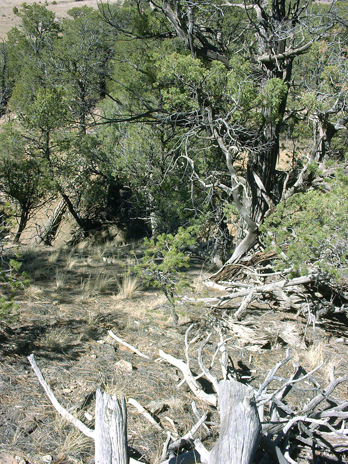
local environment
photo and link
Big
Hogan
photo
by R. Towner
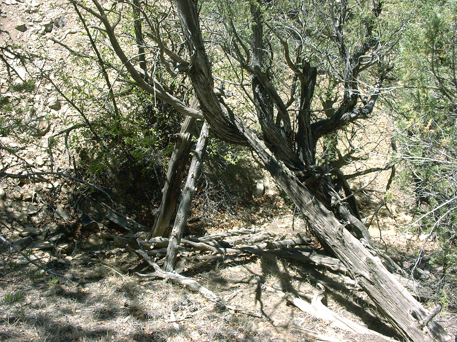
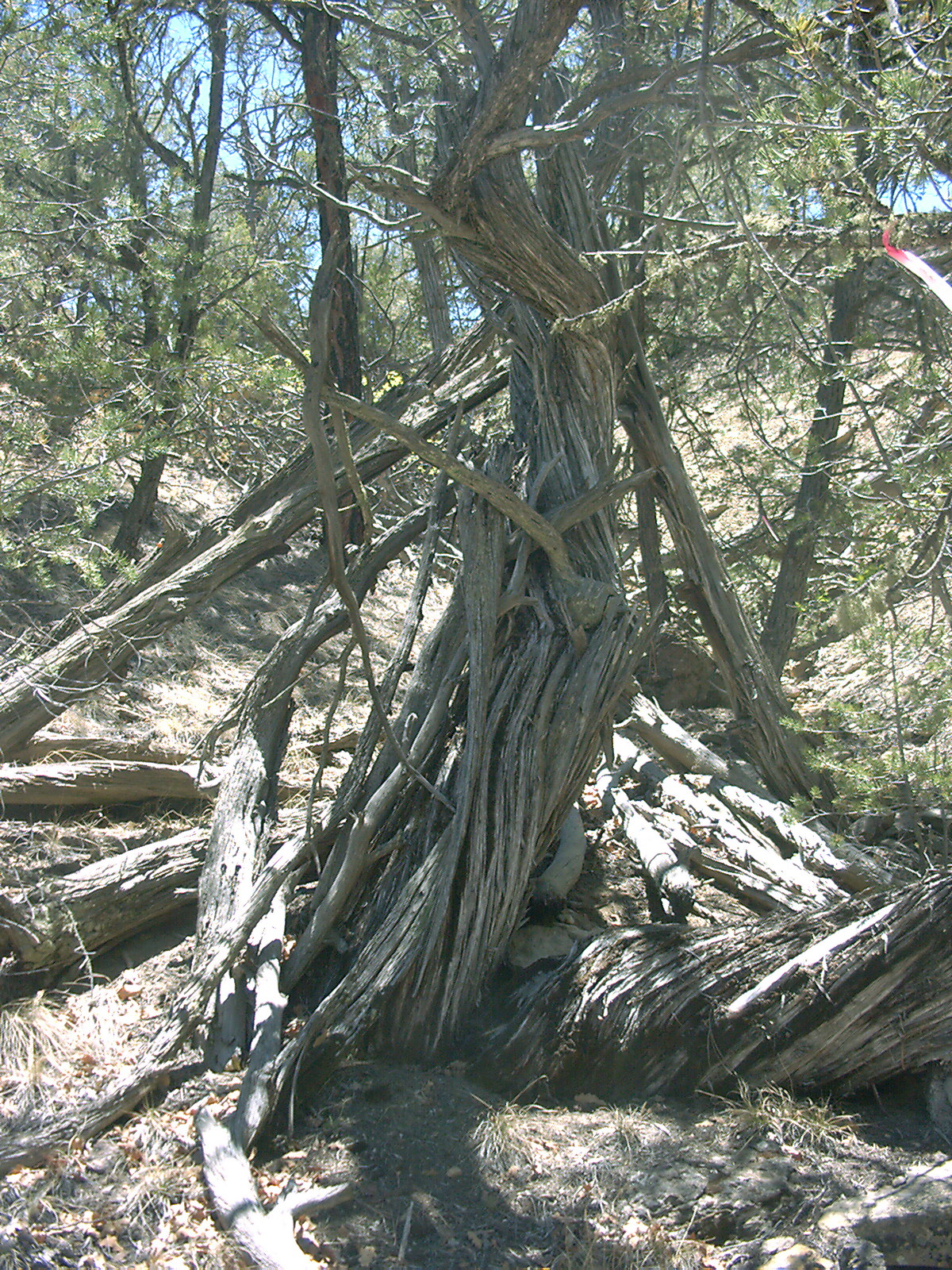
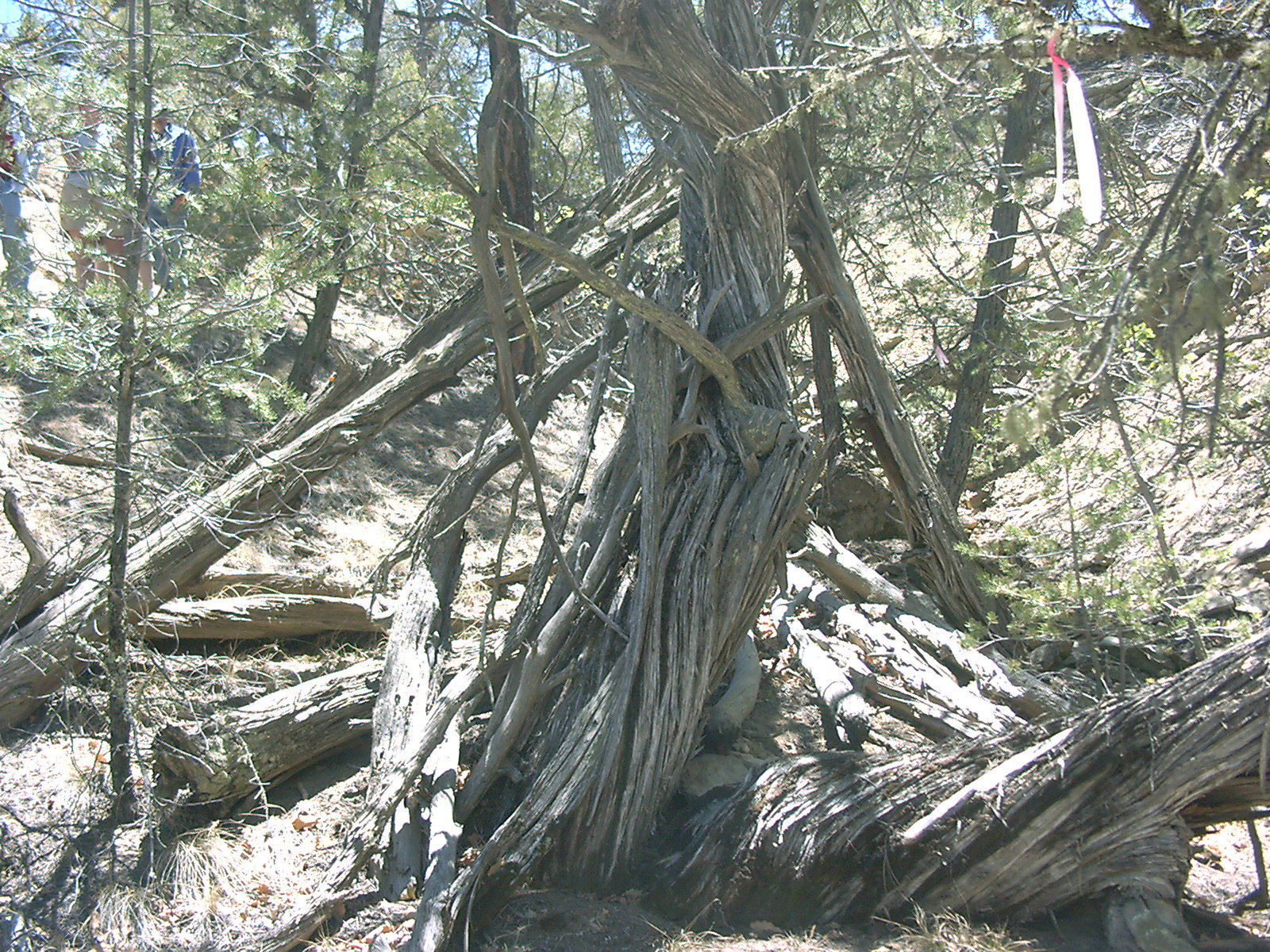
LA 143525, known as the Big
Hogan, is located in a very steep and narrow north-trending
drainage approximately 50m northeast of LA 143526. The site
location is very “hidden” and no artifacts were seen
in the area. The structure consists of 20+ timbers of various
sizes leaning into and scattered around a large juniper tree.
|
Site Map
map by R. Towner
|
|
photo
by R. Towner
|
photo
by R. Towner
|
photo
by R. Towner
|
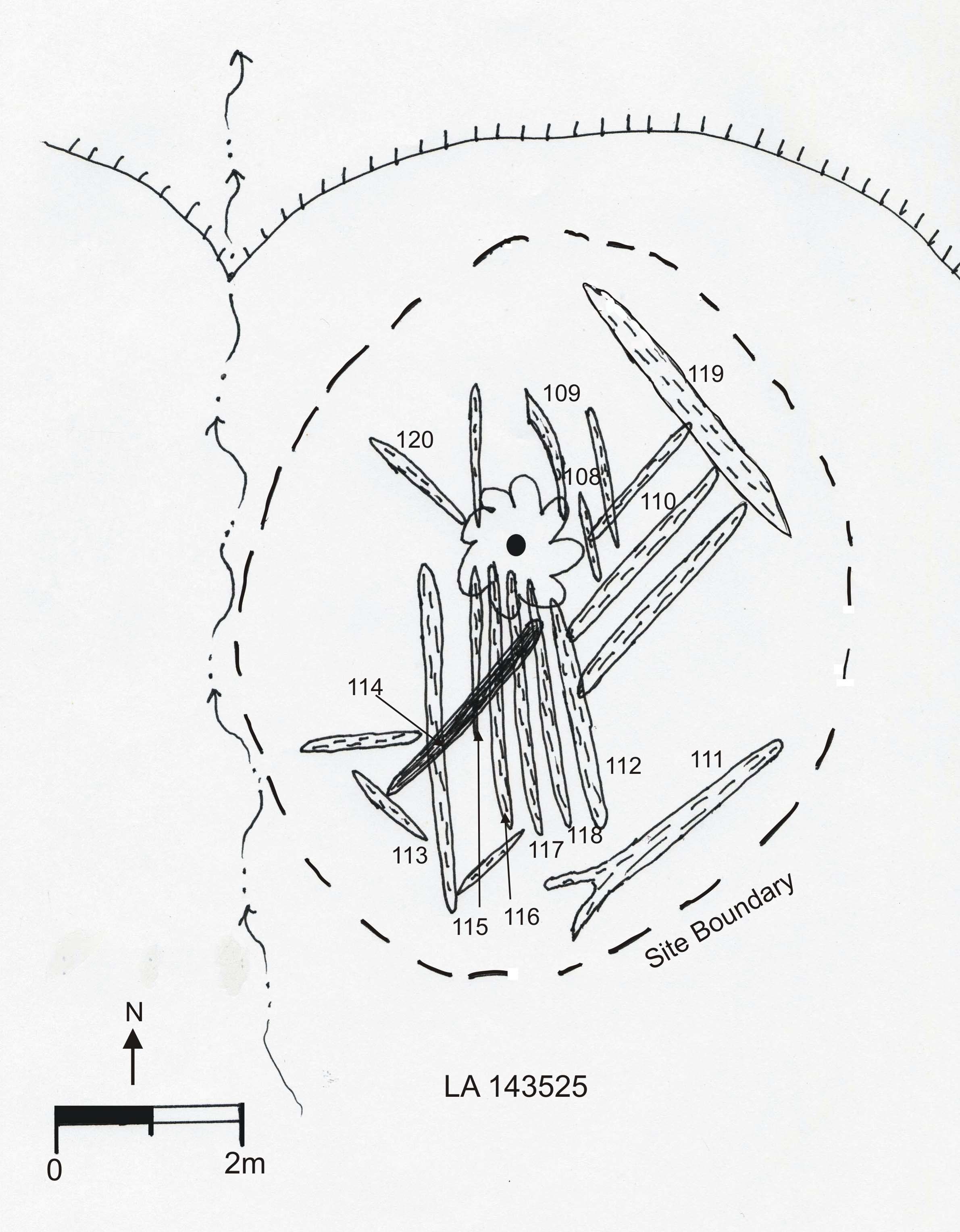
The Big Hogan (LA 143525)
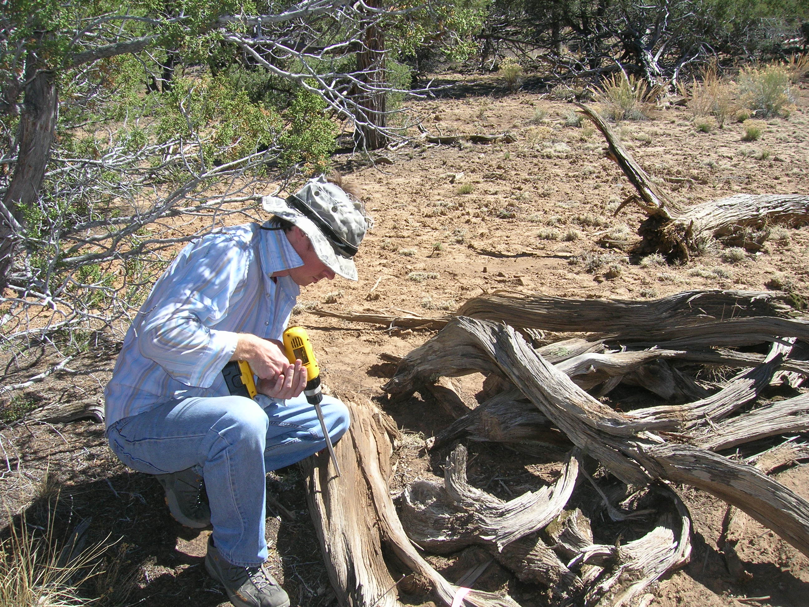
A total of 13 samples was collected from LA 143525, all
as ½” cores.
Samples were collected from the cabin using standard dendroarchaeological techniques. The samples include six junipers
and seven pinyons, which mirrors the local environmental
distribution. It may be important, however, that all six juniper
samples are Juniperus scopulorum; other juniper species grow
in the area, but were not selected for construction—probably
because the builders preferred the relatively long, straight boles of
J. scopulorum.
Seven of the samples yielded dates, including five
pinyons and two junipers. The samples that failed to date typically
exhibited erratic ring sequences that do not match the master
chronology. The dates range from 1797vv to 1915vv, but none are
cutting or near cutting dates; all the samples have suffered exterior
ring loss. Two samples (CEB-108, CEB-111), date 1914vv and 1915vv,
respectively; using Ahlstrom’s (1985) principles, indicate that the
structure was built in the mid-to-late 1910s. CEB-110, the south door
jamb dates 1887++vv and was probably procured as dead wood.
We infer that the hogan was built in the 1915-1920 interval and
was occupied for a very short time. Indeed, the lack of artifacts
suggests the site may never have served as a habitation. If the site
is Navajo—and we know of no other groups that build
hogans—it raises interesting questions about which Navajos were
using the area in the 1910s and why. More detailed studies, including
Navajo oral history research, could help address these questions.
Small
Hogan
|
photo
by R. Towner
|
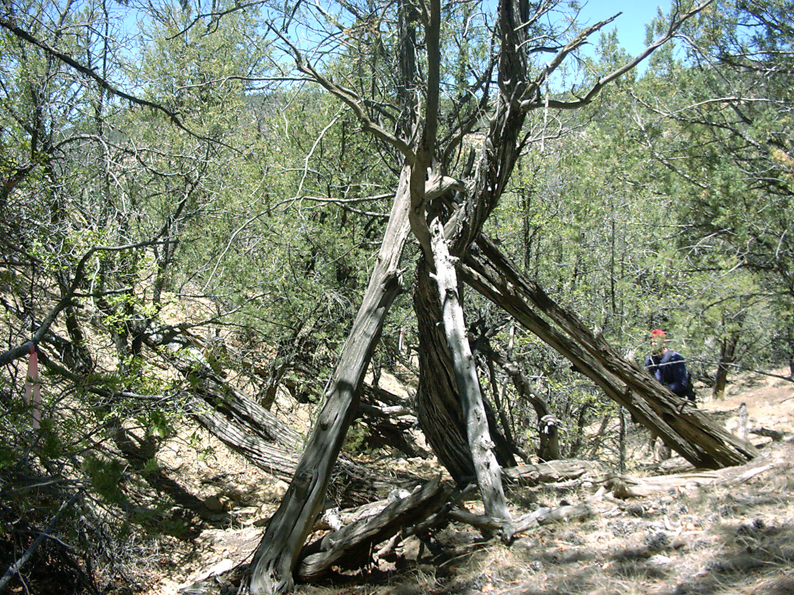
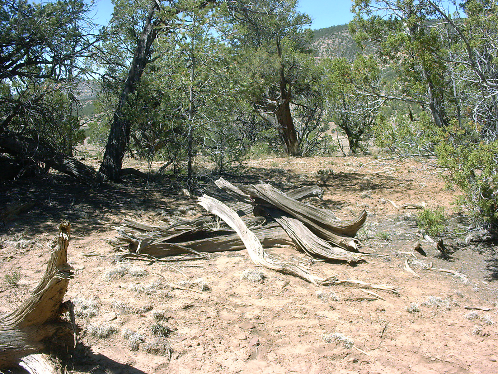
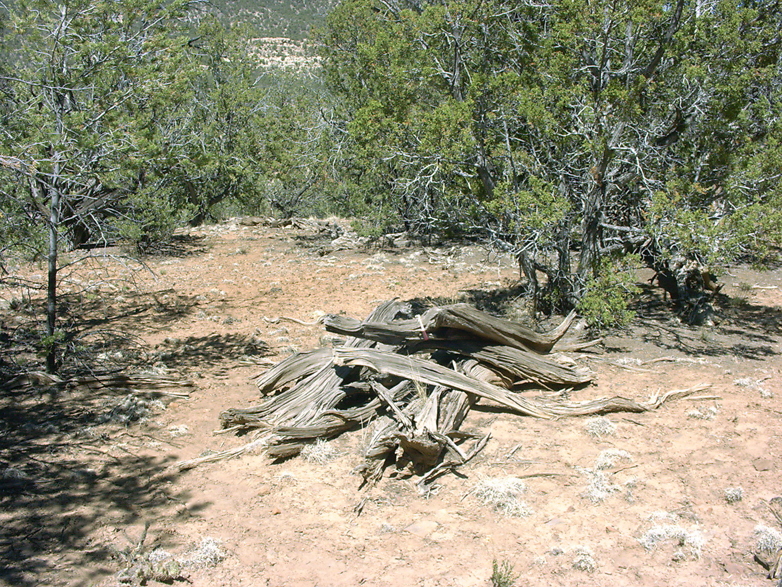
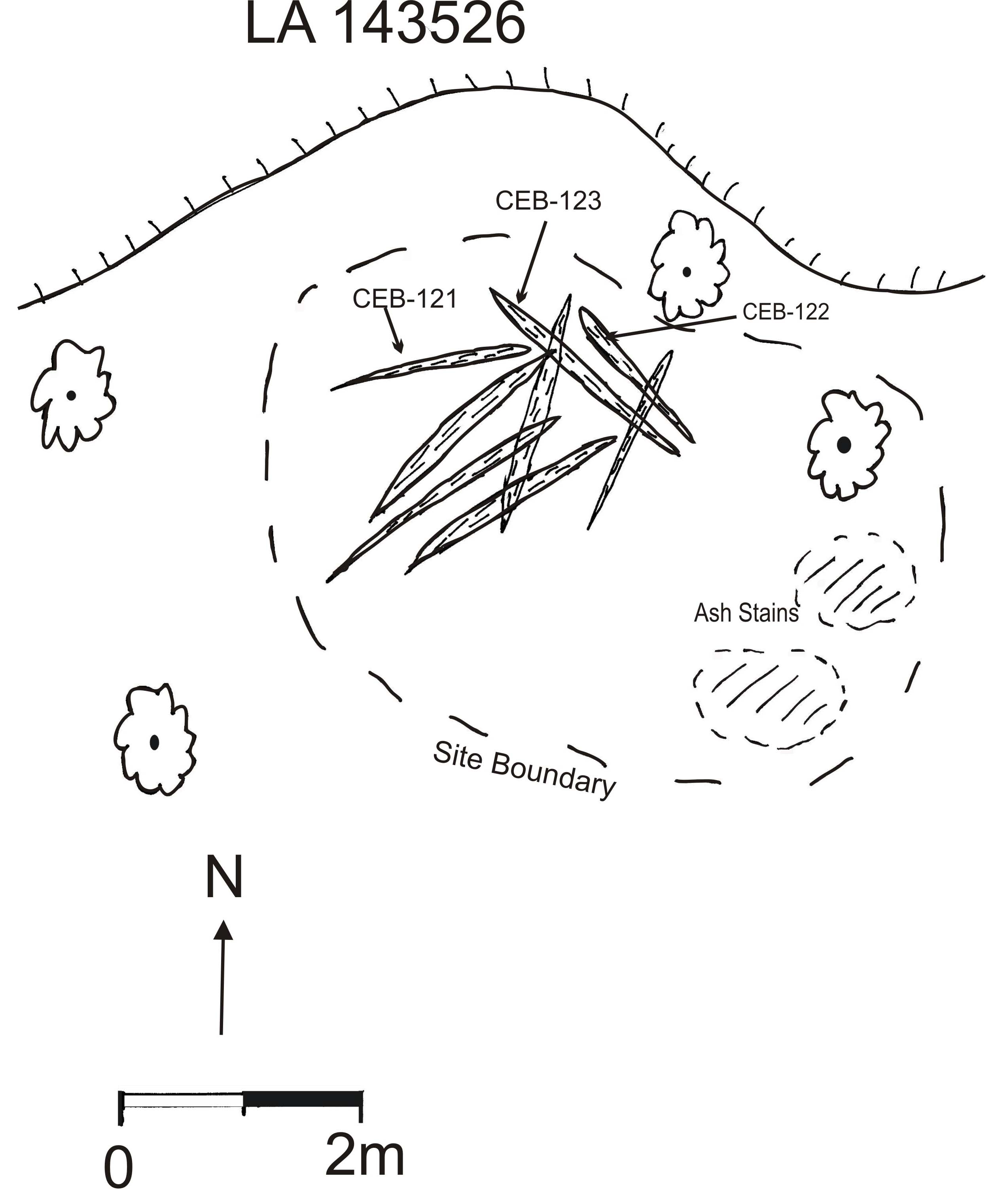
LA 143526, known as the Small Hogan, is located in the pinyon-juniper forest on a ridgetop
overlooking Cibola Creek. Although two areas of slightly ashy
soil were noted south and east of the structure, no artifacts of
any kind were observed. The structure itself has collapsed
and consists of 15+ juniper beams arranged in a semi-circular
pattern typical of forked-pole hogans in other areas. |
photo
by R. Towner
|
|
Site Map
map by R. Towner |
A total of four samples was collected from the
Small Hogan, all as ½” cores. Samples were collected from the cabin using standard dendroarchaeological techniques. All of the samples are
juniper, as are all the other identifiable timbers on the site,
but none dated. The weathered, twisted nature of the beams
suggest that all were procured as dead wood. It may be
significant that none of the timbers exhibit tool marks of any
kind; thus, the site could even date to prehistoric times, but we
consider that unlikely. Perhaps cross sections from the beams
would yield dates, but we did not believe such intrusive impacts
to the resource were warranted during this project.
photo
by M. Reiser
|
Fence
|
photo
by R. Towner
|
The “fence”
was observed during our hike to the hogan sites. It was not
documented during previous surveys in the area and was not
formally recorded during this project. The structure consists of
living and dead trees and branches, some of which were cut with a
metal ax. Our impression — without mapping — is that
the structure is somewhat ovoid or circular and that it may have
been an animal enclosure of some kind.
A single sample was collected from the long-and-brush fence.
It was a pinyon cross section sawn from a metal ax-cut branch.
Unfortunately, it could not be crossdated due to erratic ring
patterns. The fence contains dozens of additional timbers that would
undoubtedly yield tree-ring dates. A detailed recording, mapping, and
sampling effort, however, is needed to determine when and why the
structure was built.
|
Return to Top
Return to 2006 Projects Page
Return
to Dendrochronology Fieldschool Webpage
Return
to LTRR homepage