University of Arizona
Sense of Place
Geos. 195D
Tumamoc Hill
Tumamoc Hill has been called the "Acropolis of Tucson." It is the prominent hill west of downtown Tucson, just beyond "A" Mt. (Sentinel Peak). It is home to the famous, long-standing Desert Laboratory as well as various remnants of much more ancient civilizations.
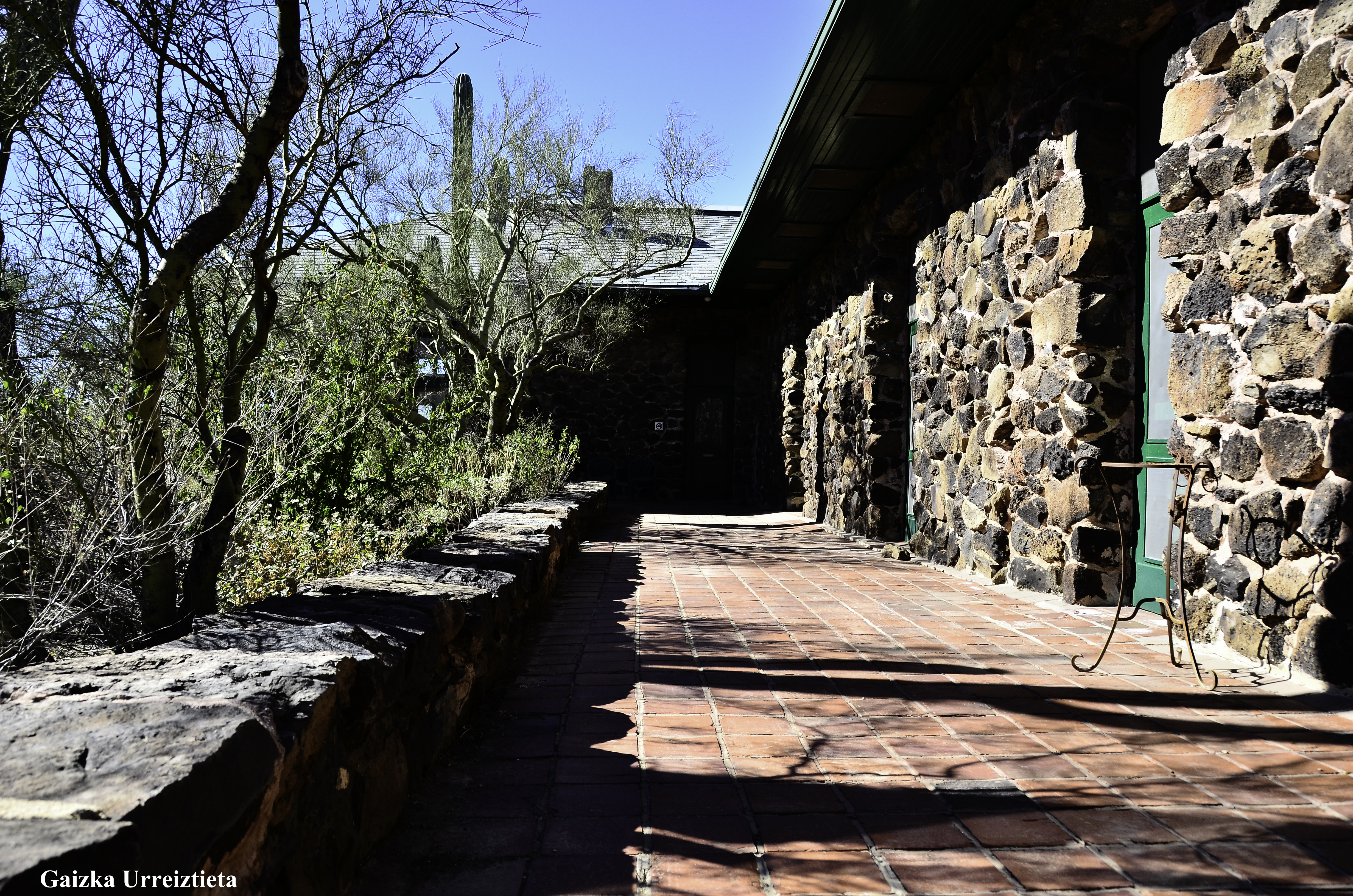
Desert Laboratory. Photo—Gaizka Urreiztieta, 2011.
Desert Lab Library. Photo—Gary Huckleberry, 2017.
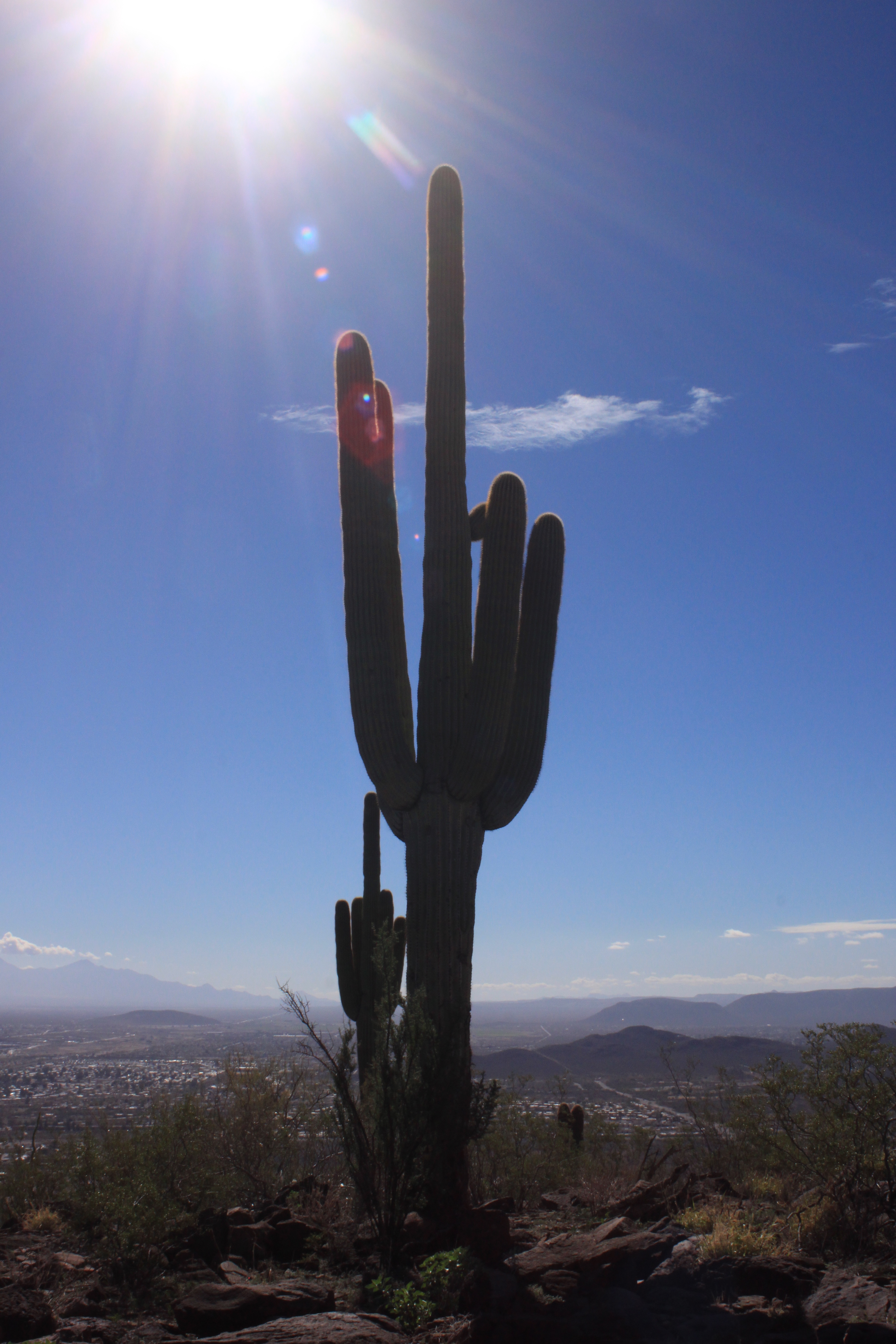
Tumamoc saguaro.
Photo—Meghan Marriott, 2014.
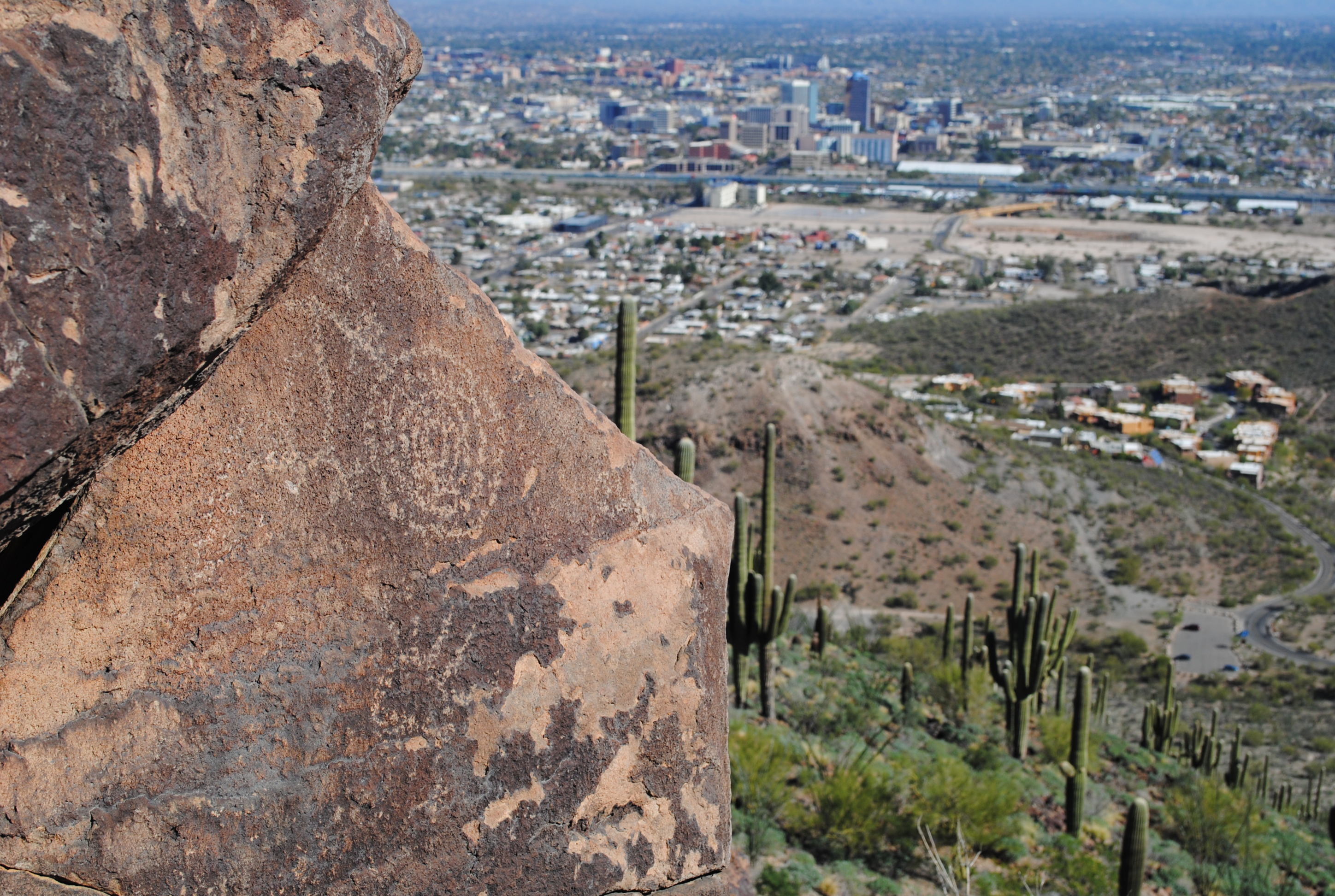
Tumamoc rock art. Photo—Carly Stewart, 2014.
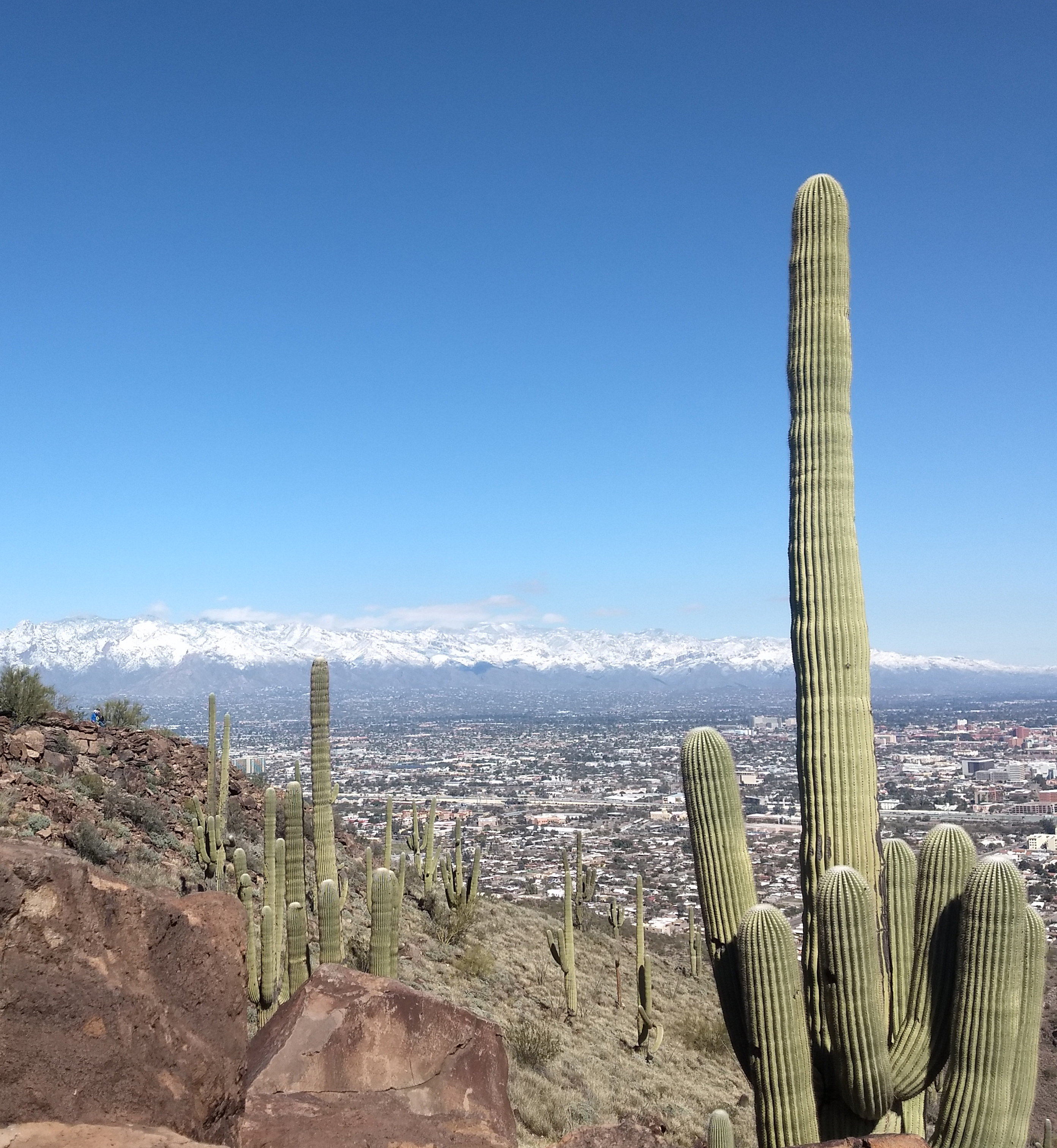
Lots of snow this year. Photo—Amanda Linville, 2019.
Tumamoc bedrock mortar.
Photo—Nina Kolodij, 2015.
Paul wins again, "biggest hat."
Photo—Carly Stewart, 2014.
It can't be said we don't go
to nice places for lunch.
Photo—Ash Abbate, 2023.
2022: Tucson Basin from Tumamoc, with weather looming.
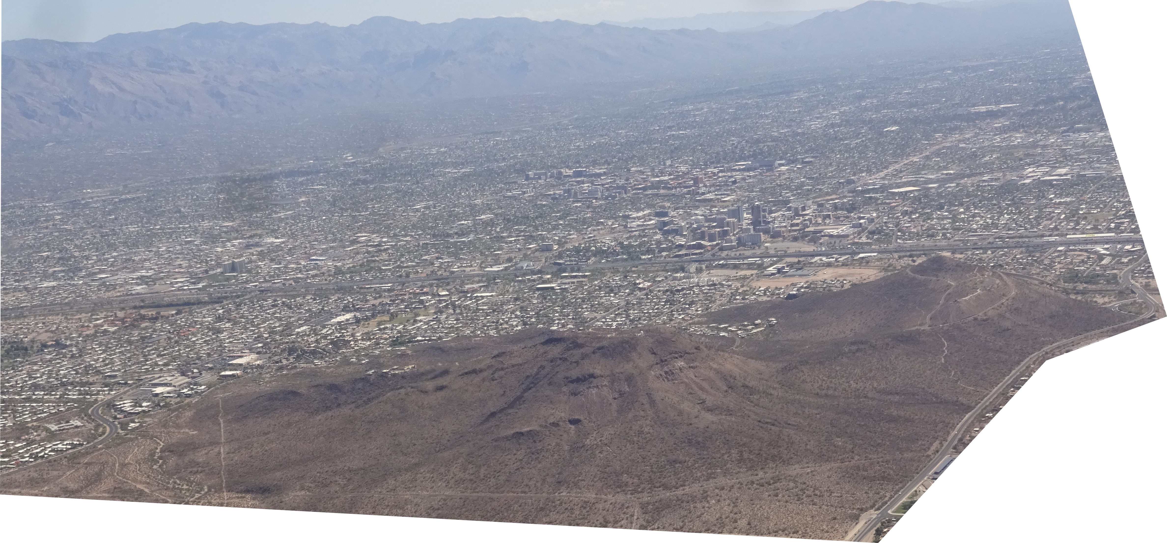
Tumamoc and A Mt. from the air, landing into TUS.
Tumamoc Hill is also a cherished spot for hill walkers, people who like to hoof it up and down the whole way to get exercise, see the great views, and socialize. Click here for a webpage for and by Tumamoc Walkers, and click here for an account of walking Tumamoc plus basic stats of the Hill. This walking activity has been somewhat controversial because of access and protection issues. See the following links to the local newspaper for entries to this debate:
- 2/9/06: Desert Lab may shut Tumamoc to hikers: The director of the Desert Lab comments that the Hill might have to be closed to the general public in order to protect long-term research on the Hill.
- 2/13/06: West Side walk strains muscles and UA patience: An editorial asking for compromise on access versus closure.
- 2/16/06: Letters to the editor: The vox populi, letters to the editor, give a sense of the public on this issue. The first two letters in this link are about Tumamoc access.
- 2/19/06: Hilltop privy is a comfort to all: An editorial noting a compromise that has resulted in a portable toilet on Tumamoc Hill.
- 2/23/06: Careful who you call elite: A letter to the editor (5th one down) noting the lengthy research tradition of the Desert Laboratory on Tumamoc Hill.
- 4/24/07: Tumamoc Hill is too crowded: A letter to the editor (3rd one down) complains that Tumamoc Hill has so many walkers that there's no longer any solitude in the walk.
- 2/23/06: The Lost World: Paul Martin's look back at animal extinctions leads to some controversial ideas for the future. Paul Martin is a prominent figure recently of the Desert Lab of Tumamoc Hill.
- 7/18/10: Tumamoc Hill and Tucson - we need each other: Dean Joaquin Ruiz and Director Michael Rosenzweig write about how Tumamoc Hill and Tucson can co-exist, to the benefit of both entities.
- 8/28/17: Tumamoc Hill now open all day for walking. Acknowledging the obvious.
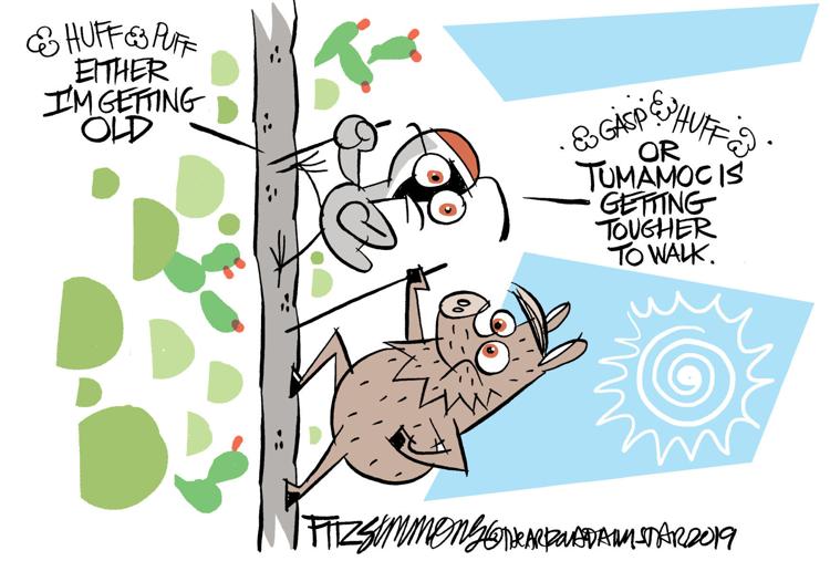
- Fitzsimmons humor:
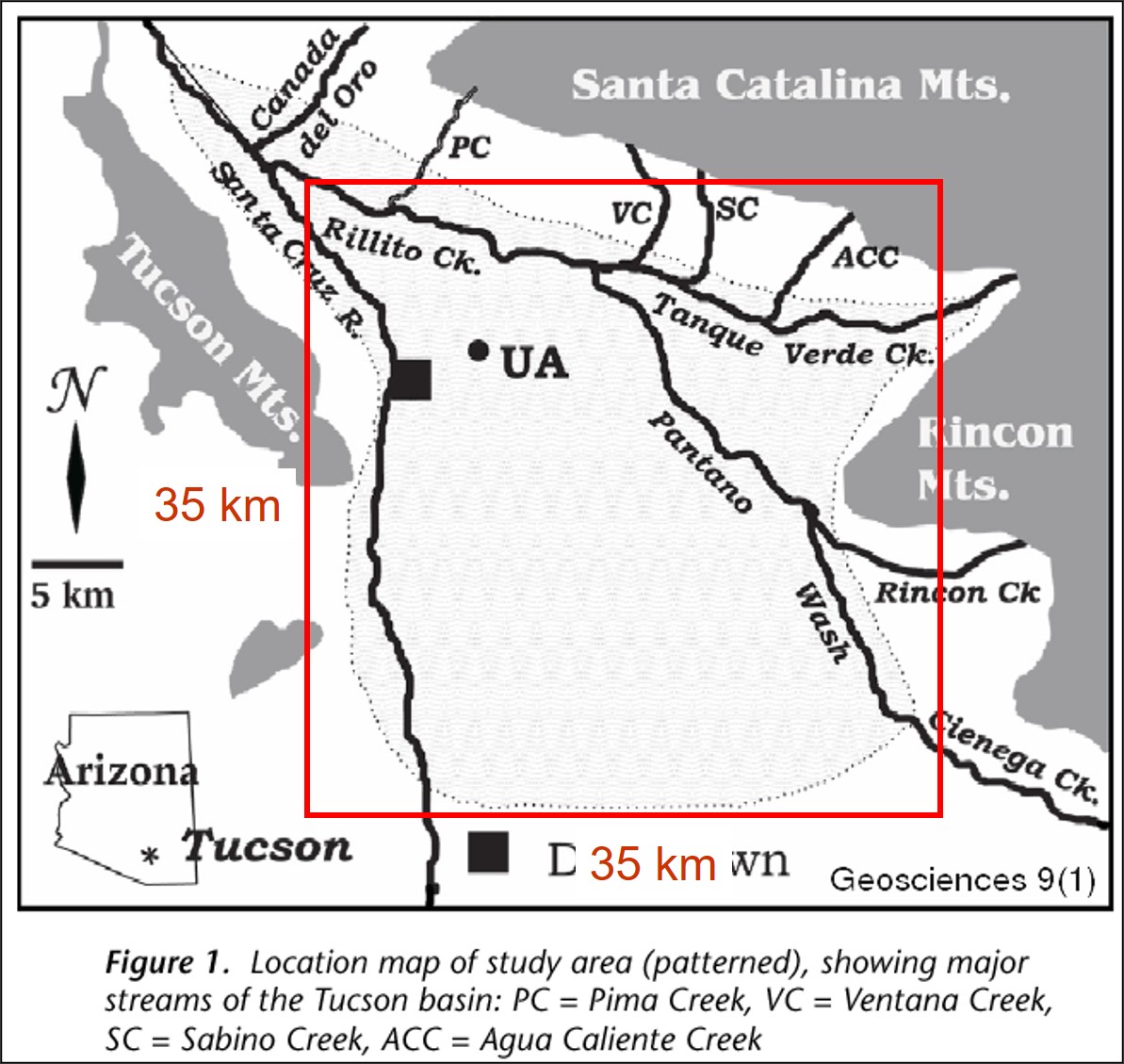
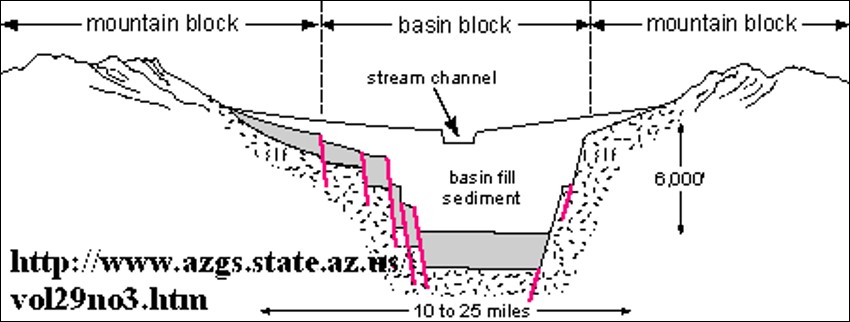
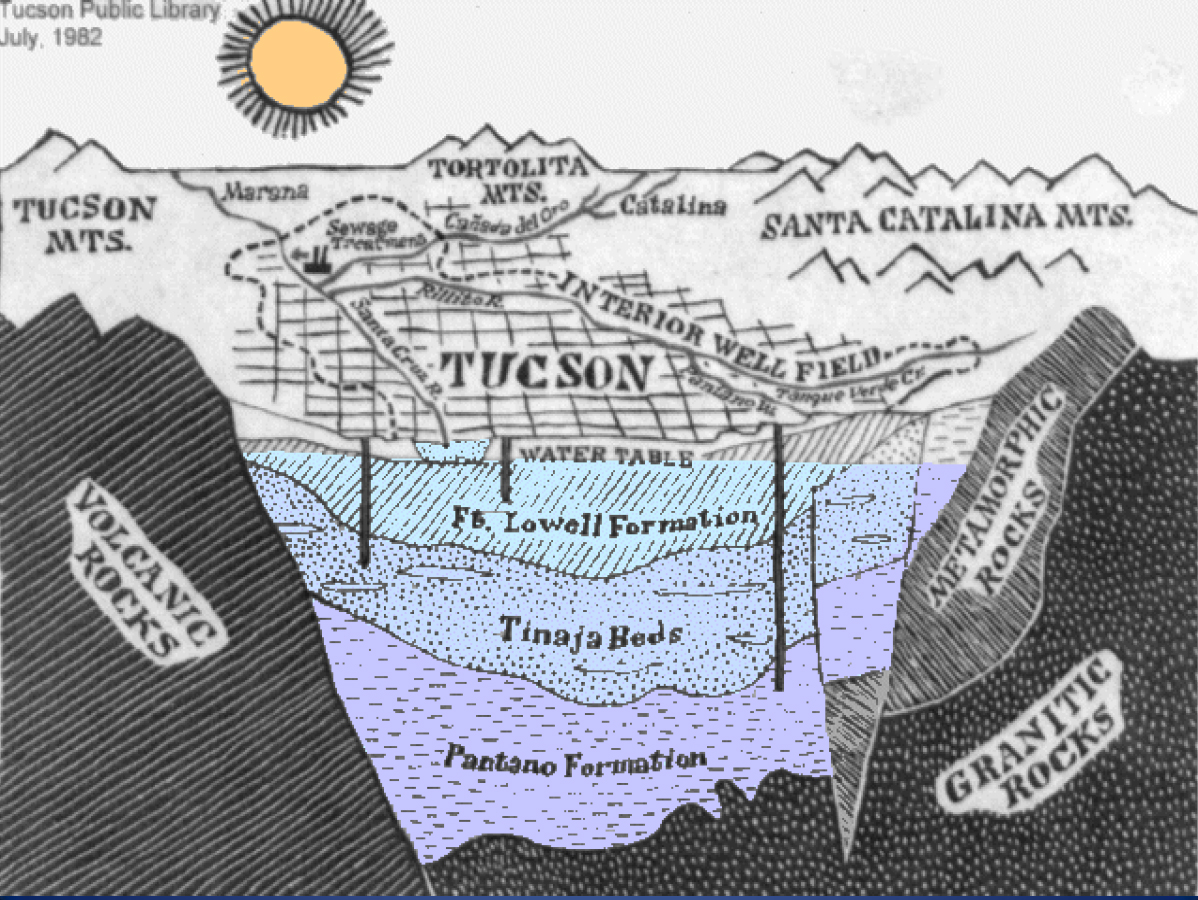
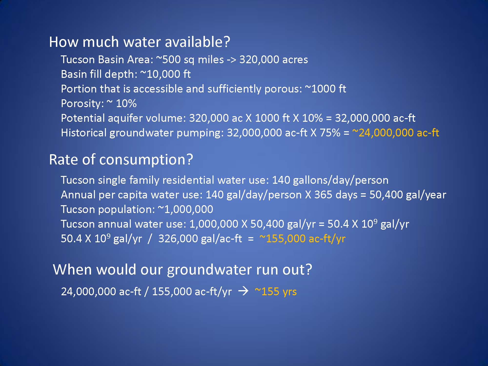
Tucson's Bucket of Sediment Visible from Tumamoc Hill:
At ~500 sq. mi. in area and several thousand feet thick, Tucson's bucket of sediment is enormous. How much groundwater might be down there? Still? Do the math:
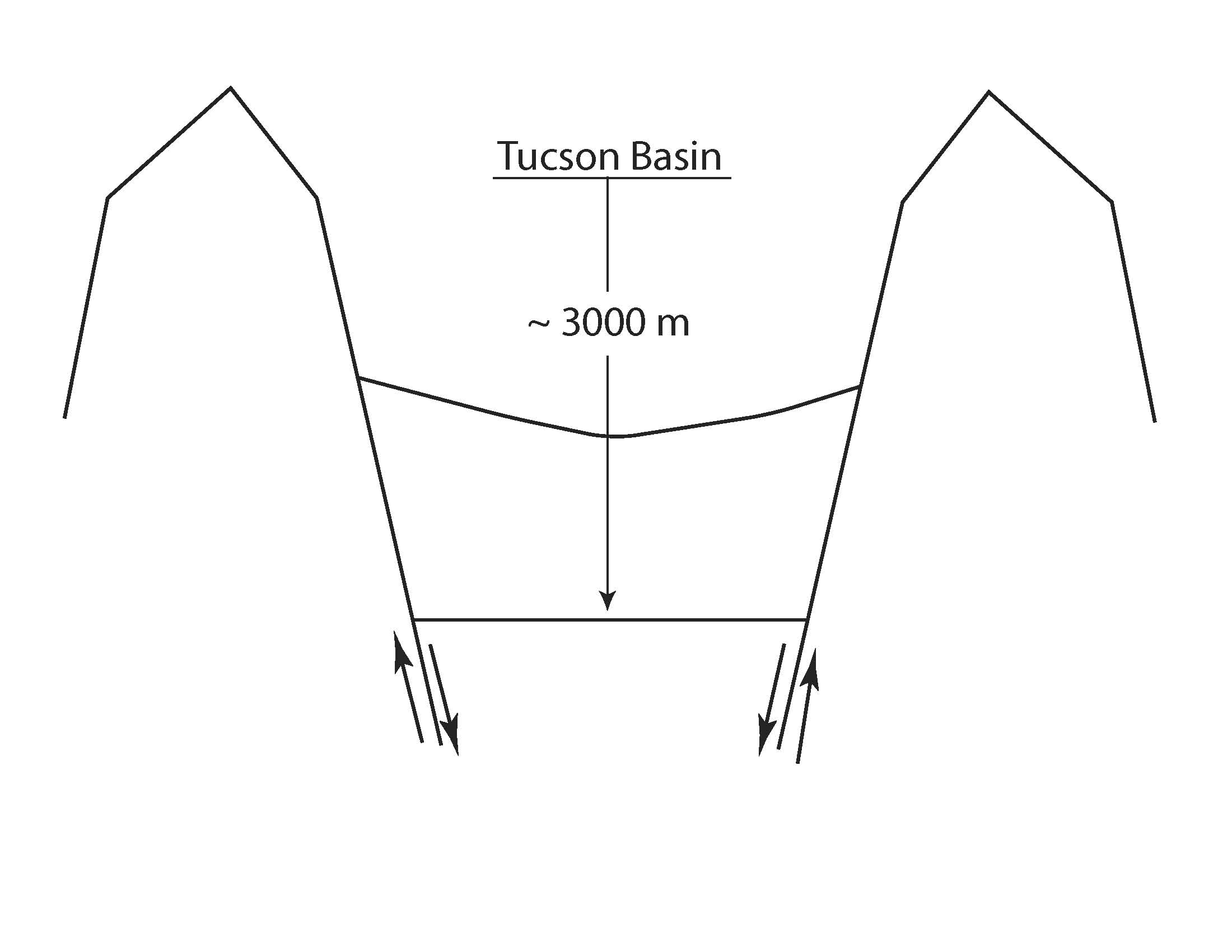
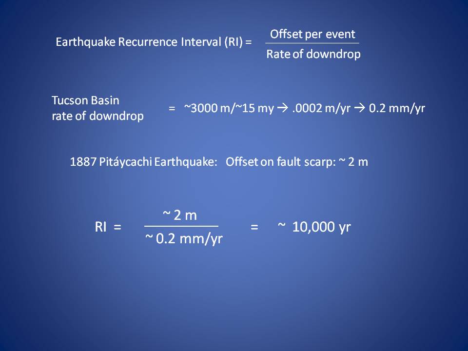
Tucson's Next Big Earthquake? In 1887, a strong earthquake occured in northern Sonora, part of Basin and Range seismicity. Known as the Sonoran, or Pitáycachi, quake, it caused serious damage to buildings in Tucson. This raises the question: when might the next big one hit? How often do quakes like the one at Pitáycachi happen? This back-of-the-envelope calculation provides an idea of how often a quake of that magnitude might occur on a range-bounding fault in this region. However, it is important to remember that there are multiple range-bounding faults in southern Arizona, and thus the actual frequency of strong quakes felt in Tucson will be higher. Friends of Tumamoc
A Video Report of Walking Tumamoc
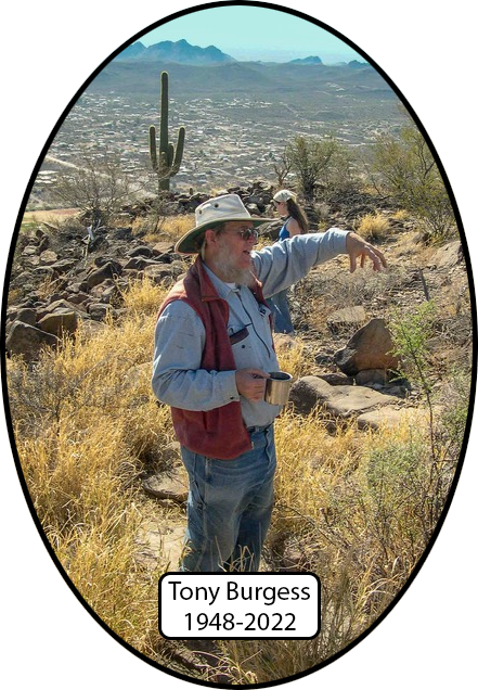
SOP Pays Tribute to Tony Burgess
Tony Burgess, pictured here on top of Tumamoc (2003 photo by Pete Kresan), co-taught SOP throughout the early years, from its inception in 1993 until 2003. See here for a write-up on Tony. There's an App for That Now
Click here to get the app for enjoying Tumamoc Hill on your own.
Back to Sense of Place Home Page