University of Arizona
Sense of Place
Geos. 195D
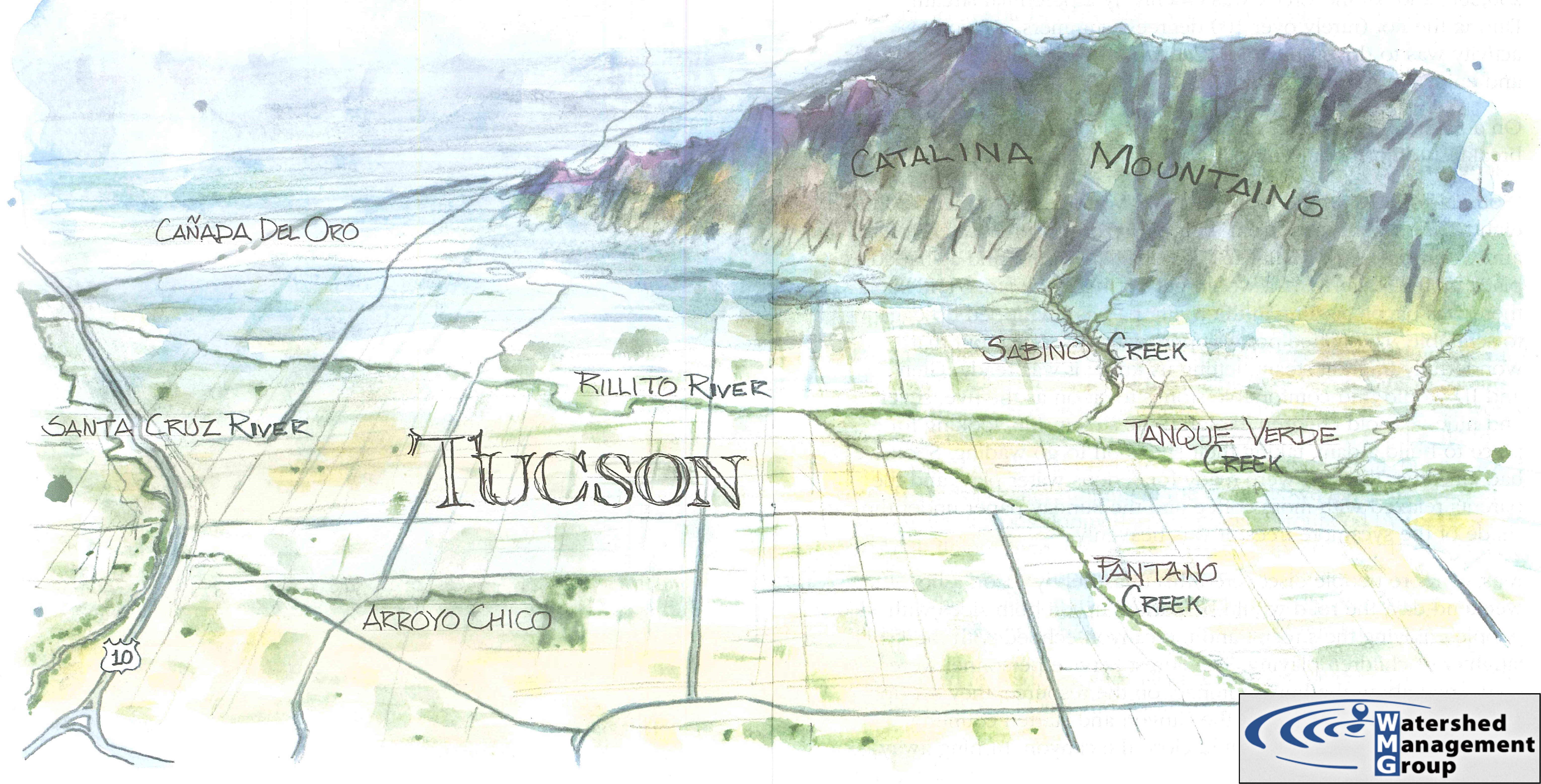
Tucson Desert Washes
Illustration by Dennis Caldwell,
Map shared courtesy of Watershed Management Group
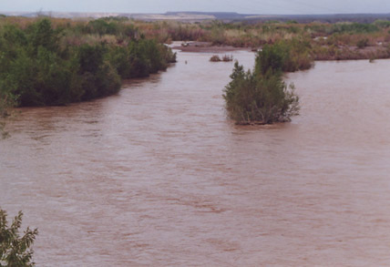
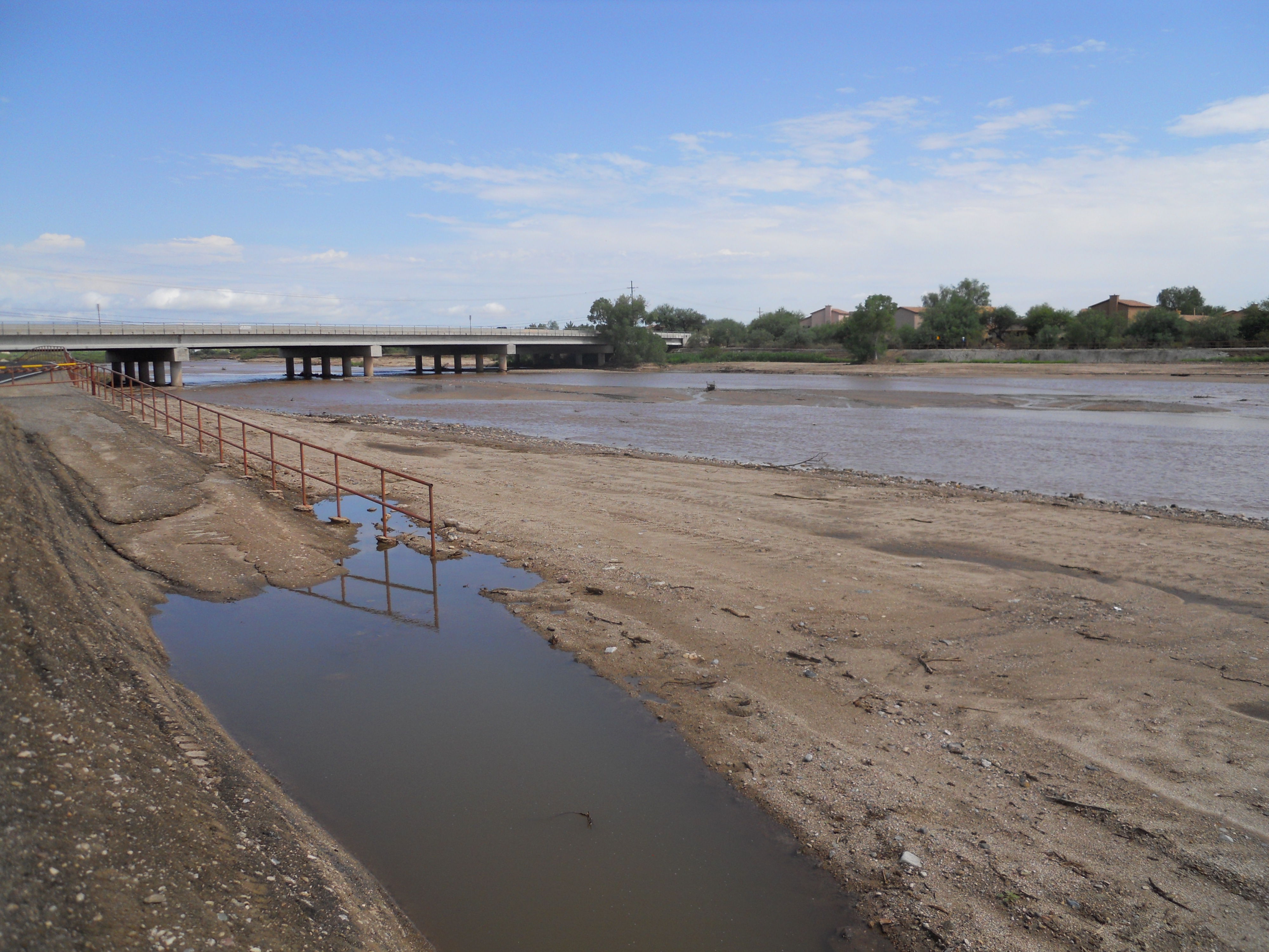
Tucson washes are mostly dry, except when they flood.
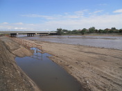
The Rillito in moderate flood,
with lots of muddy water.
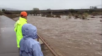
Click to see a short video of the January, 2015,
flooding of the Rillito.
Click to see a short 2022 newsclip of past flooding of Tucson.
- The Rillito experienced a peak flood during late July, 2006. Click here to see the USGS report on it, and here to see a video of it. Very impressive!
- '83 flood-control work helps limit damage: This AZ Daily Star article says the side wall cementing of our washes helped get us through the July '06 flooding.
- Marana floods: Then again, the downstream community of Marana took a hit in the July '06 flood.
The Rillito (Río-ito, little river)
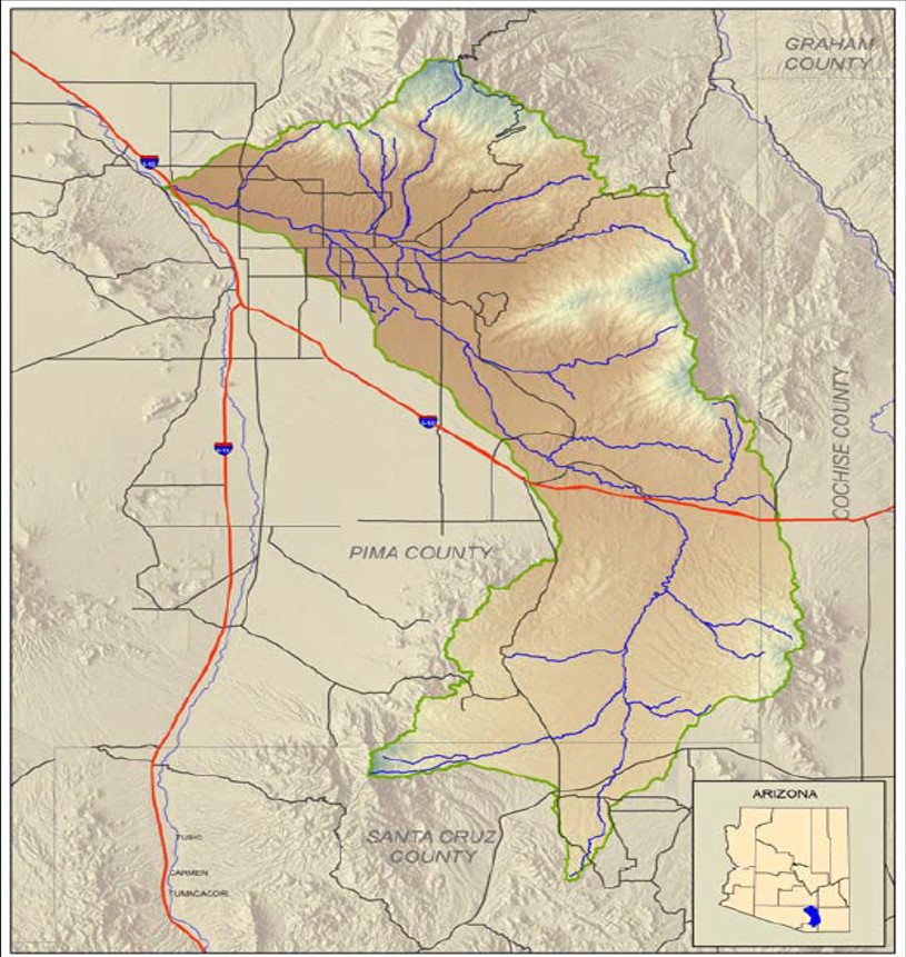
The Rillito-Pantano watershed is 588,800 acres (920 square miles) in area, starting in Santa Cruz County and flowing north-northwest. The Rillito runs along the north side of Tucson and drains into the Santa Cruz River just south of Orange Grove Rd.
Pantano Wash - Rillito River Watershed, Arizona: Rapid Watershed Assessment
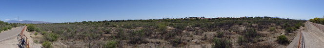
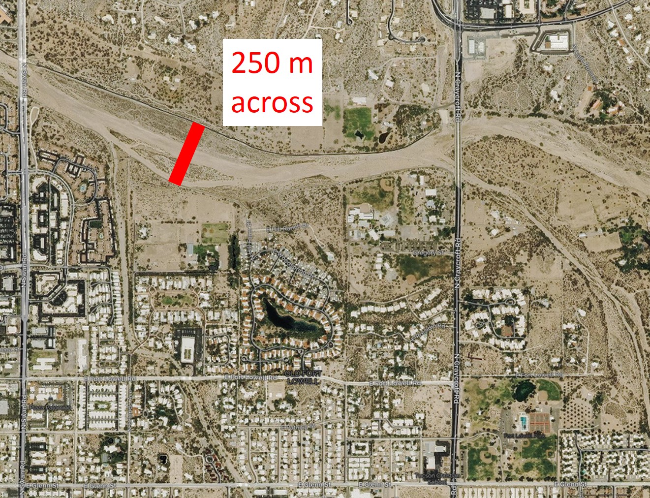
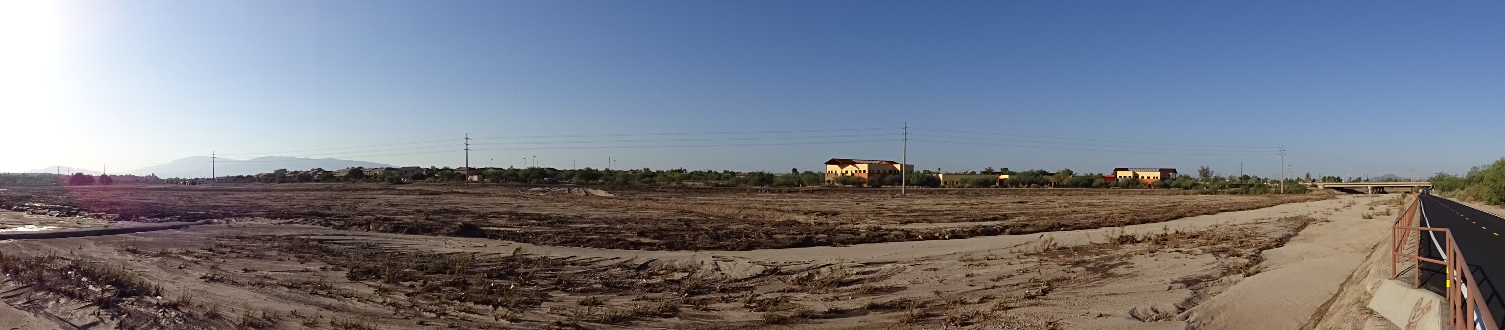
Looking south (pano) and down (aerial) at the Rillito between Craycroft and Swan.
Shallow but wide, loaded with burrobush.
- Stripping Tucson's washes of vegetation: June, 2016, Tucson Weekly article on reducing Manning's roughness number on the Rillito. Pros and cons? (On right image, notice shopping cart for scale.)
- Trees, shrubs, soil cleared from major stretch of Tucson's Rillito River: September, 2016, AZDS article on clearing out the Rillito.
- Santa Cruz through downtown at risk for big flood: September, 2017, AZDS article on clearing out the Santa Cruz.
Modern Settlement Along the Banks of Tucson Washes
A sense of place conundrum: Should houses and business be built in or near Tucson's washes?
- 7/5/06: Neighbors Oppose Go Ahead For House To Be Built In Wash: A housing development is planned for inside the Campbell Wash. The pros and cons are interesting.
- 3/13/07: Condo resident fears cracked wall won't withstand another flood: Just as we talked about in the Rillito, others have noticed changes in the flood protection due to the July, 2006, flood.
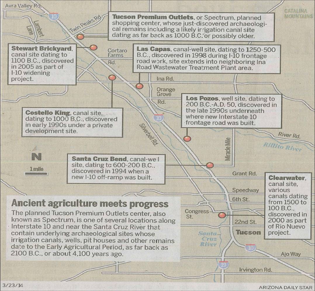
Settlements Along the Banks of Tucson Washes
People have been living along the banks of the Rillito and the Santa Cruz for millennia. For example, here's a map of archaeological sites along the Santa Cruz.
March 23, 2014: Arizona Daily Star.
Bank-full Discharge Measurement
It's possible to measure the maximum bank-full discharge (volume of water per unit time) rate of washes, even when they're dry.
First, stream cross-sectional area.
Then, slope using a topo map.
Then, back of the envelope.
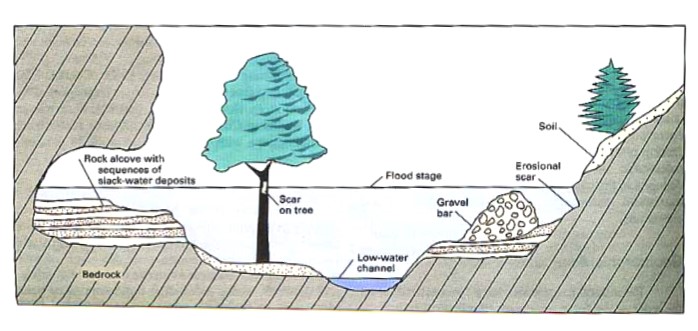
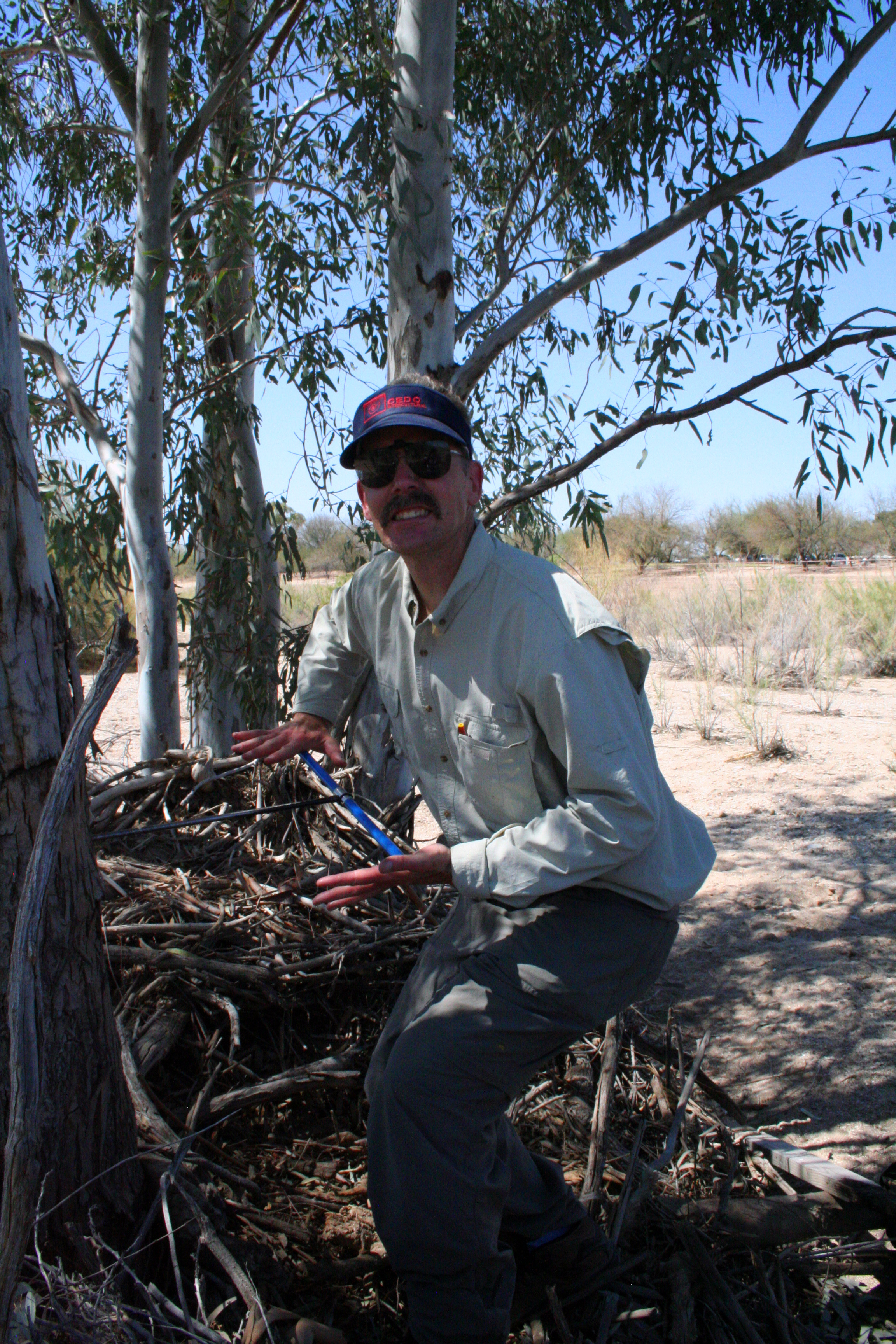
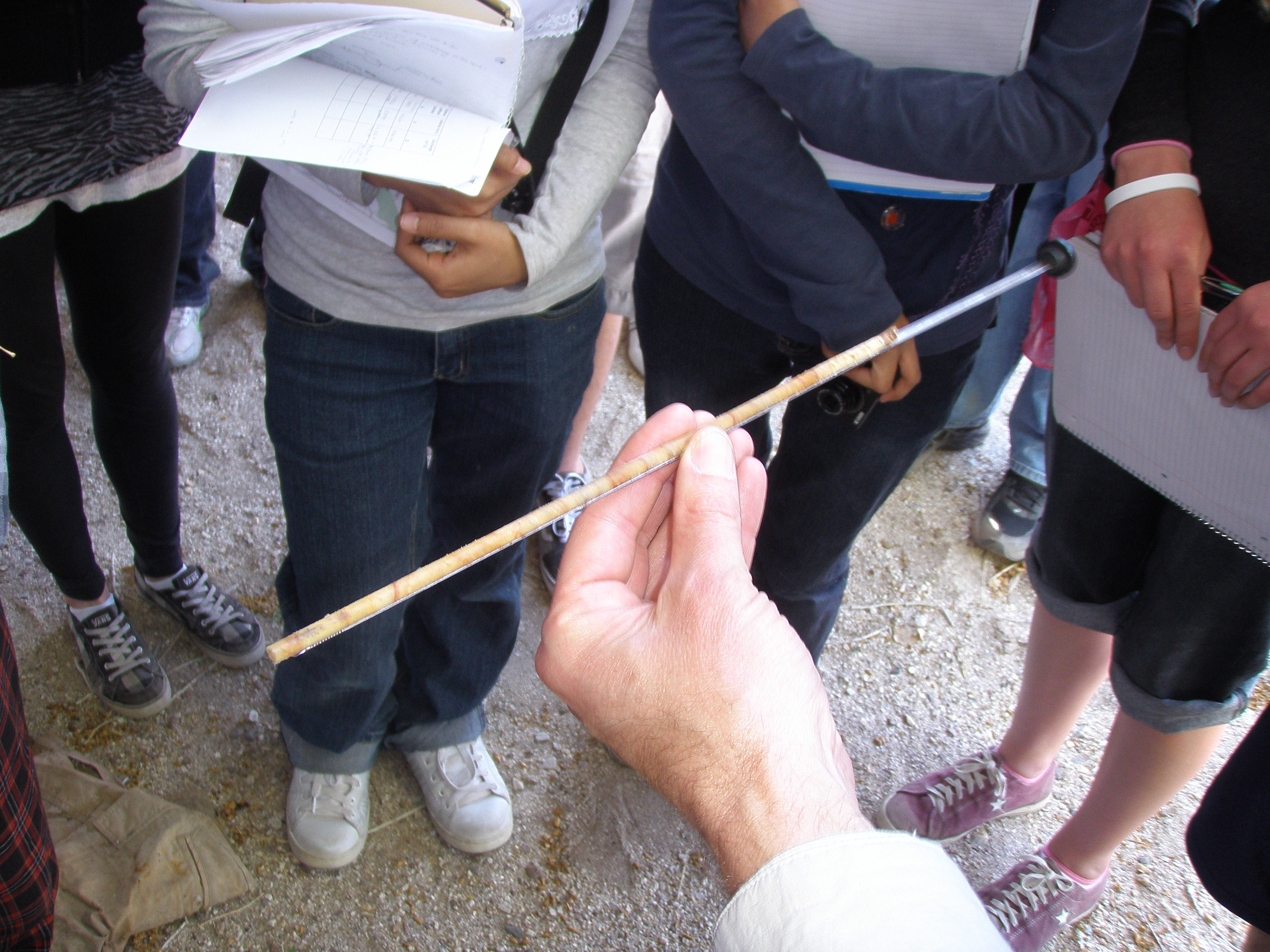
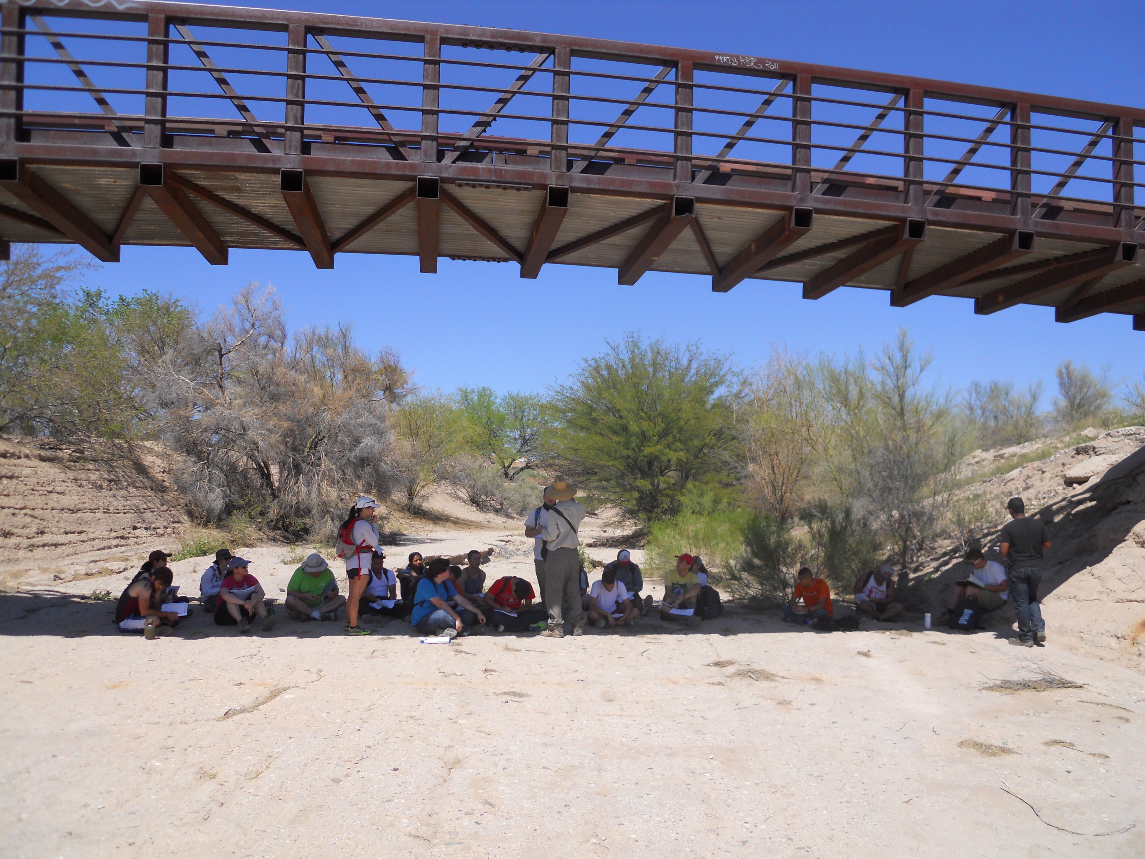
Dendrochronology
Dendrochronology, the study of tree rings, can be applied to riparian trees to date past floods.
2011: Coring a tree.
Photo — Jason Eckelbarger
2011: A tree core. Photo — Rachel Feuerbach
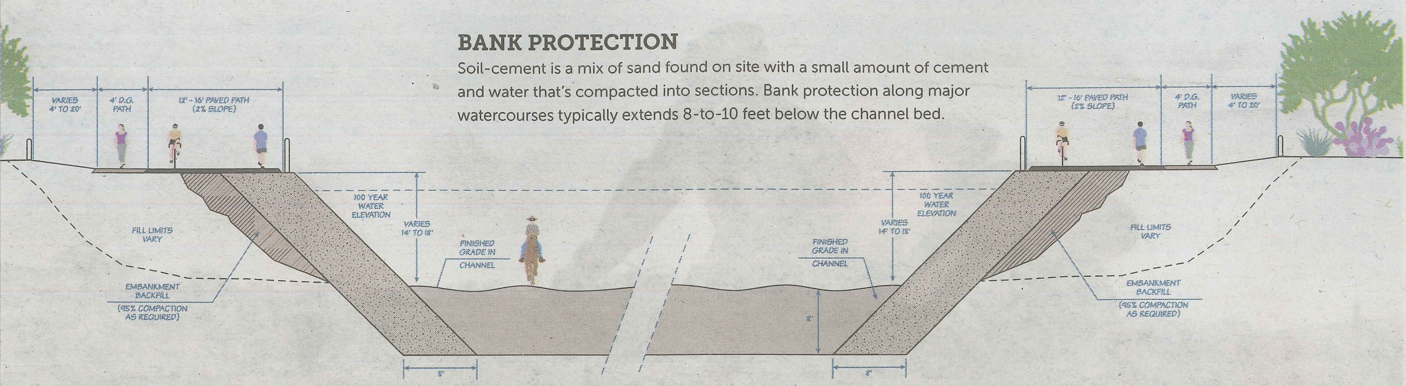
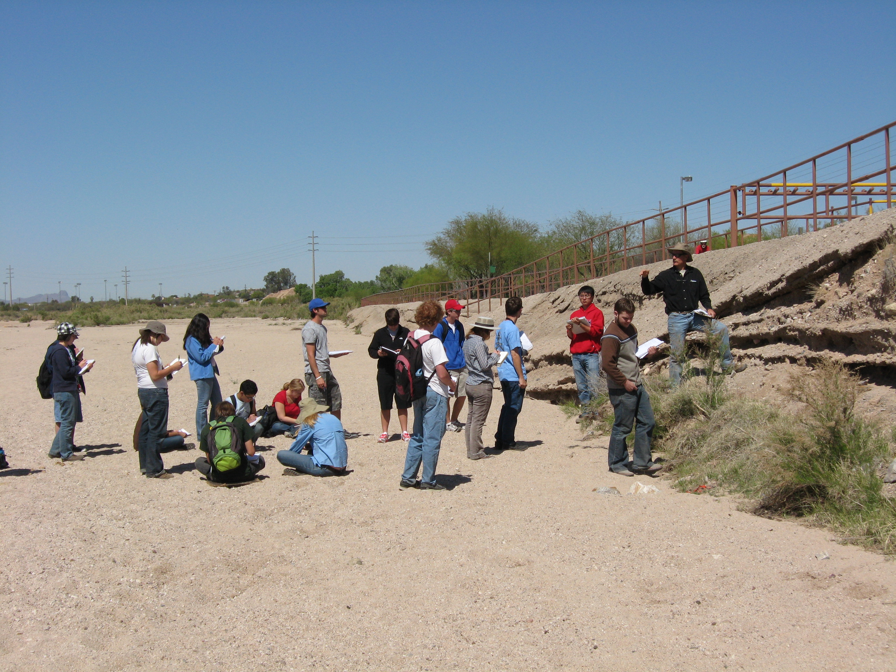
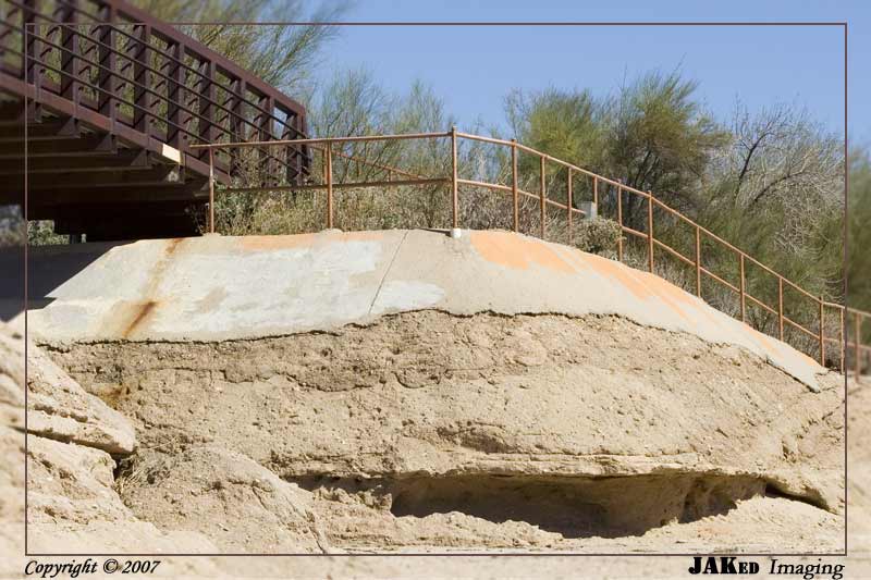
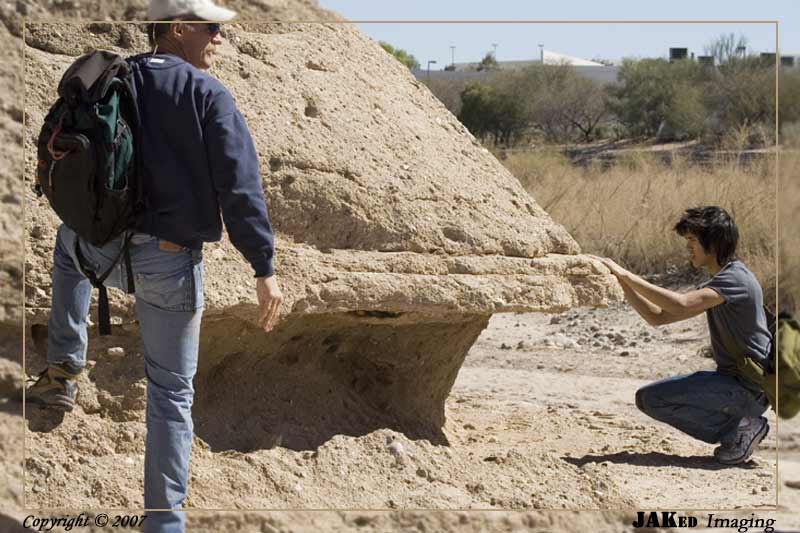
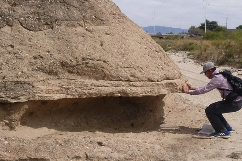
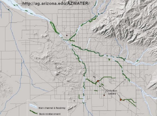
Cemented Banks
The banks of the Rillito have been cemented in, aka, re-inforced (see map below), which protected many "streamside" areas during the July, 2006, flooding. Will the cement hold out forever?
Engineering cross-section
2009: Photo — Paul Sheppard
2007: Photo — Jayme Kelter
2007: Photo — Jayme Kelter
2022 repeat photo — Gary Huckleberry
2014: Seeking shade, Pima Wash.
Photo — Gary Huckleberry
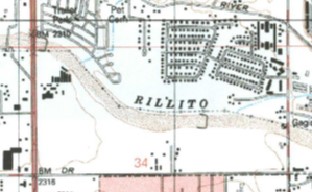
Map of bank reinforcement of Tucson washes.
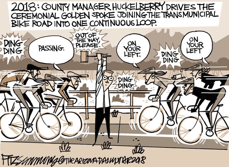
Desert Wash Humor
- Click here to see a K. Rat comic on cleaning out Tucson washes of all vegetation.
- Right: watch out for the cyclists on this trip!
2018: Fitzsimmons, AZDS
The Rillito Freeway
Rillito Freeway: A plan has been floated to build a crosstown freeway on the Rillito, and continuing on the Pantano. Is this a good idea? As usual, pros and cons?
Back to Sense of Place Home Page
Laboratory of Tree-Ring Research, University of Arizona
Tucson, Arizona 85721 USA
Comments to Paul Sheppard: sheppard @ ltrr.arizona.edu
Copyright © 2004-2022 Laboratory of Tree-Ring Research, The University of Arizona
Revised — March, 2022