University of Arizona
Sense of Place
Geos. 195D
Mt. Lemmon
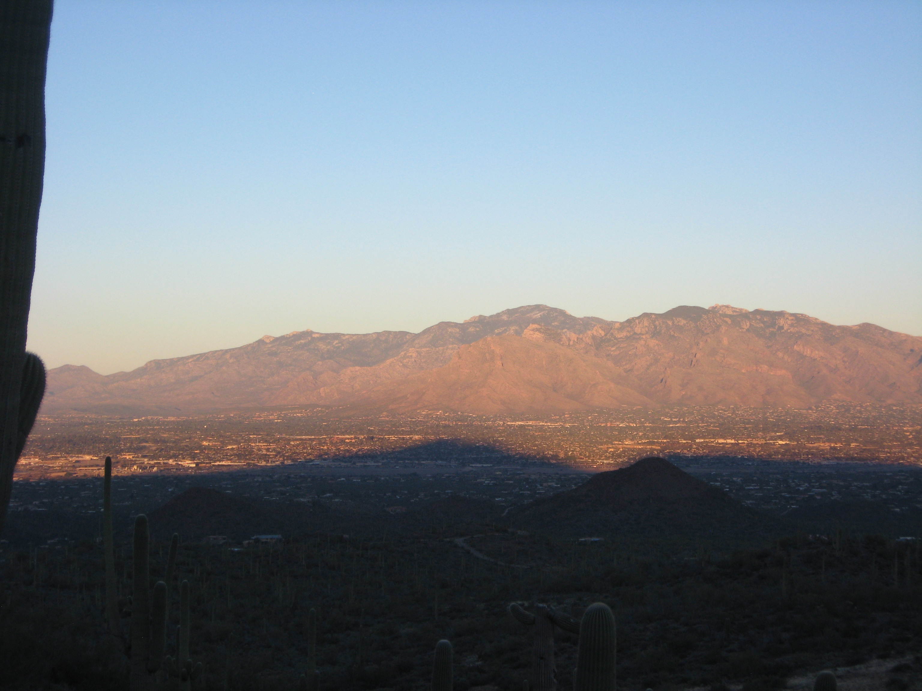
The Catalinas in late afternoon sun, with
shadows from the Tucsons.Mt. Lemmon, all the way to the top of the Catalina Mountains, is one of the great single-day natural history tours of Tucson, if not the entire country. Start here with this video about Sky Islands, courtesy of the UA Flandrau Science Center.
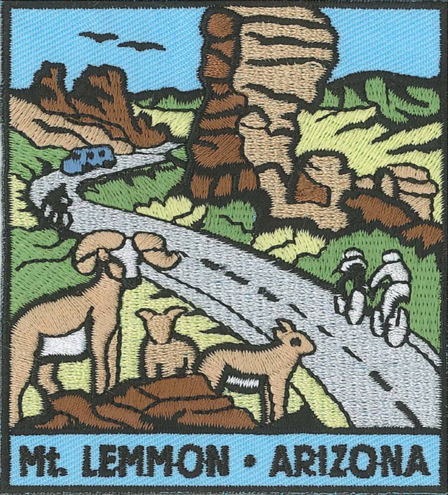
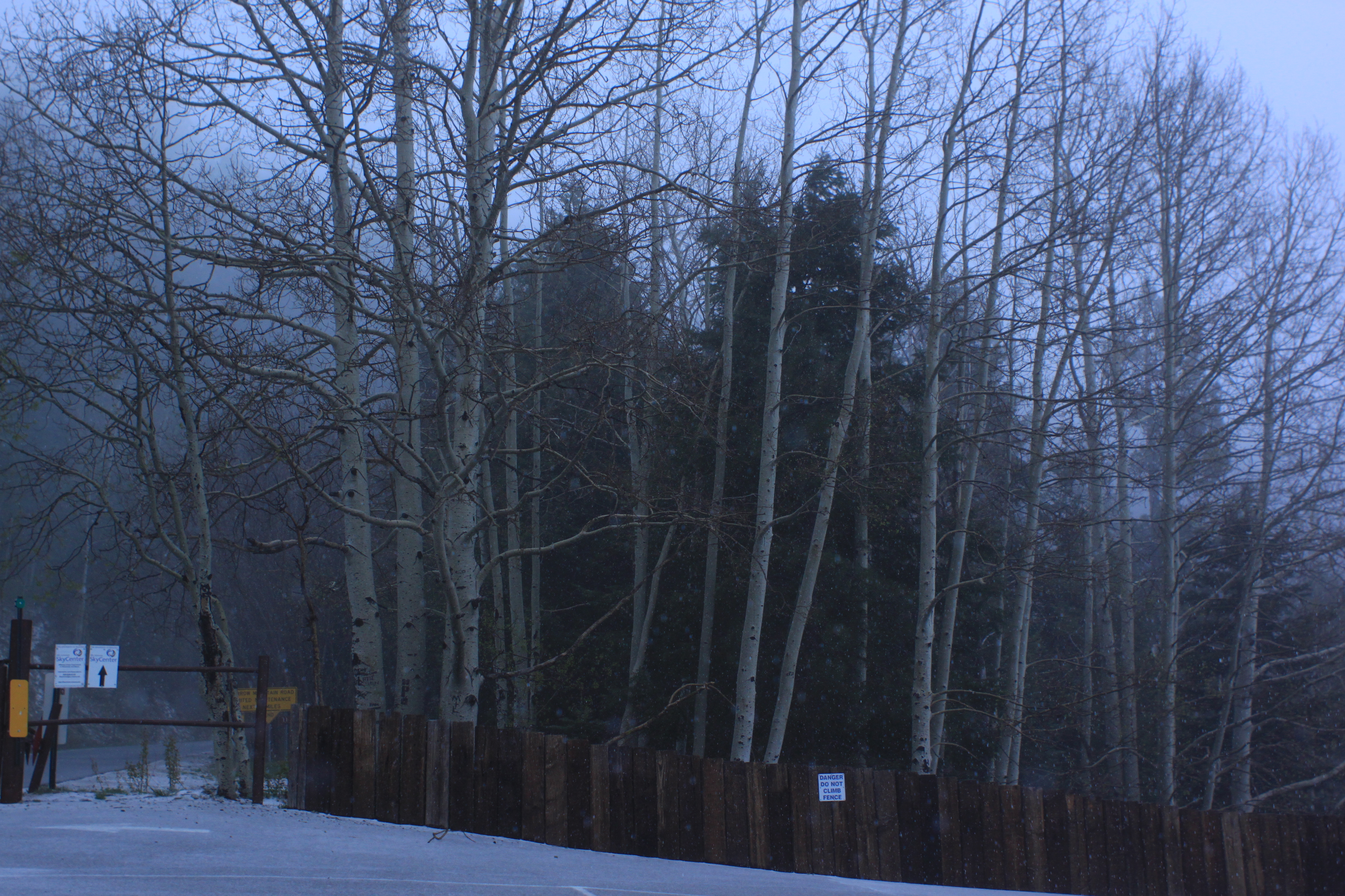
Nice patch, available at the
Palisades Visitor Center.
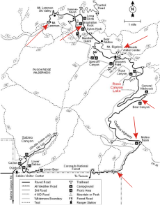
Mt. Lemmon Highway (aka, General Hitchcock Highway)
Mt. Lemmon Highway
This Arizona Daily
Star article explains
who Sara Lemmon
was, one namesake
for the mountain
highway.
Sara Lemmon
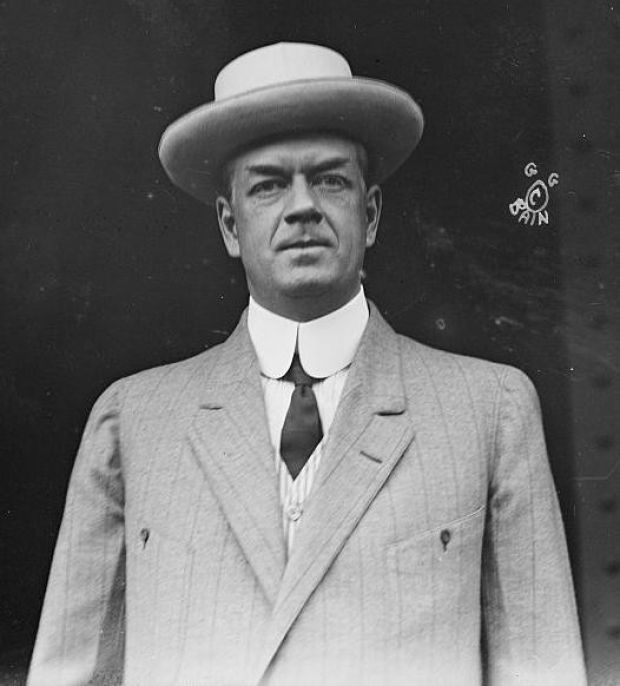
- Hitchcock Highway: This Arizona Daily Star article explains who General Hitchcock was, another namesake for the mountain highway.
- Drive Up Mount Lemmon: This 1990 Arizona Highways article covers various issues of the mountain highway. Password needed.
- Catalina Highway - Building a better road isn't a bad idea: This 1992 Arizona Daily Star article implores improving the Catalina Highway.
Frank Hitchcock
Proposed Aerial Tramway Up Mt. Lemmon
An idea to build an aerial tramway up Mt. Lemmon is floated every now and then. In chronological order, many Arizona Daily Star articles:
- March 11, 1992: Tram to summit of Mount Lemmon envisioned.
- Spetember 10, 1998: Supervisor Carroll pushes for a tram up Lemmon.
- October 12, 2003: Lemmon tram idea said worth exploring.
- October 15, 2003: Torpedo the tram.
- May 18, 2005: Supervisors greenlight Summerhaven plans.
- July 16, 2005: County leaders eye Mt. Lemmon tram.
- July 24, 2005: Consider nature on Lemmon tram decision.
- July 24, 2005: This is all just a really bad dream - isn't it?
- July 28, 2005: Speak up on Mount Lemmon tram idea.
- August 11, 2005: Mt. Lemmon tram piques Oro Valley's interest.
- December 7, 2005: Lemmon tramway study is rejected.
- August 19, 2012: New plan for tram up to Mt. Lemmon.
- August 21, 2012: Let's put to rest dream of tram into Catalinas.
Sandia Peak, NM
Palm Springs, CA
The Santa Catalina Mountains
Catalina Mountains
This Forest Service pub explains how the Catalinas were named, as well as the other Sky Islands.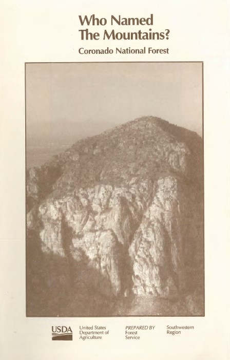
Good Book
Islands in the Desert: A History of the Uplands of Southern Arizona, by John P. Wilson.
Catalina Gneiss
- Sabino's a gneiss canyon: This April 17, 2011, Arizona Daily Star article covers the taffy-like gneiss rock at the bottom of the Catalinas.
- Catalinas' rock: Life's foundation: This October 28, 2012, Arizona Daily Star article covers the geological formation of the Catalinas.
Taffy rock. Photo — Paul Sheppard
Gary, action block modelist. Photo — Paul Sheppard
Ta-da! Photo — Paul Sheppard
Gary demonstrating the deck of cards model in video (2:06 minutes)
Gary demonstrating the block model in video (3:32 minutes)Babad Do'ag (Tohono O'Odham for "Frog Mountain") 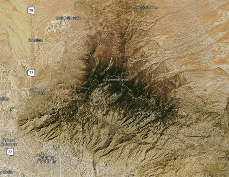
Aerial of the Santa Catalinas
(see the frog?)Babad Do'ag Vista Possibly to be Encroached Upon by Trophy Homes
- 8/1/10: 8 hillside homes may harm views in Catalinas. Large luxury homes are being considered for right near Babad Do'ag Vista, our first stop on the Mt. Lemmon trip.
- 8/8/10: Letter to the editor. The vox populi, with an impassioned viewpoint.
Babad Do'ag vista, 2023, still unblocked by trophy homes.
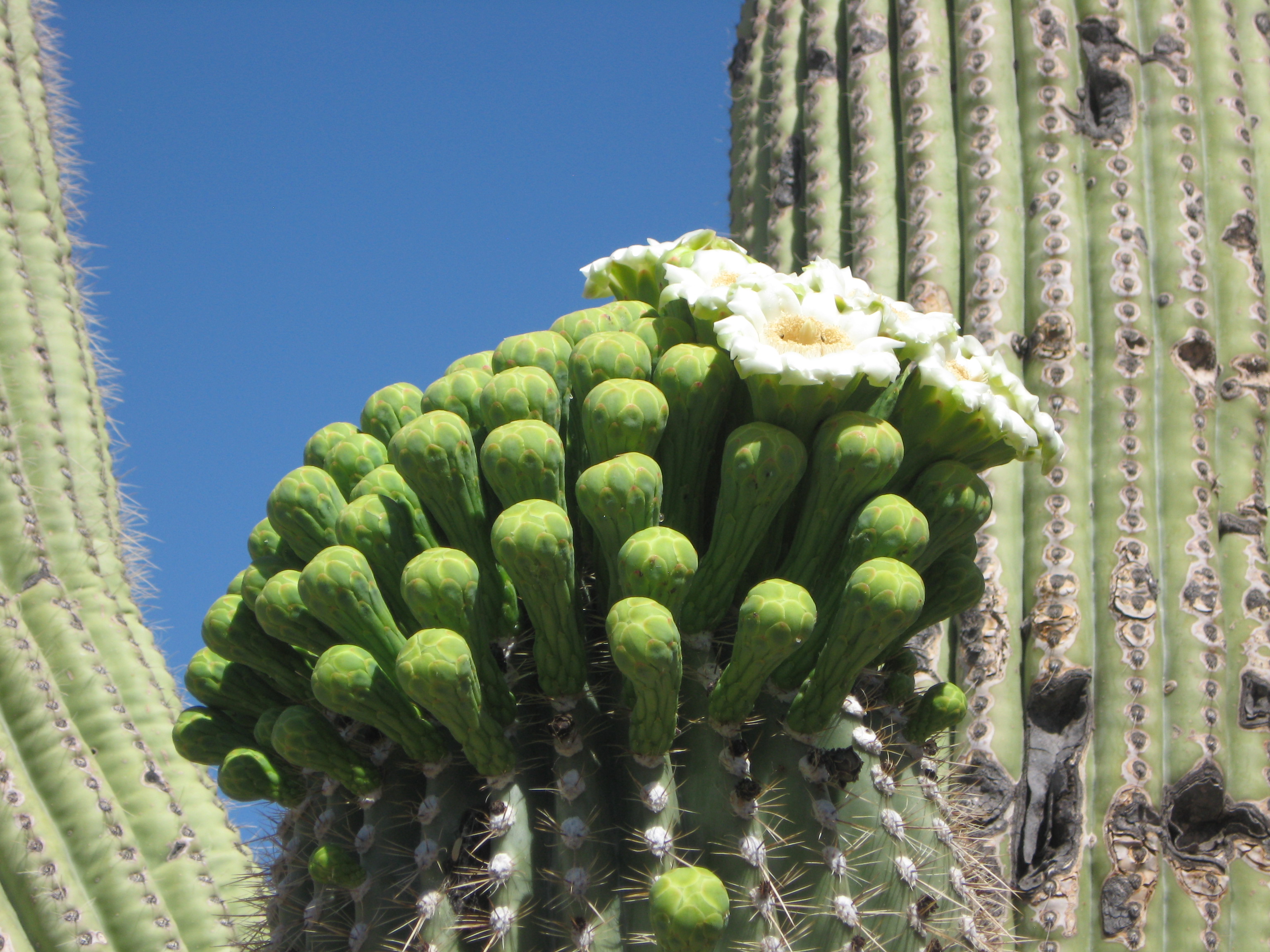
Photo — Paul Sheppard (click to see enlarged photo.)Saguaro Blossoms
On the 2013-2016 trips, a saguaro at Babad Do'ag had already created flower buds, some of which were open as flowers. End of April seems early for saguaro blossoms, but the Arizona-Sonora Desert Museum says this is not unheard of:
Photo — Paul Sheppard
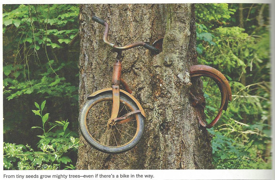
How Trees Grow
Trees grow: And:
- Tall from the top (or ends of their branches)
- Same for roots, but in the opposite direction
- Wide from the bark
- Some 95% of a living tree is comprised of dead tissue
- Quite the opposite life strategy employed by animals
So, how is this situation explainable?
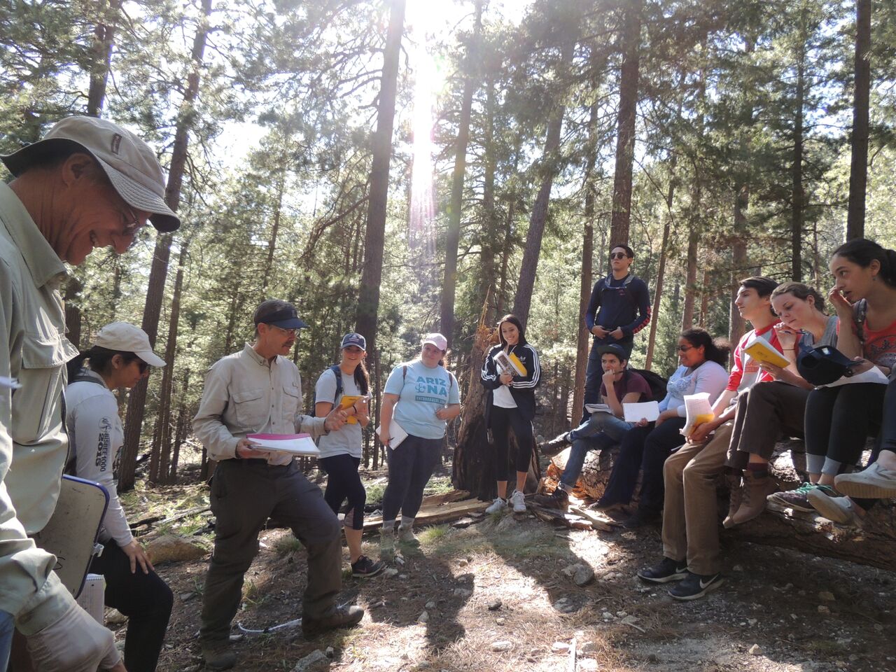
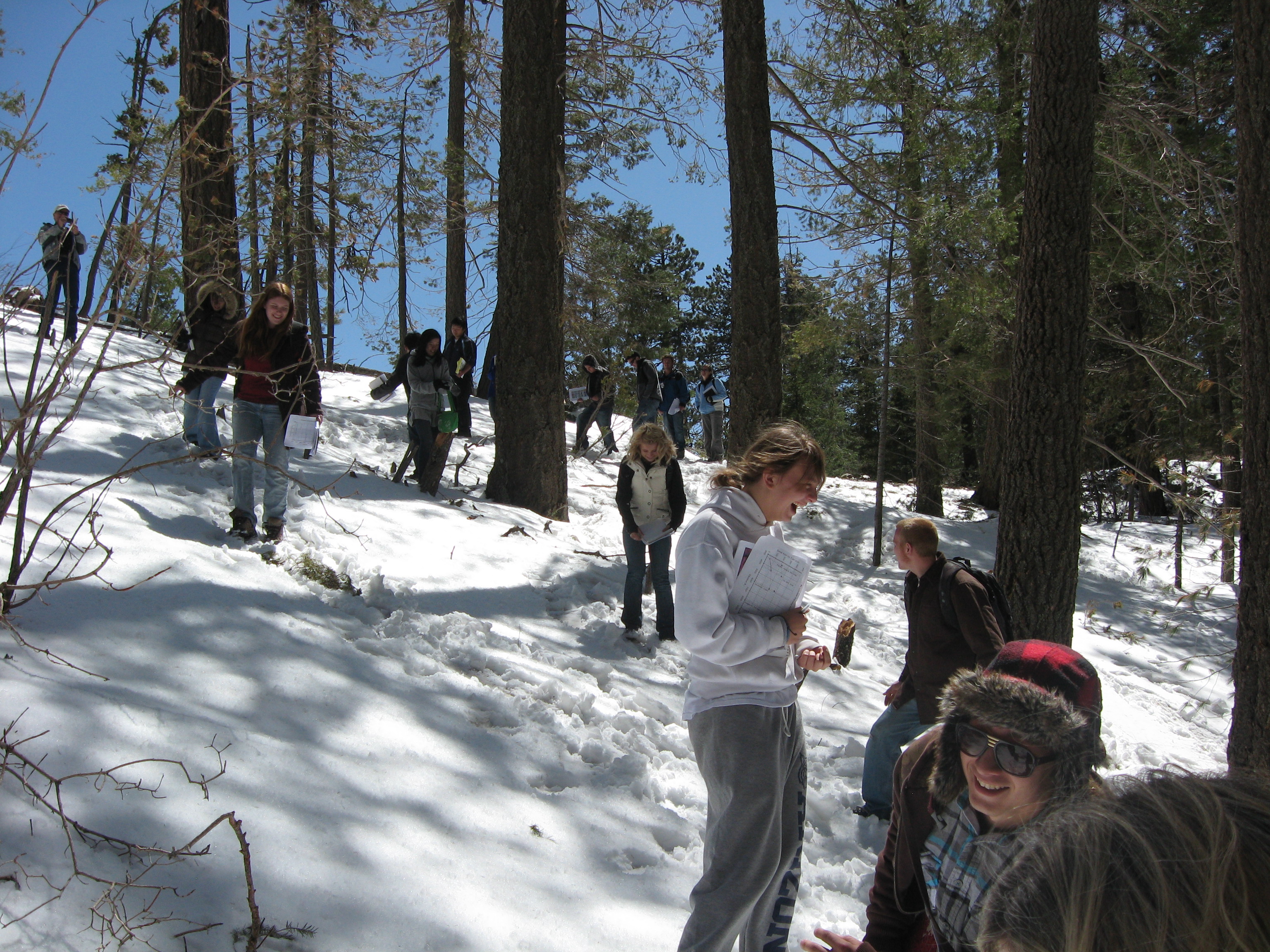
Ecosystem Productivity by the "Thumb Trick"
Ecosystem productivity can be expressed as "basal area," i.e., how much area, say of one acre, is occupied by the main stems of trees. One way to measure this is laboriously measuring each tree in an acre. Another way it to use a point-centered technique that extends triangles into the infinite distance. This is affectionately known as the "thumb trick," an ingenious invention of the 20th Century by an Austrian forester, Walter Bitterlich. The math (below) is easy.
Thumb trick in action, 2016.
Photo — Paul Sheppard
User Fee to Drive the Highway
A user fee is charged to drive the Mt. Lemmon Highway and stop to hike and/or picnic or do whatever to enjoy the mountain. There are various pros and cons to user fees. Some recent voices on this subject:
- 9/13/06: U.S. judge's ruling could end forest user fees. This is about our very own Mt. Lemmon Highway user fee.
- 9/16/06: Ruling to halt forest fee will be appealed. Ever the appeals system at work.
- 9/17/06: Clear ruling needed on rec-area user fees. An op-ed piece asking for a ruling from the courts.
- 3/14/10: Forest Service user fee upheld. A lawsuit by four Tucsonans against the fee is thrown out.
- 2/10/12: Court halts fees for use of Forest Service land. Court changes its mind: fee is slapped down.
- 2/22/12: Fees for parking, hiking ended on road to Lemmon. Fee is officially ended for Mt. Lemmon.
- 5/12/12: Fee-collecting rangers are called 'intimidating'. Fee is still being charged at Sabino and Madera canyons.
- 4/14/18: Coronado Forest seeks comment on proposed fee increases. Still talking about user fees to visit national forest lands.
Paul's Piñon Pine-Nut Muffins 1 cup (~6 oz.) piñon pine nuts, ground ½ cup flour (wheat, corn, or gluten-free) ½ cup water 3 tablespoons honey 2 teaspoons baking powder ½ teaspoon salt
Combine dry ingredients. Add water and honey and mix well. Pour into greased muffin tins. Bake for ½ hour @ 350º F. Makes 24 bite-sized muffins (or ~6 big ones).
Enjoy in the shade of a Madrean mixed woodland of a Sky Island of the American Southwest.
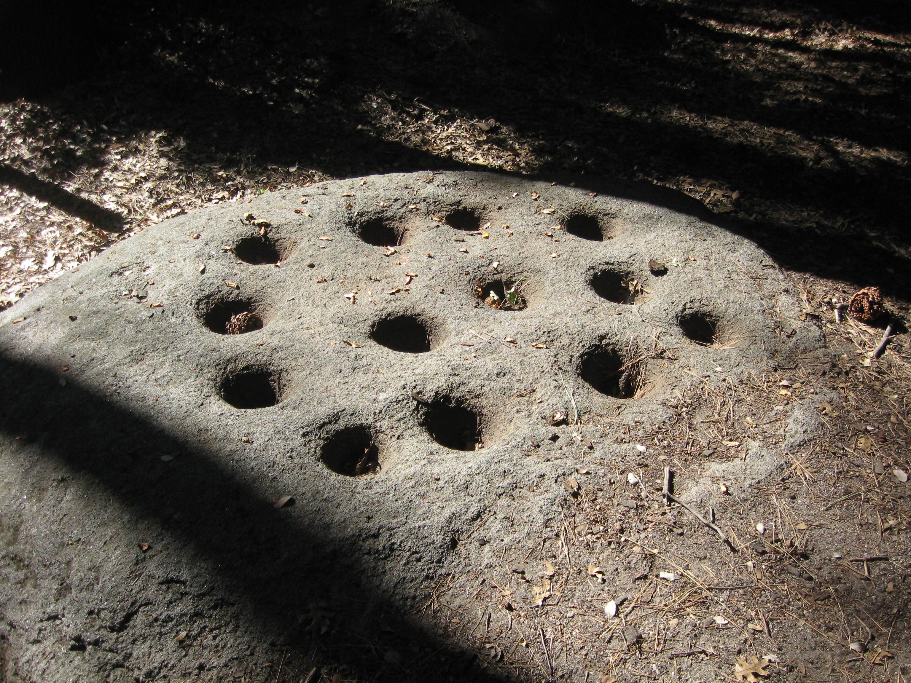
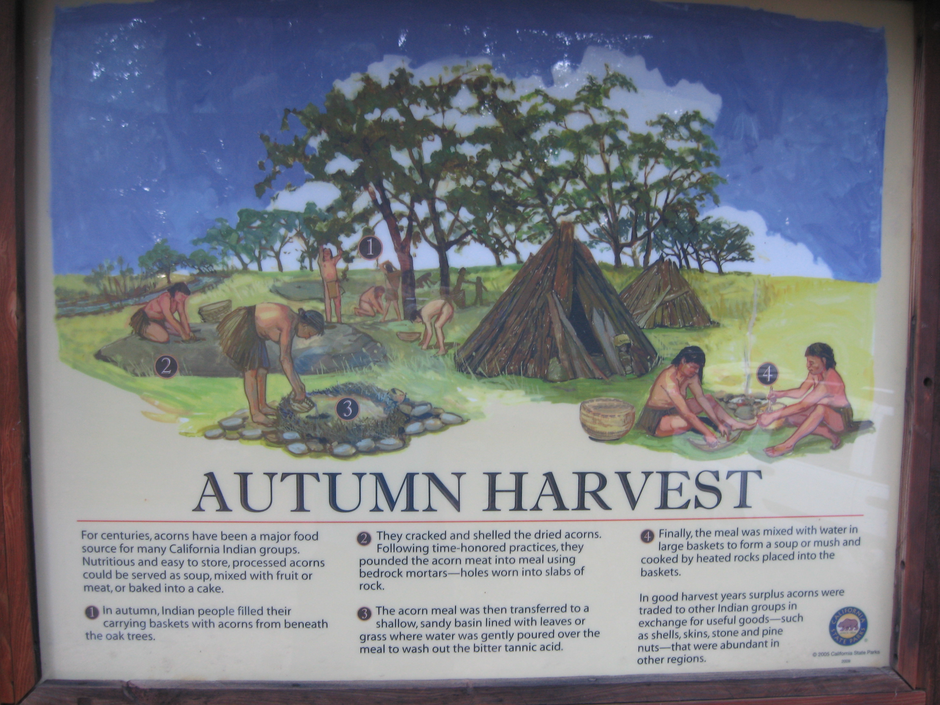
From: Niethammer, Carolyn. 1974. American Indian Cooking: Recipes From the Southwest. University of Nebraska Press.Live Oaks of the Mixed Madrean Woodland
Quite the kitchen.Lower-mid elevations of the Sky Islands have the Madrean Mixed Woodland forest type, which includes live oaks that grow throughout the Southwest and down into the Sierra Madre of northern Mexico. Acorns can be a food source for humans, but processing is required. These photos are from the San Jacintos of California, a similar sky island setting as the Catalinas of southern Arizona. Both photos — Paul Sheppard.
Some processing necessary.• Guide to the various species of live oaks on the mountain Fire in the Mixed Madrean Woodland
Wildland fire plays a role in Madrean mixed woodland oak savannas. Research shows that low-intensity fire in oak savannas of the Southwest are not destructive to either the over- or understory levels, i.e., the oak trees themselves or the chaparral shrubs that grow beneath the trees. These two Forest Service publications document fire effects in oak savannas of the Southwest. 
Gordon Hirabayashi Prison Camp
An abandoned prison camp is located on the highway just above Molino Basin. It's named for Gordon Hirabayashi, who passed away in early January, 2012. See his obituary here.
Sky Islands of the American Southwest
The Sky Islands of the American Southwest are very biodiverse.
Global Change and Stacked Ecosystems of the Sky Islands
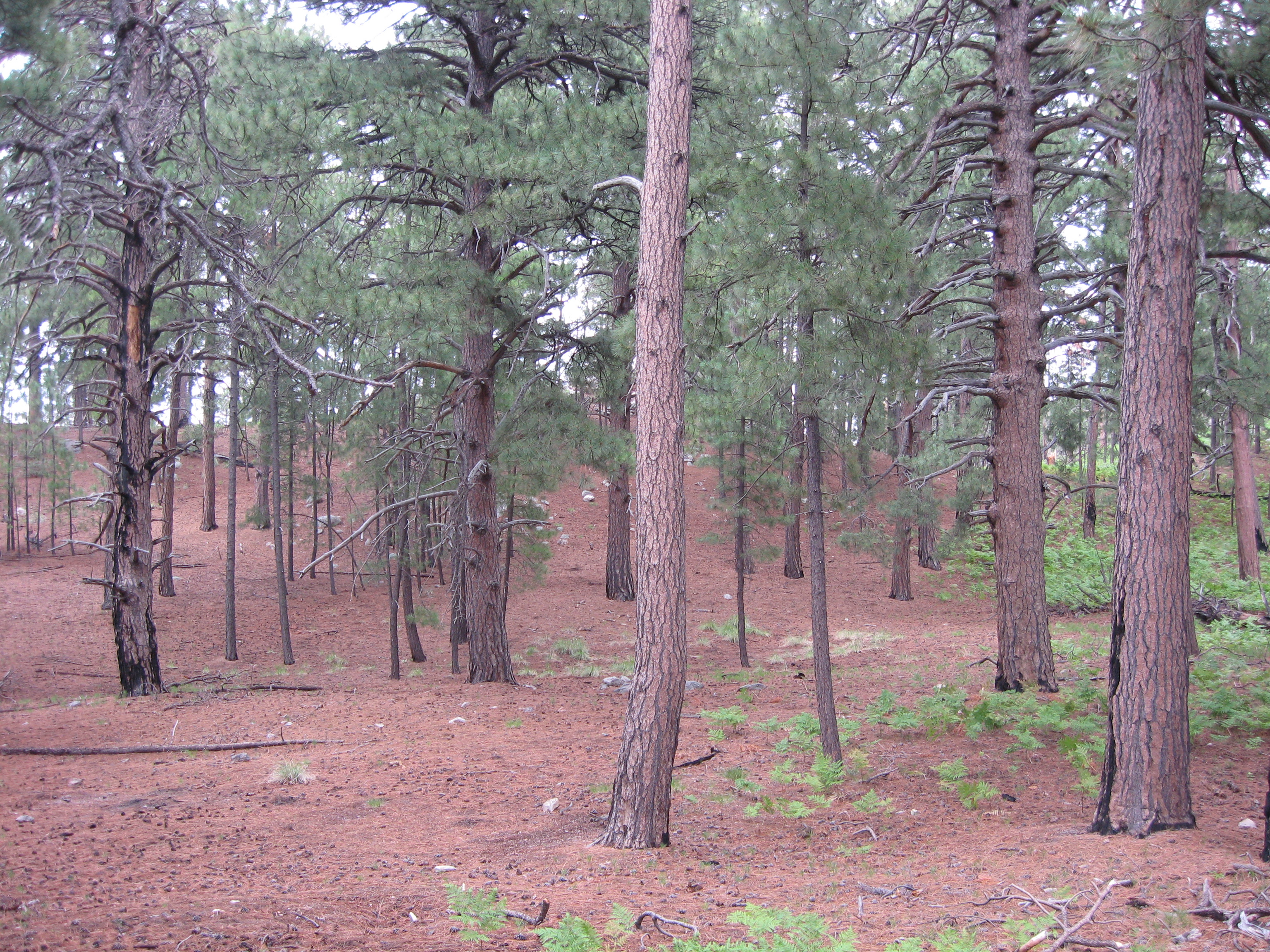
Arizona is rightly known as the "Grand Canyon State," but Baja Arizona could be just as reasonably dubbed the "Sky Island State." The Catalina Highway allows a close-up look at Sky Island biogeography, namely, stacked ecosystems. With changing elevation, ecosystems themselves change, from Sonoran Desert down low, to Madrean mixed woodland in the middle, and to Rocky Mountain subalpine forest on top.
- 3/27/07: Heat Invades Cool Heights Over Arizona Desert. This New York Times article suggests that it is already warmer up the mountains of southern Arizona.
- 4/6/07: Study Predicts Dust-Bowl Southwest. This study suggests that stacked ecosystems would be in danger from global warming, if it really truly continued warming up here.
- 2/15/09: Persistent Hiker Discovers Plants Blooming at Higher Elevations Than Ever Before. This AZ Daily Star article observes that plants are already blooming at higher elevations now than 20+ years ago. Evidence of warming?
- August 2010: Forest Management and the Grand Carbon Debate. This issue of Forestry Source has three op-ed essays on using forest management to control carbon emission to the atmosphere. Essential reading.
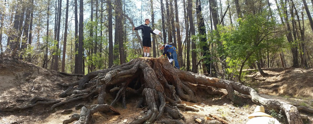
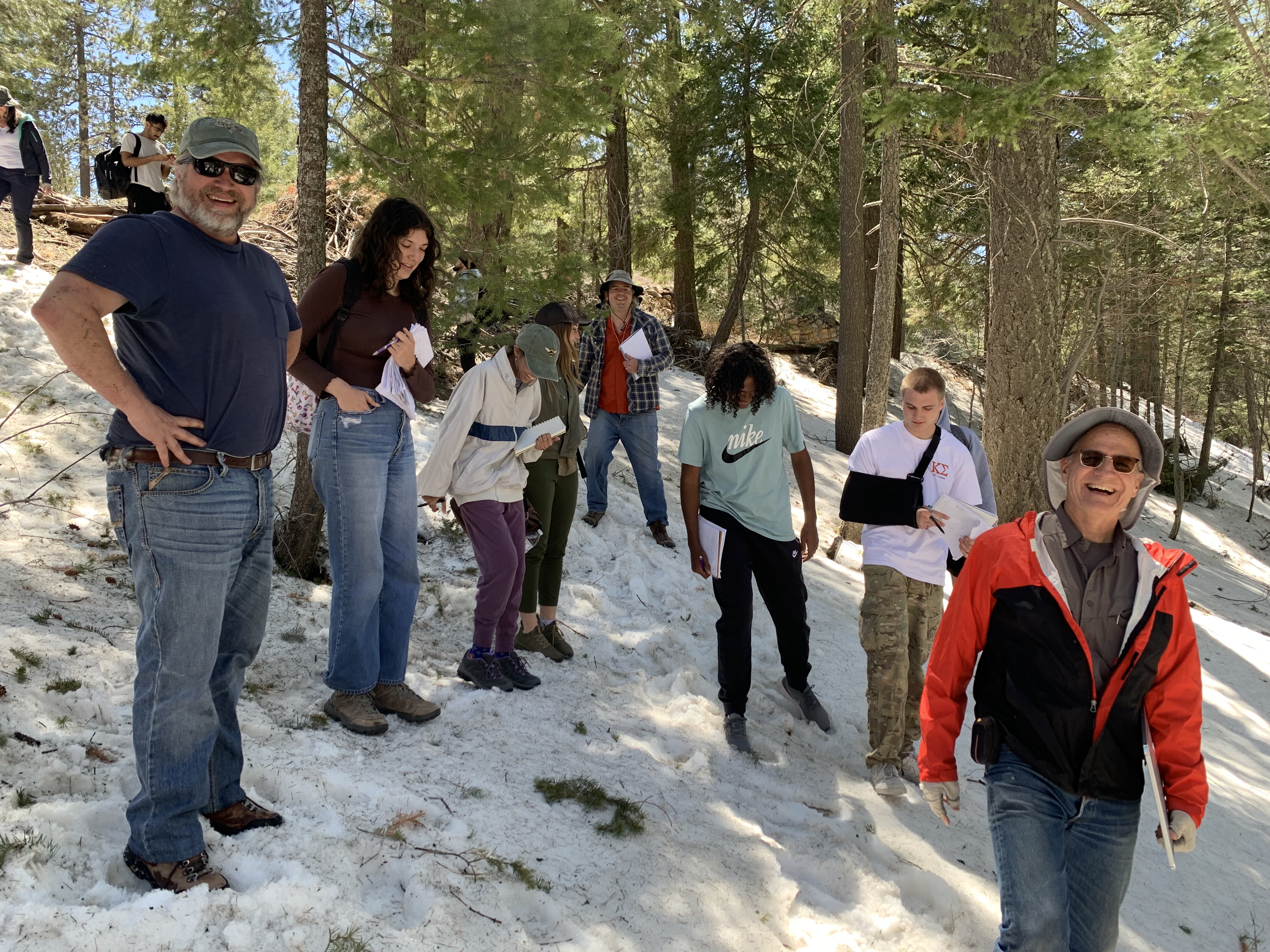
Middle Bear Erosion
Middle Bear has evidence of erosion.
- Did this occur recently, or long ago?
- Any relationship with fire?
- How to find out?
- An excellent opportunity to integrate geology-ecology-culture.
A ponderosa pine tree, now a stump, with roots exposed. Photo — Nina Kolodij, 2015
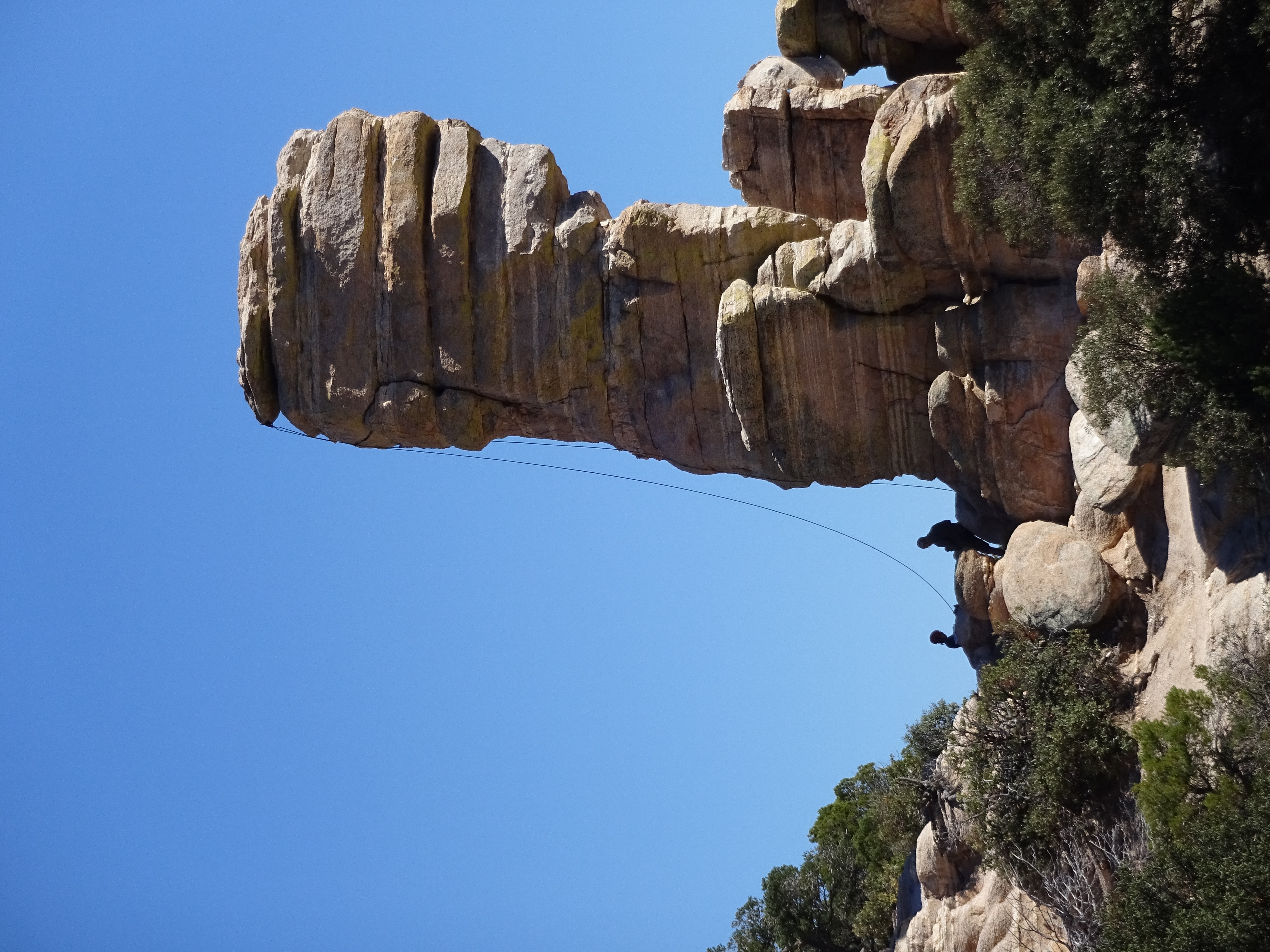
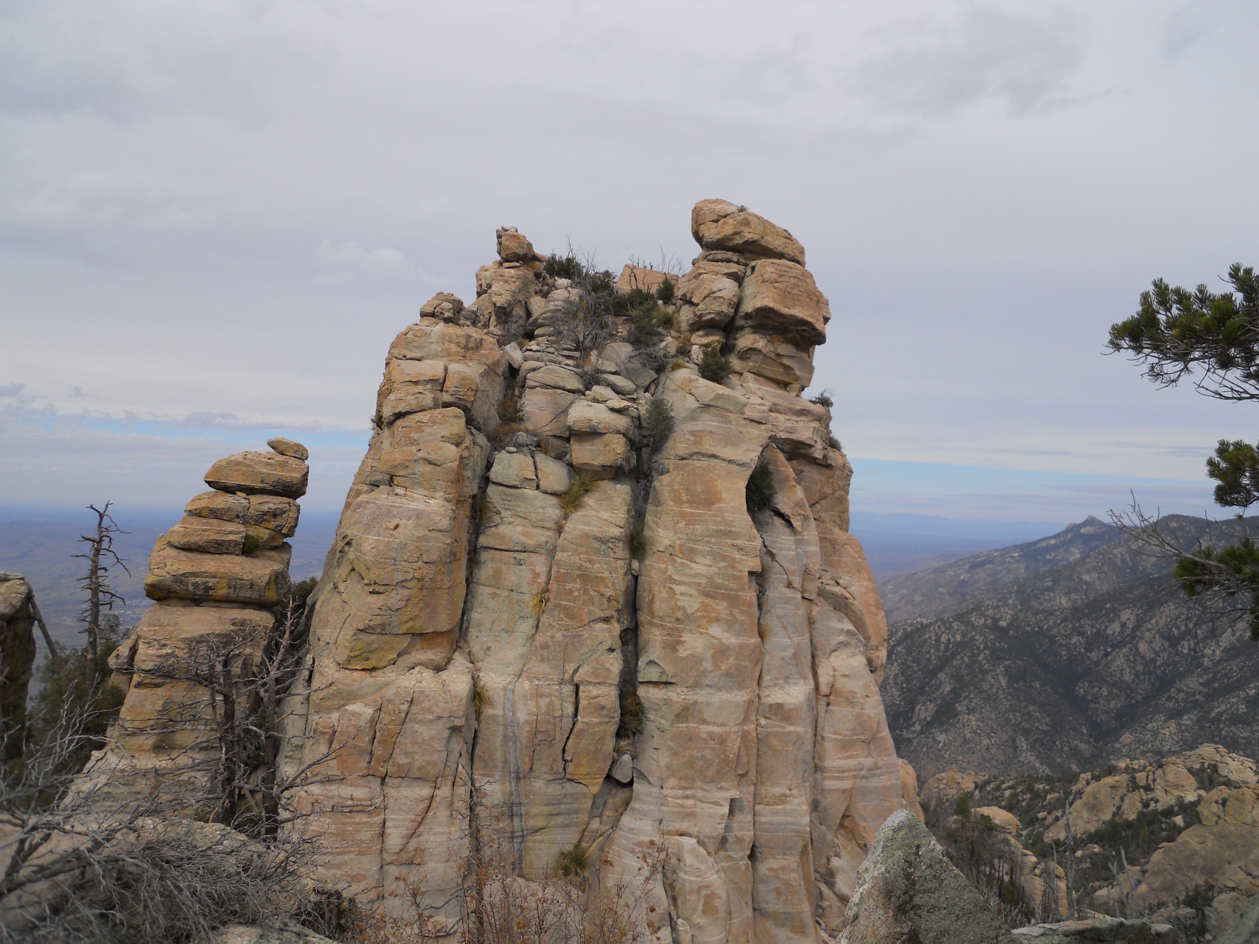
Mt. Lemmon Hoodoos
hoodoo (n): Column or pinnacle of rock produced by differential weathering and erosion of horizontal strata. Word origin: African.Hoodoos of Mt. Lemmon: 2017, a brief article on the hoodoos along the Catalina Highway.
Popular for climbing.
Photo — Paul Sheppard
Hoodoos on Cathedral Rock.
Photo — Gary Huckleberry
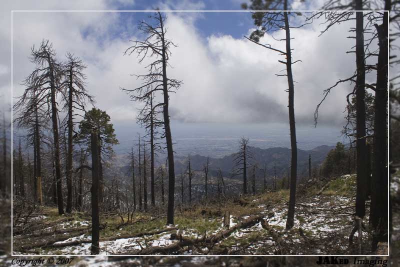
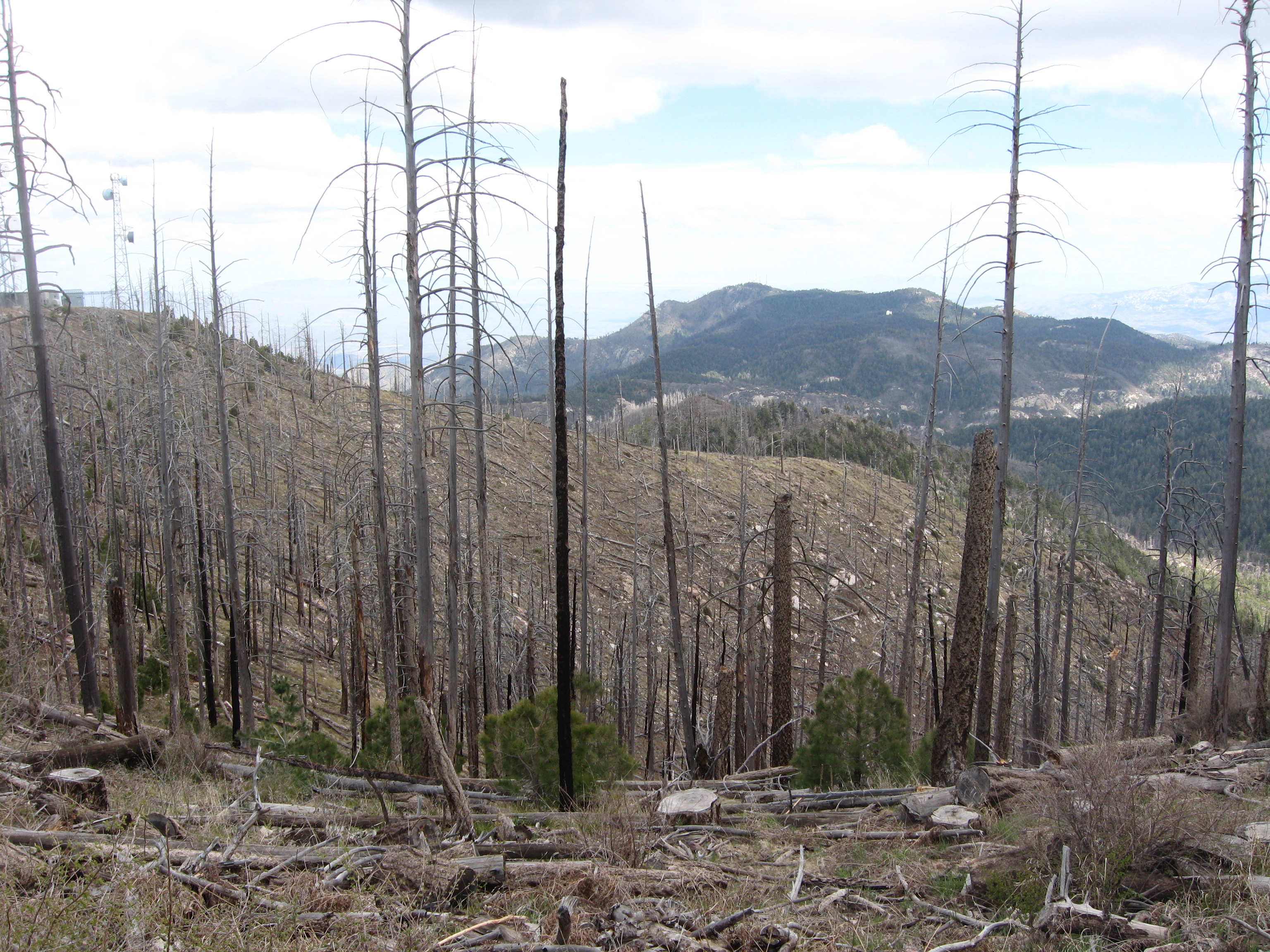
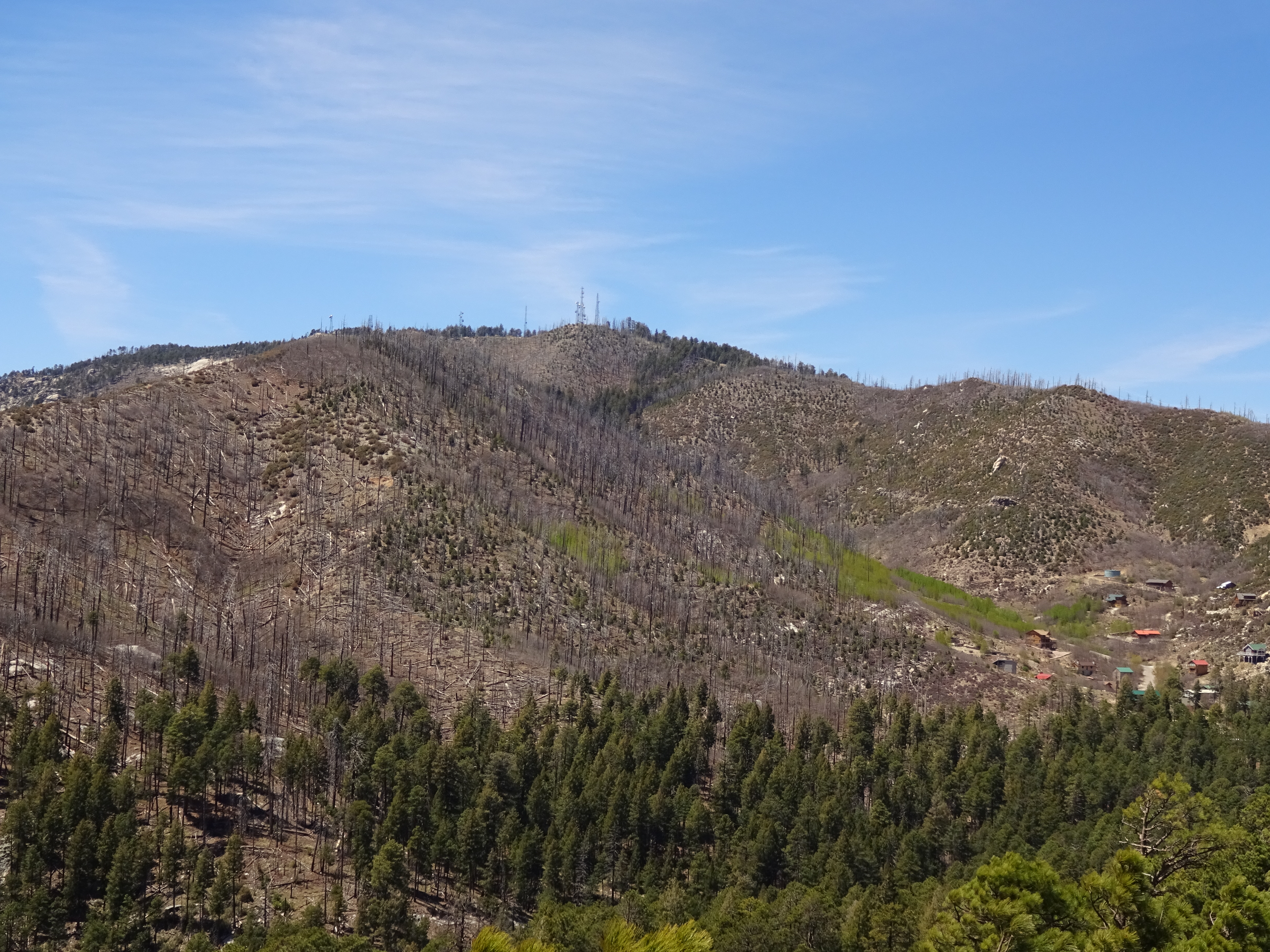
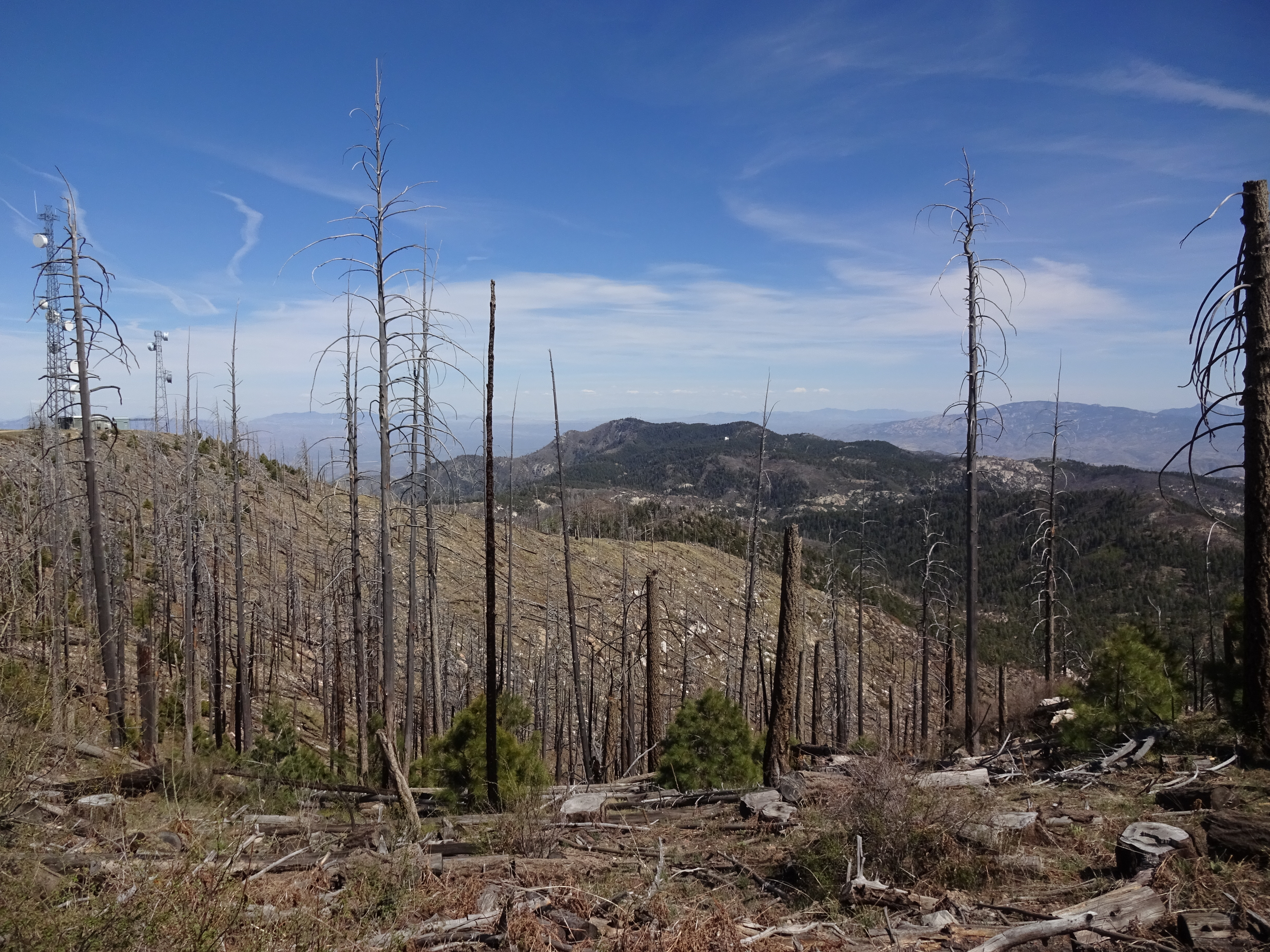
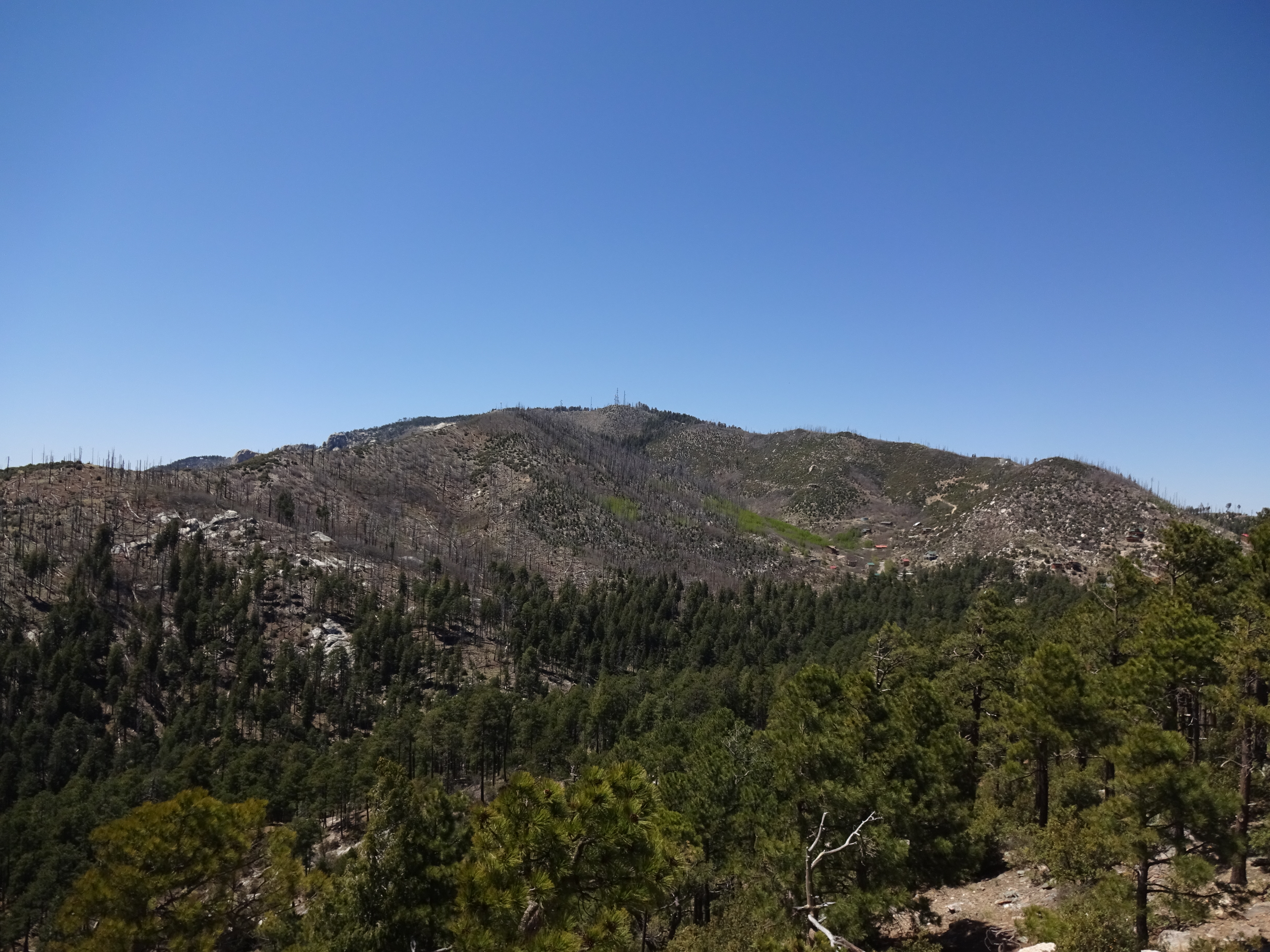
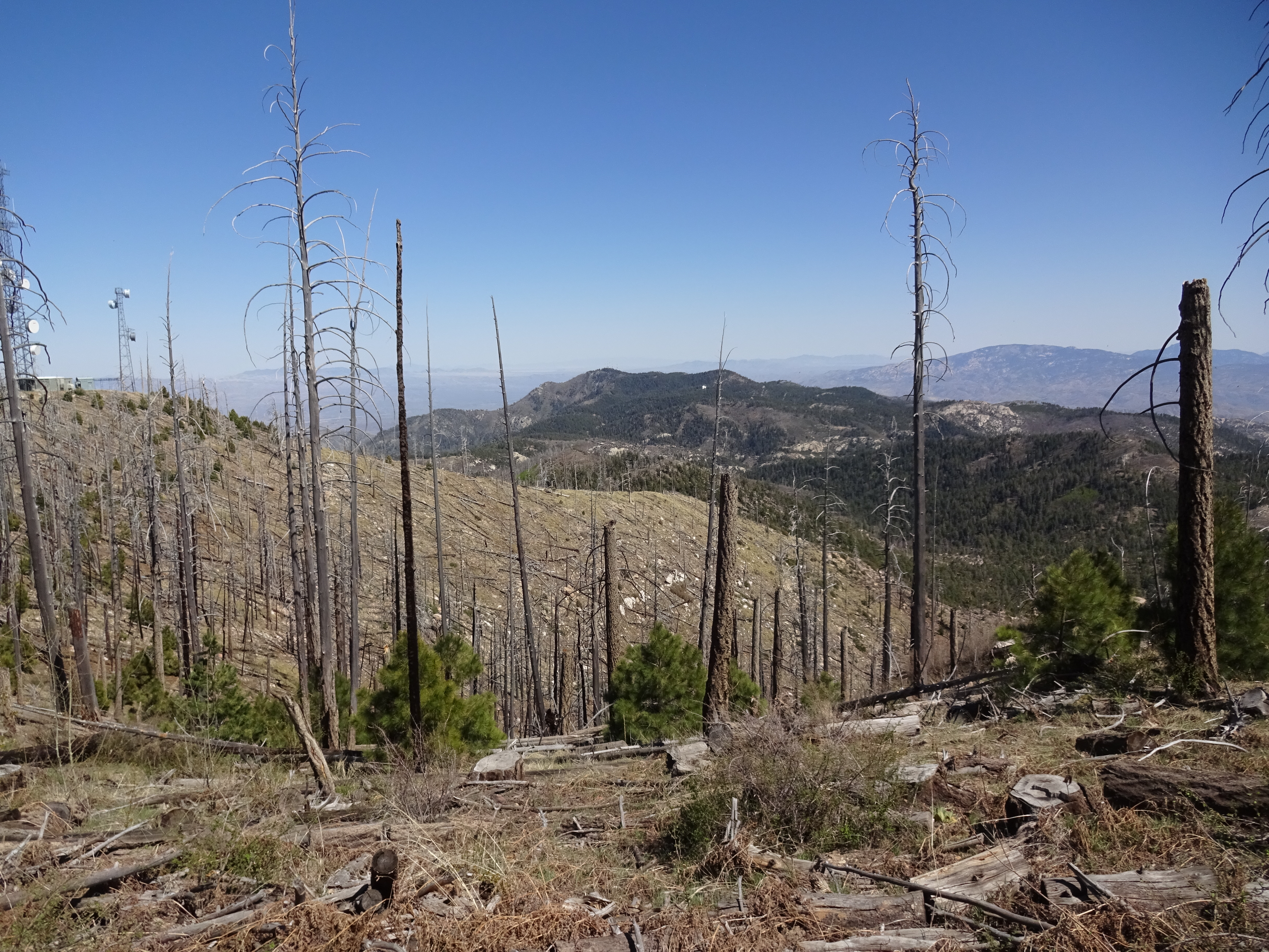
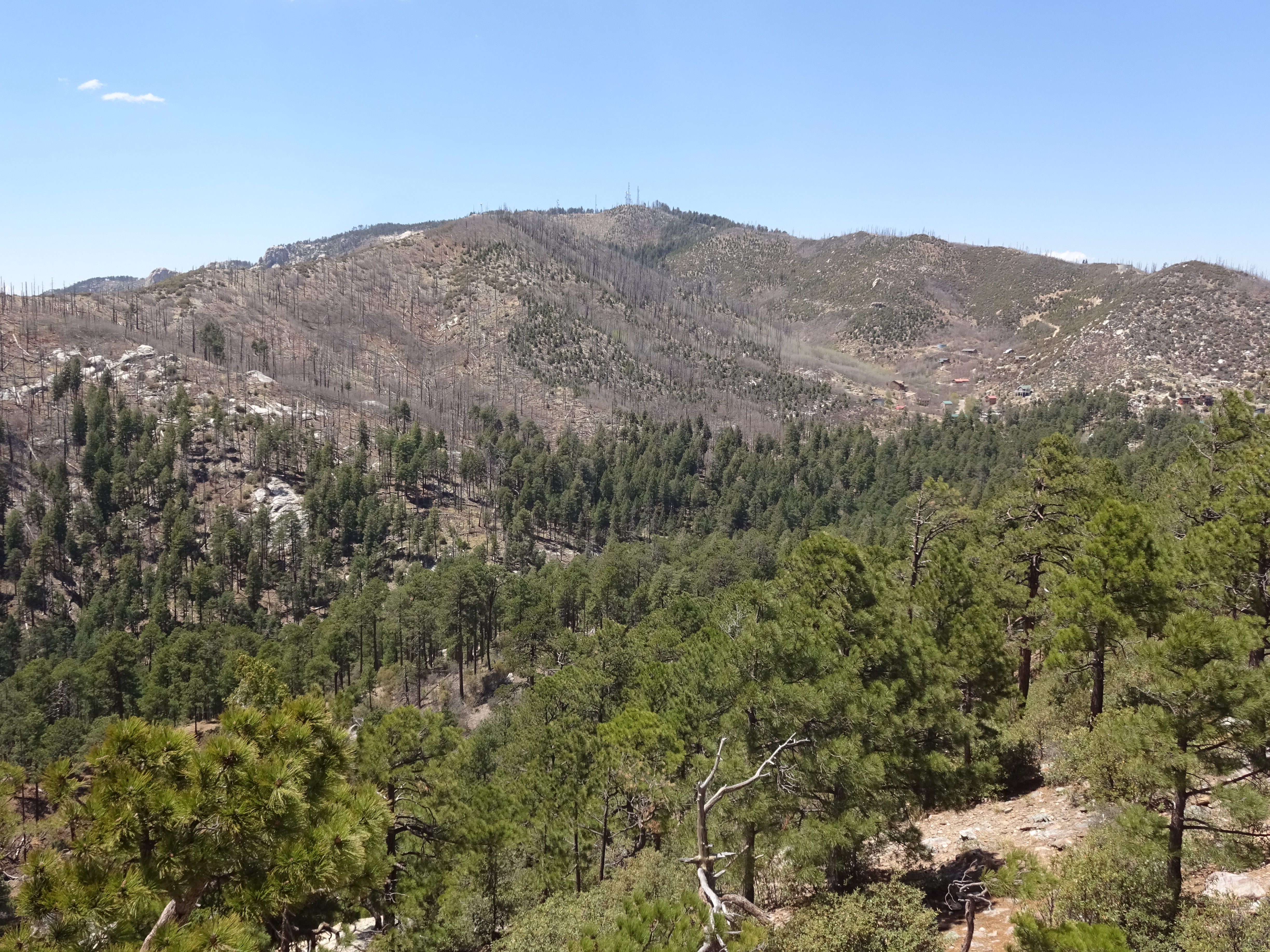
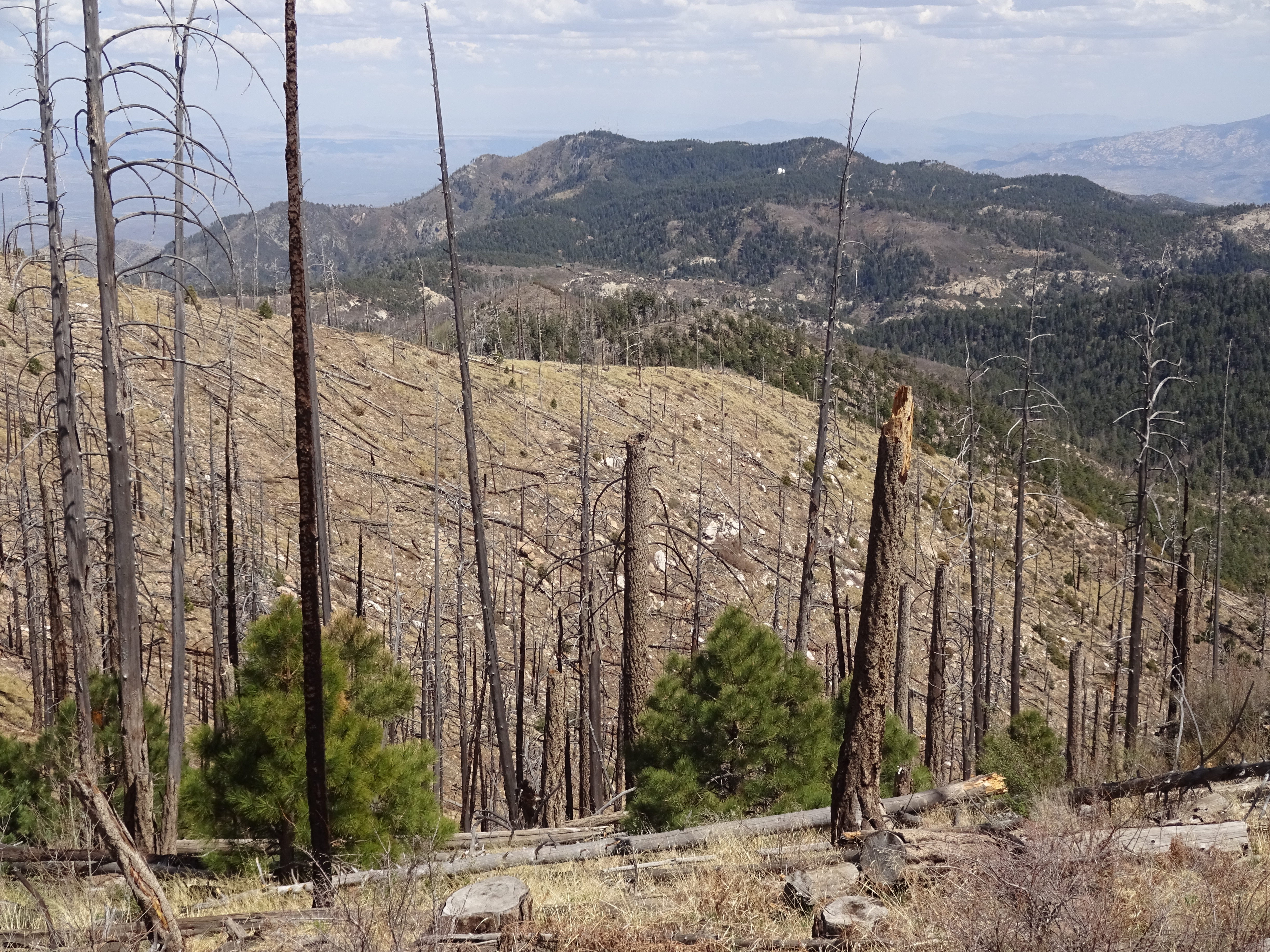
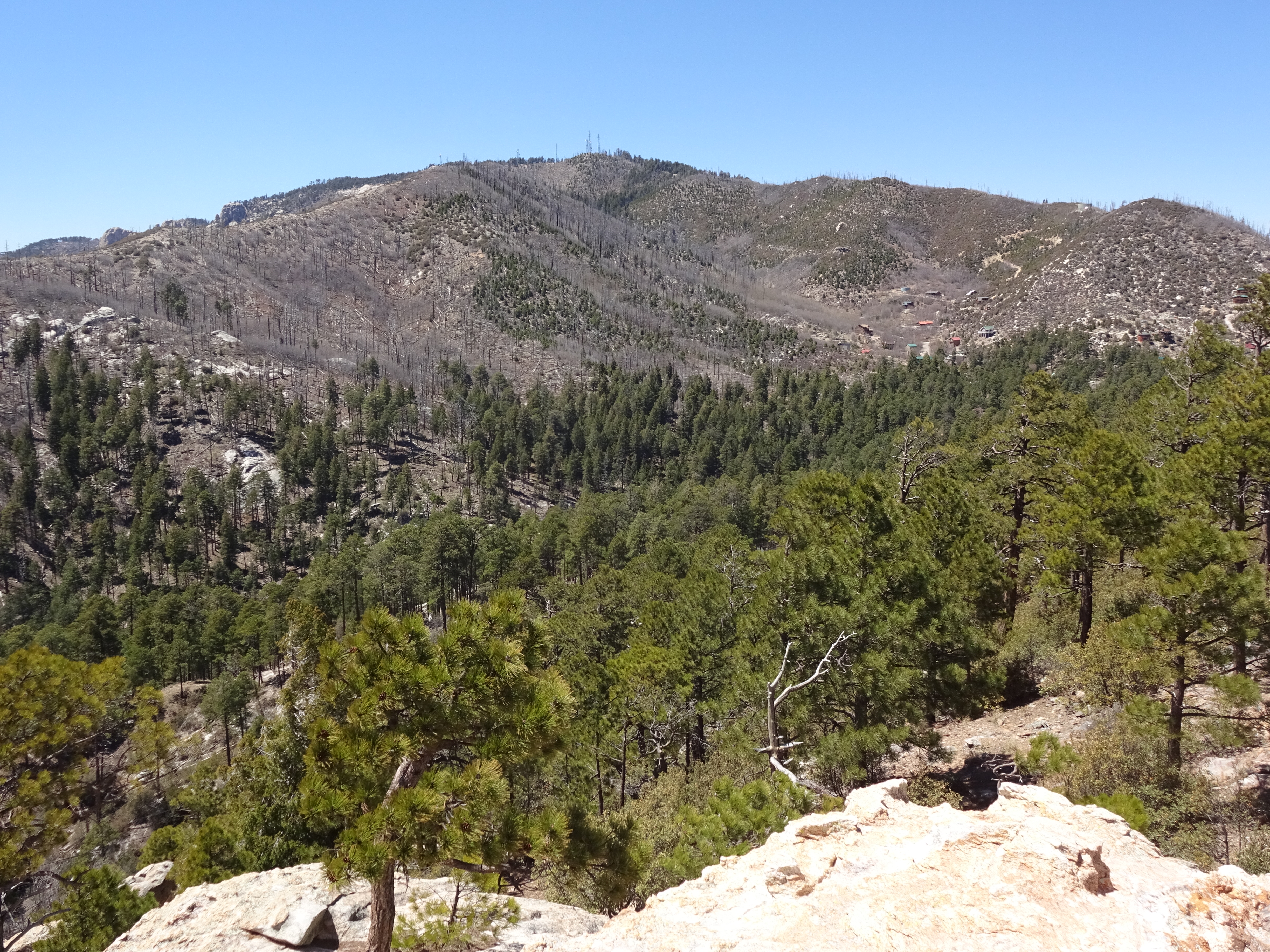
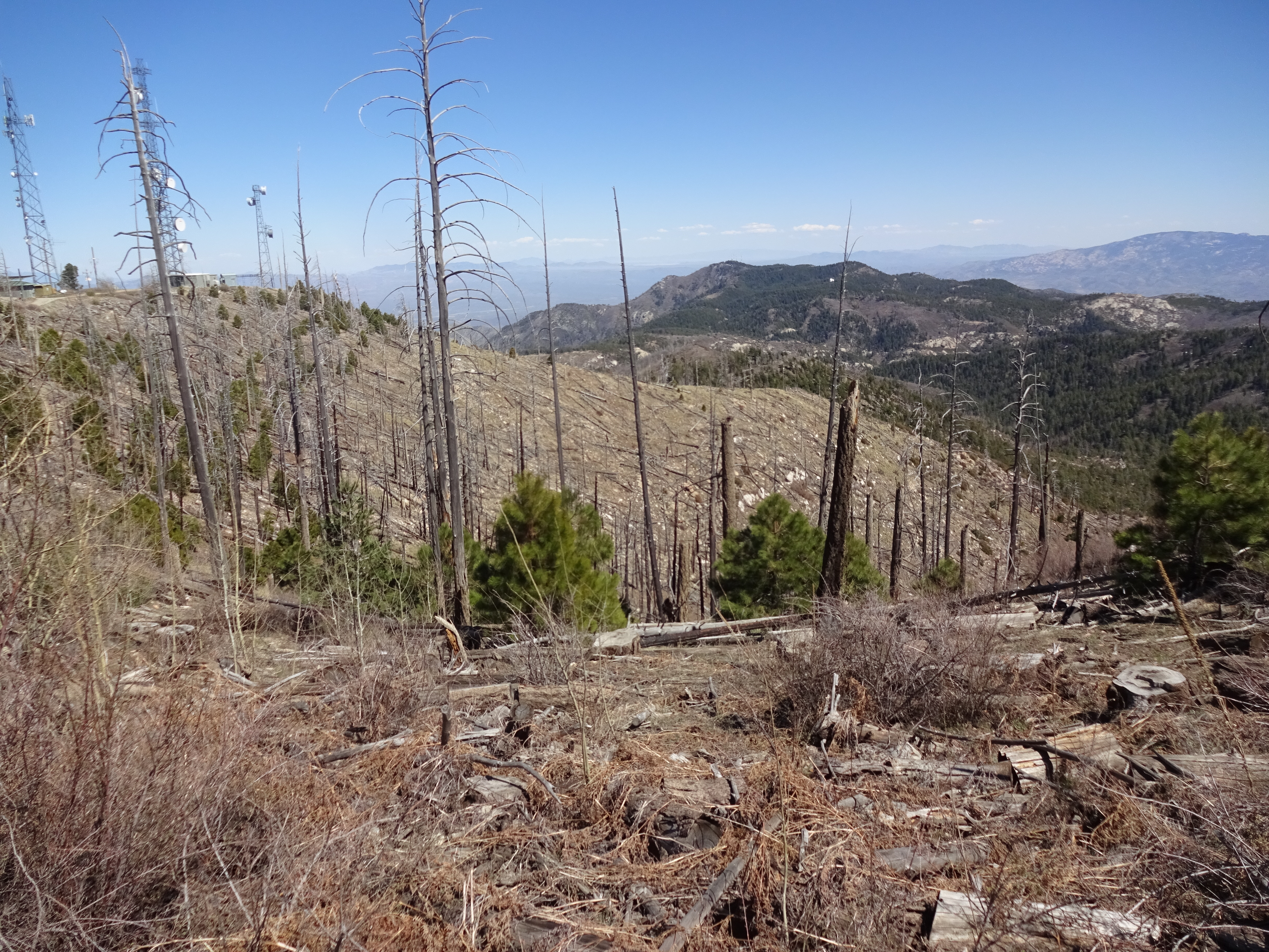
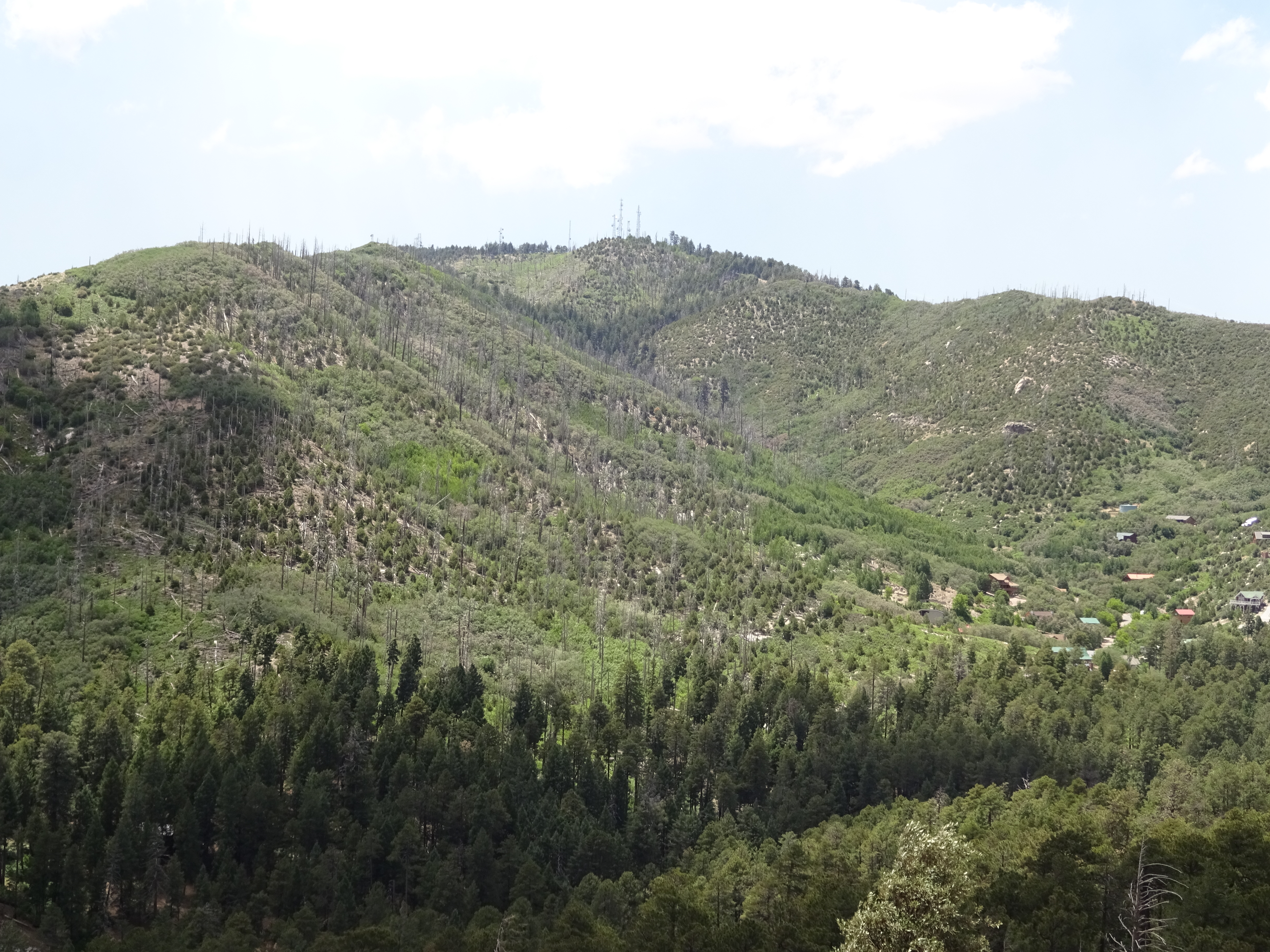
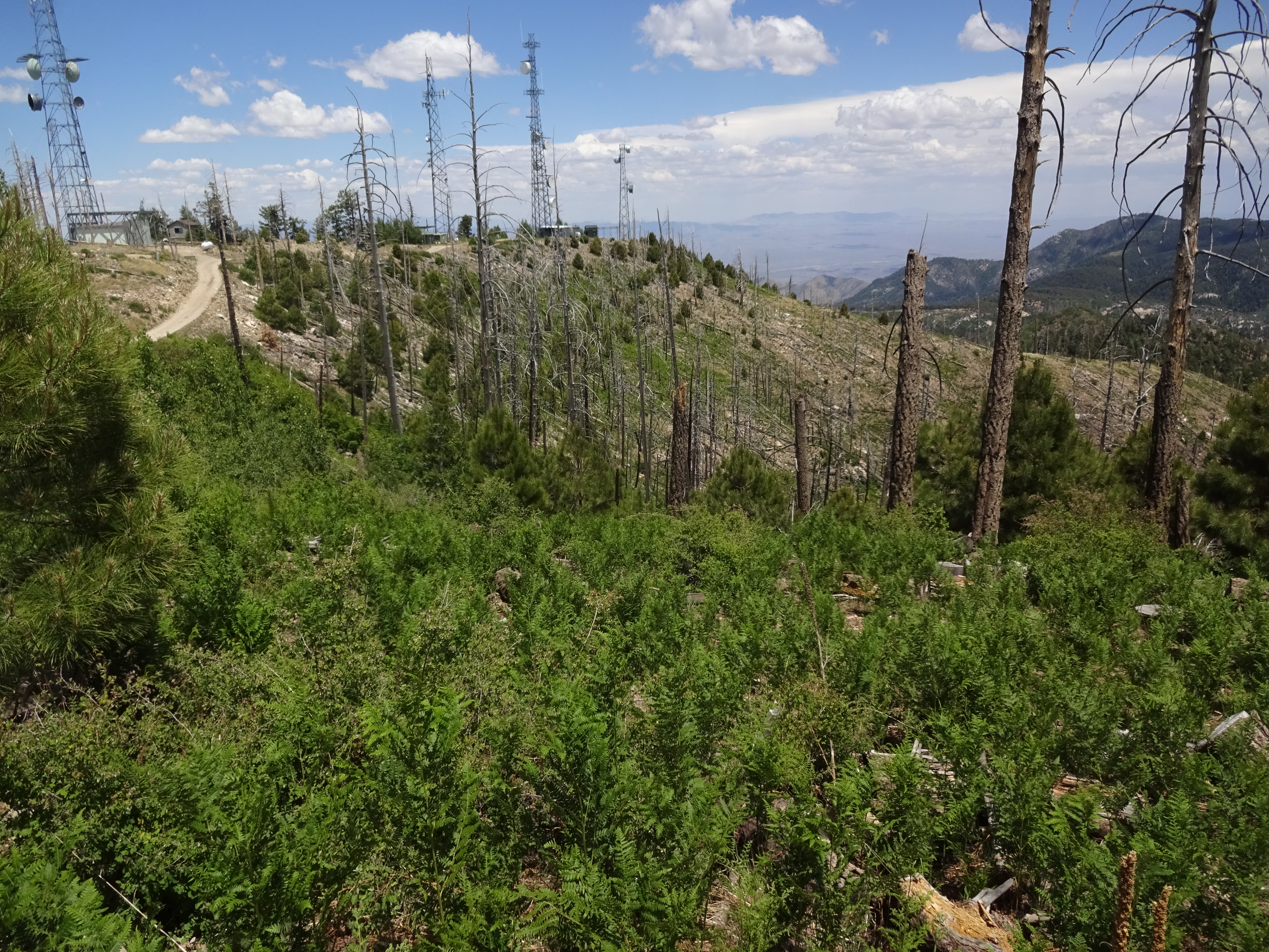
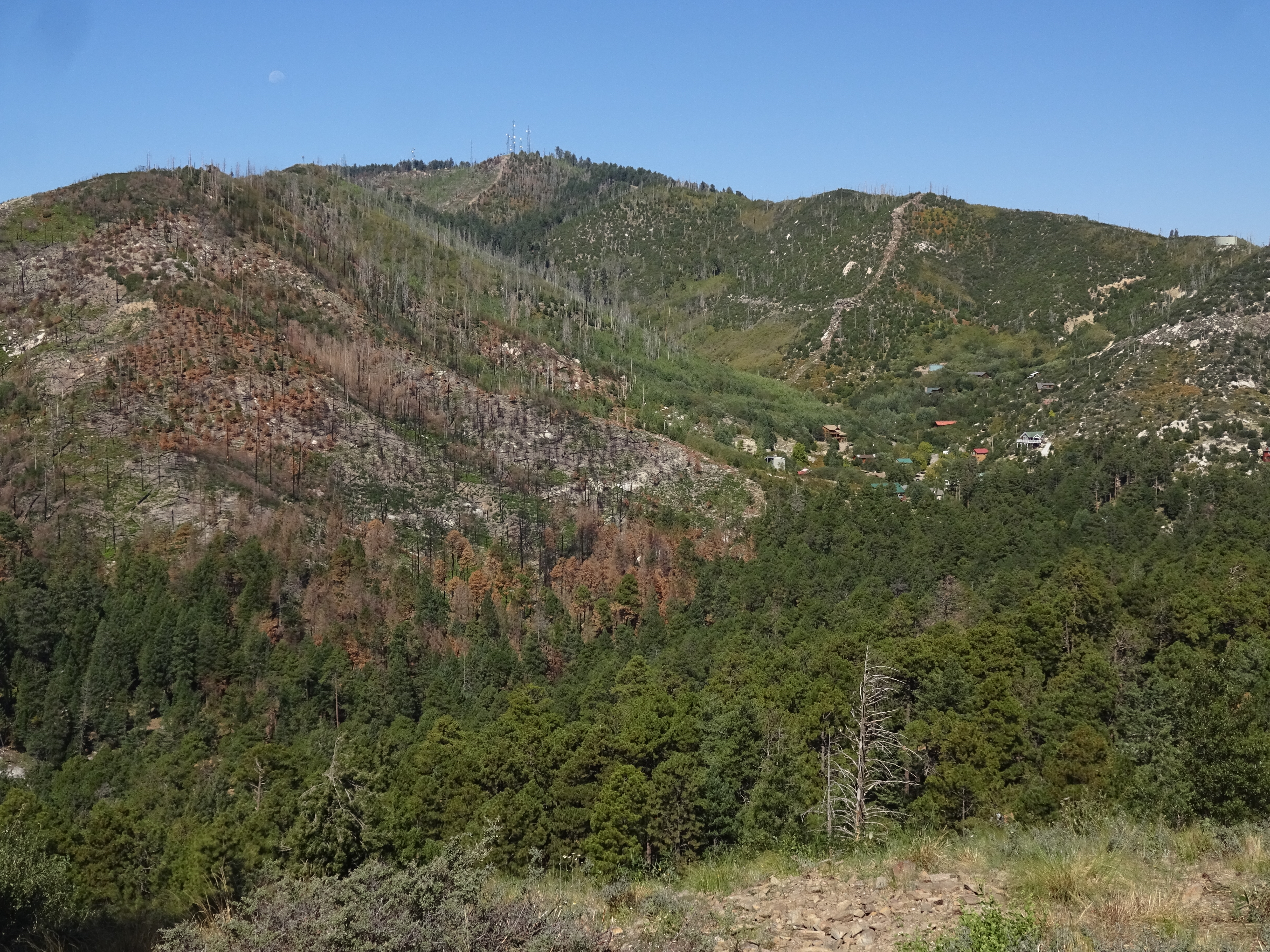
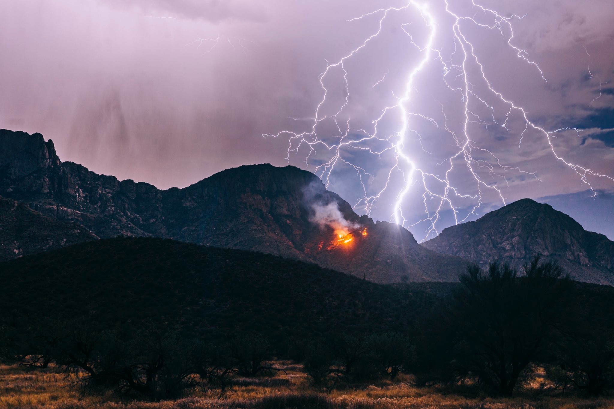
Fire on the Mountain
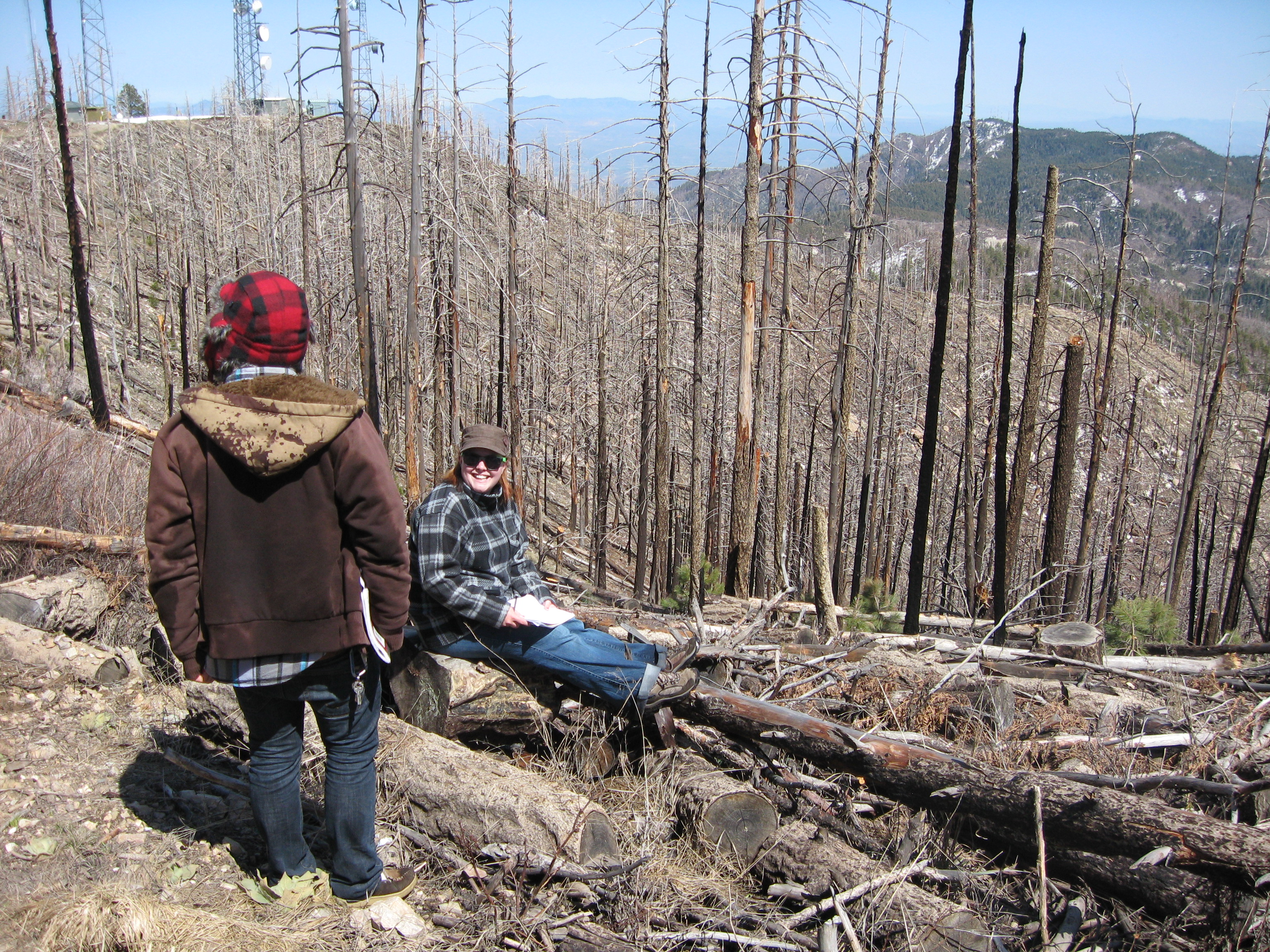
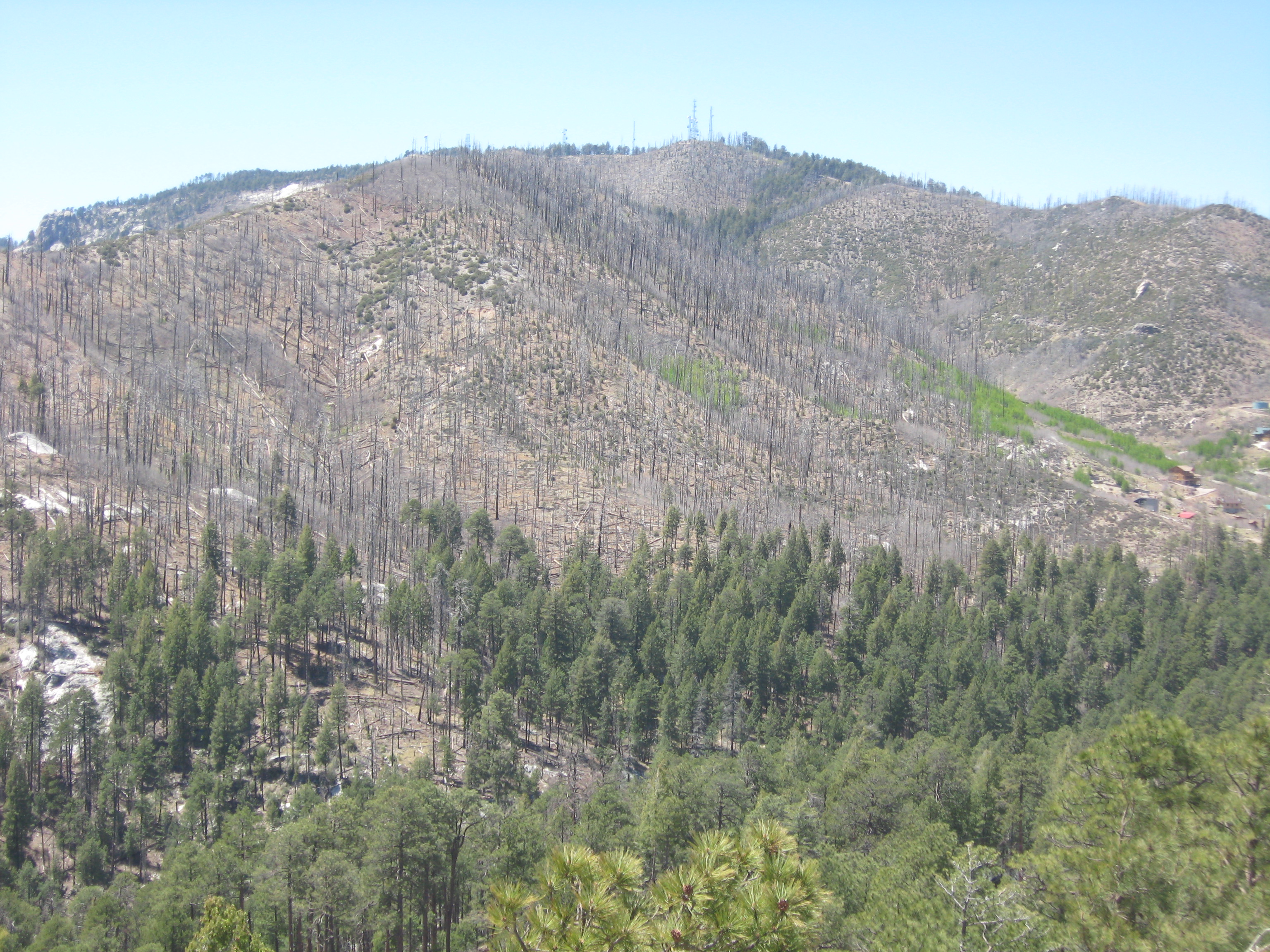
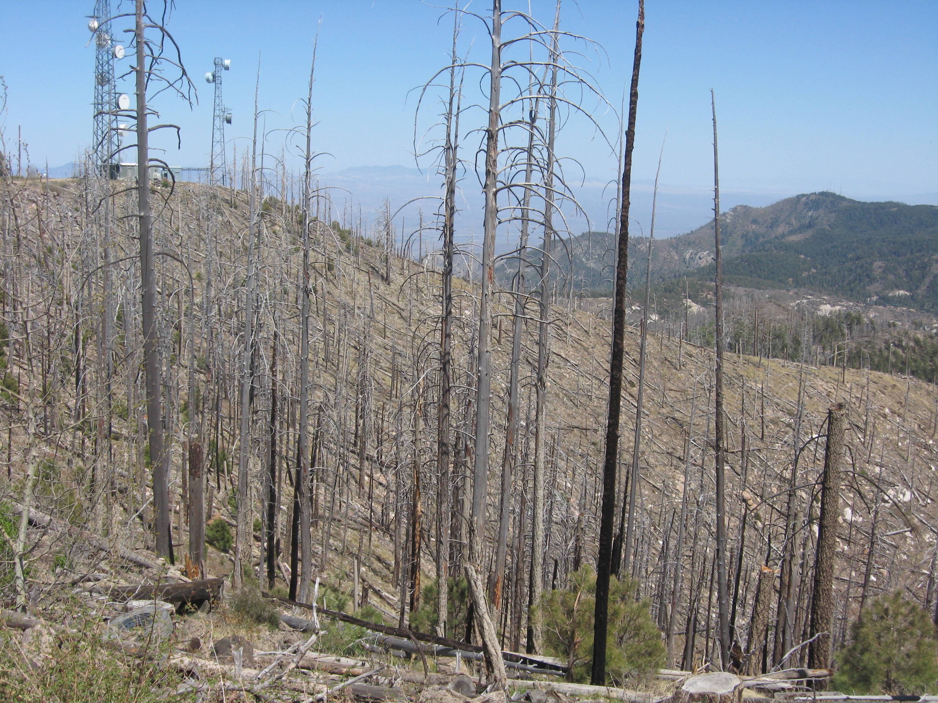
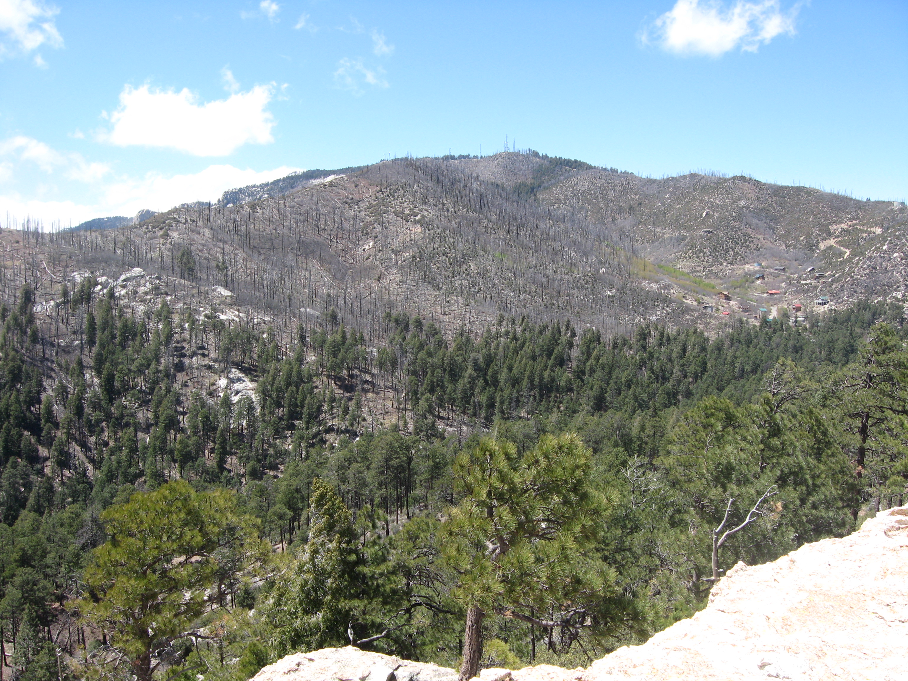
A large fire called the Bullock burned parts of Mt. Lemmon in 2002, and other parts were burned in 2003 in the Aspen fire.
Aspen burn area up close, 2007. Photo — Jayme Kelter
Aspen burn area up close, 2010. Photo — Paul Sheppard
Aspen burn area from below, 2014.
Photo — Paul Sheppard
Aspen burn area from above, 2014.
Photo — Paul Sheppard
Aspen burn area from below, 2015.
Photo — Paul Sheppard
Aspen burn area from above, 2015.
Photo — Paul Sheppard
Aspen burn area from below, 2016.
Photo — Paul Sheppard
Aspen burn area from above, 2016.
Photo — Paul Sheppard
Aspen burn area from below, 2017.
Photo — Paul Sheppard
Aspen burn area from above, 2017.
Photo — Paul Sheppard
Aspen burn area from below, 2018.
Photo — Paul Sheppard
Aspen burn area from above, 2018.
Photo — Paul Sheppard
Aspen burn area from below, 2019.
Photo — Paul Sheppard
Aspen burn area from above, 2019.
Photo — Paul Sheppard
Aspen burn area from below, June 2020.
Photo — Paul Sheppard
Aspen burn area from above, June 2020.
Photo — Paul Sheppard
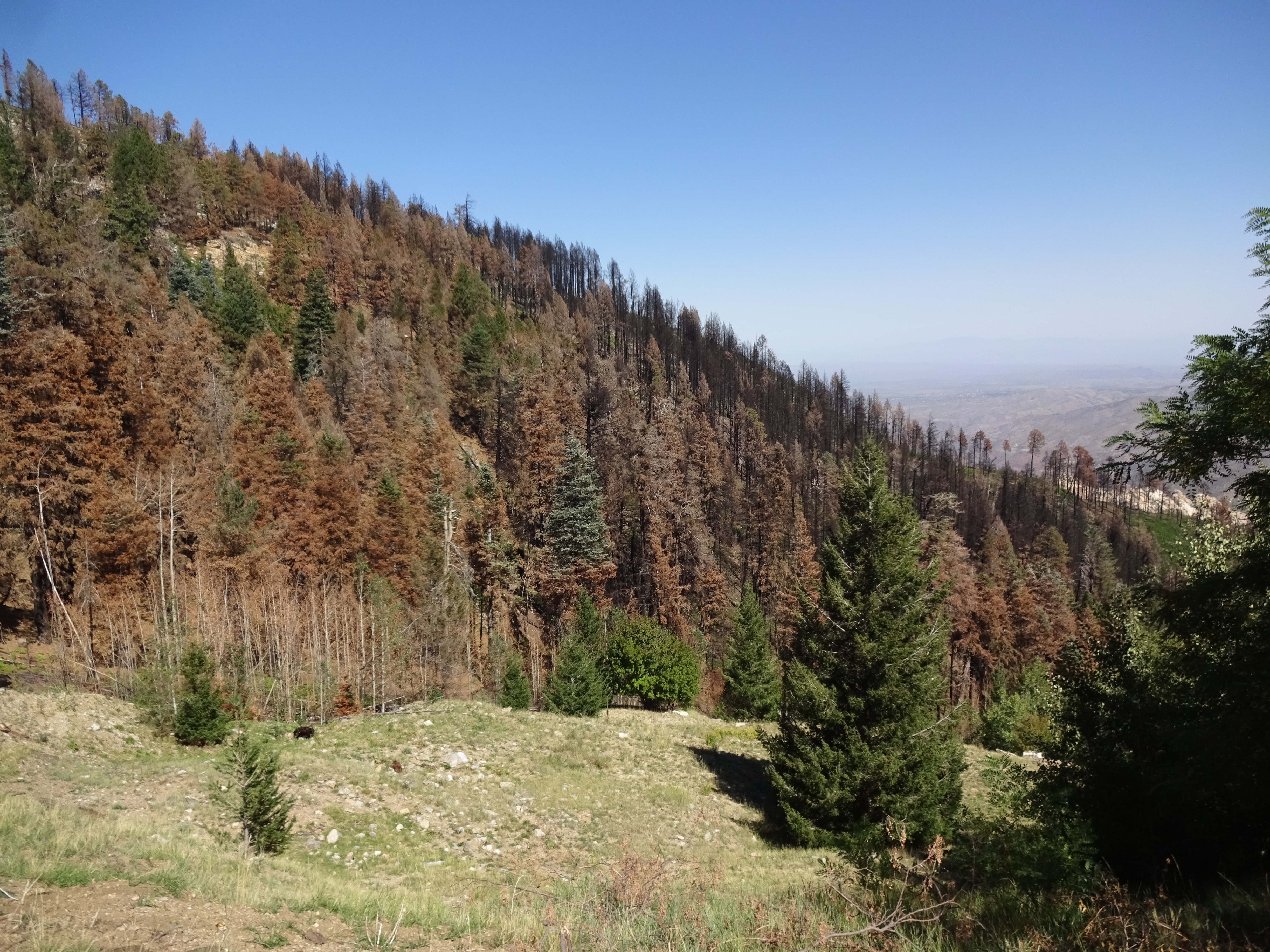
Aspen burn area from below, Sept 2020 (after Bighorn).
Photo — Paul Sheppard
Aspen burn area from below, April 2021.
Aspen burn area from above, April 2021.
Aspen burn area from below, April 2022.
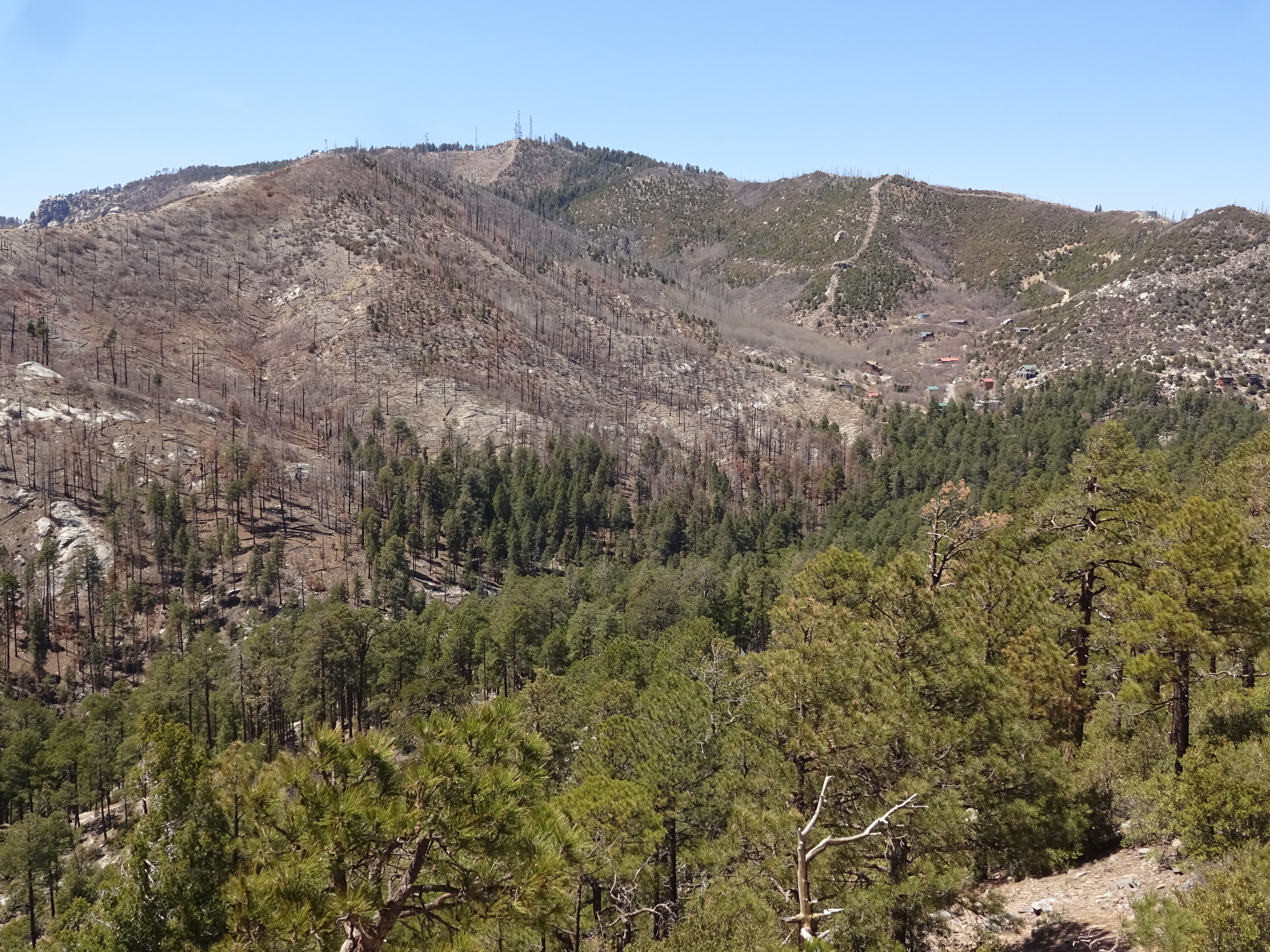
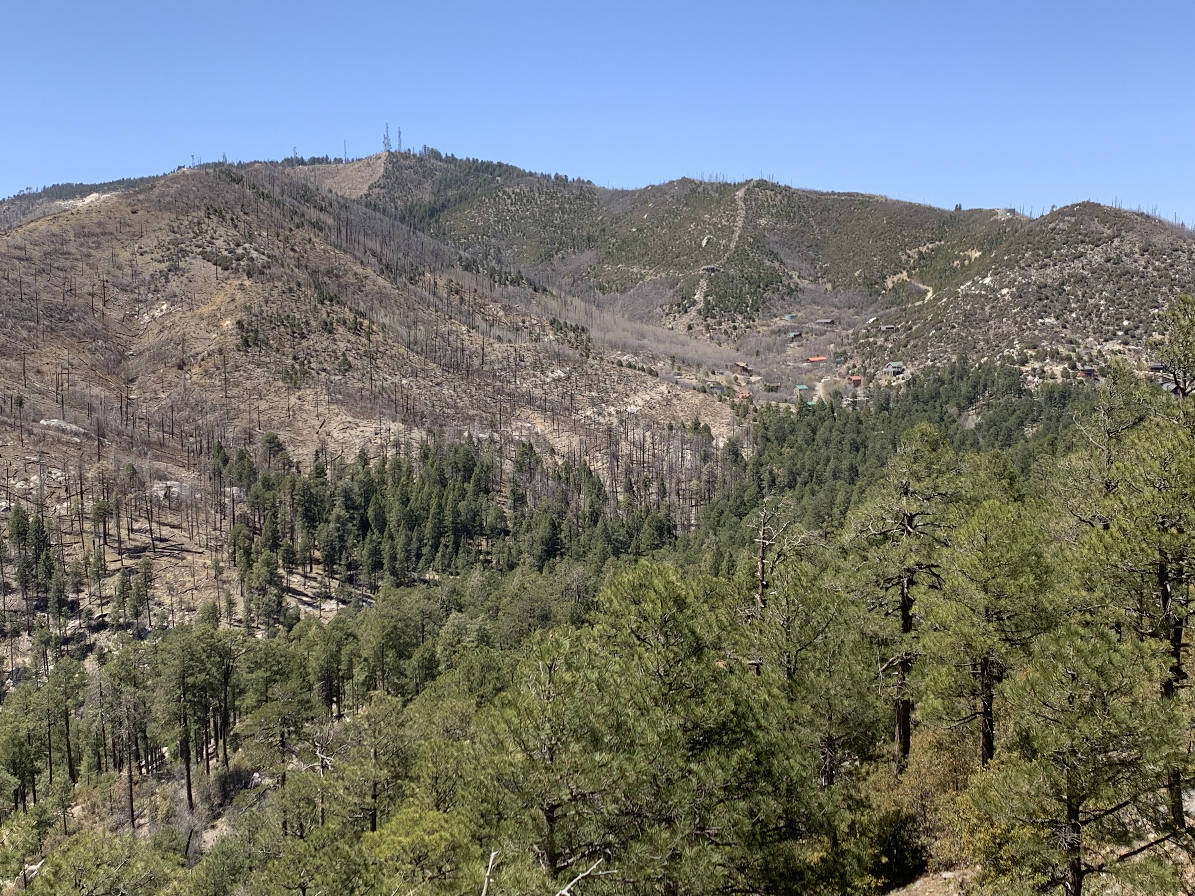
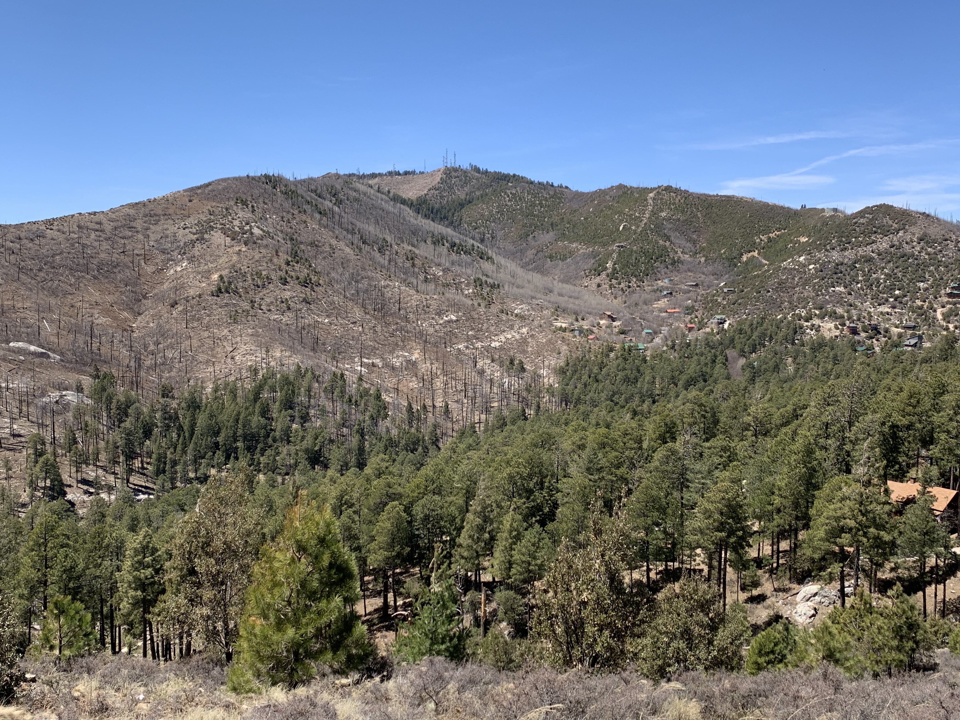
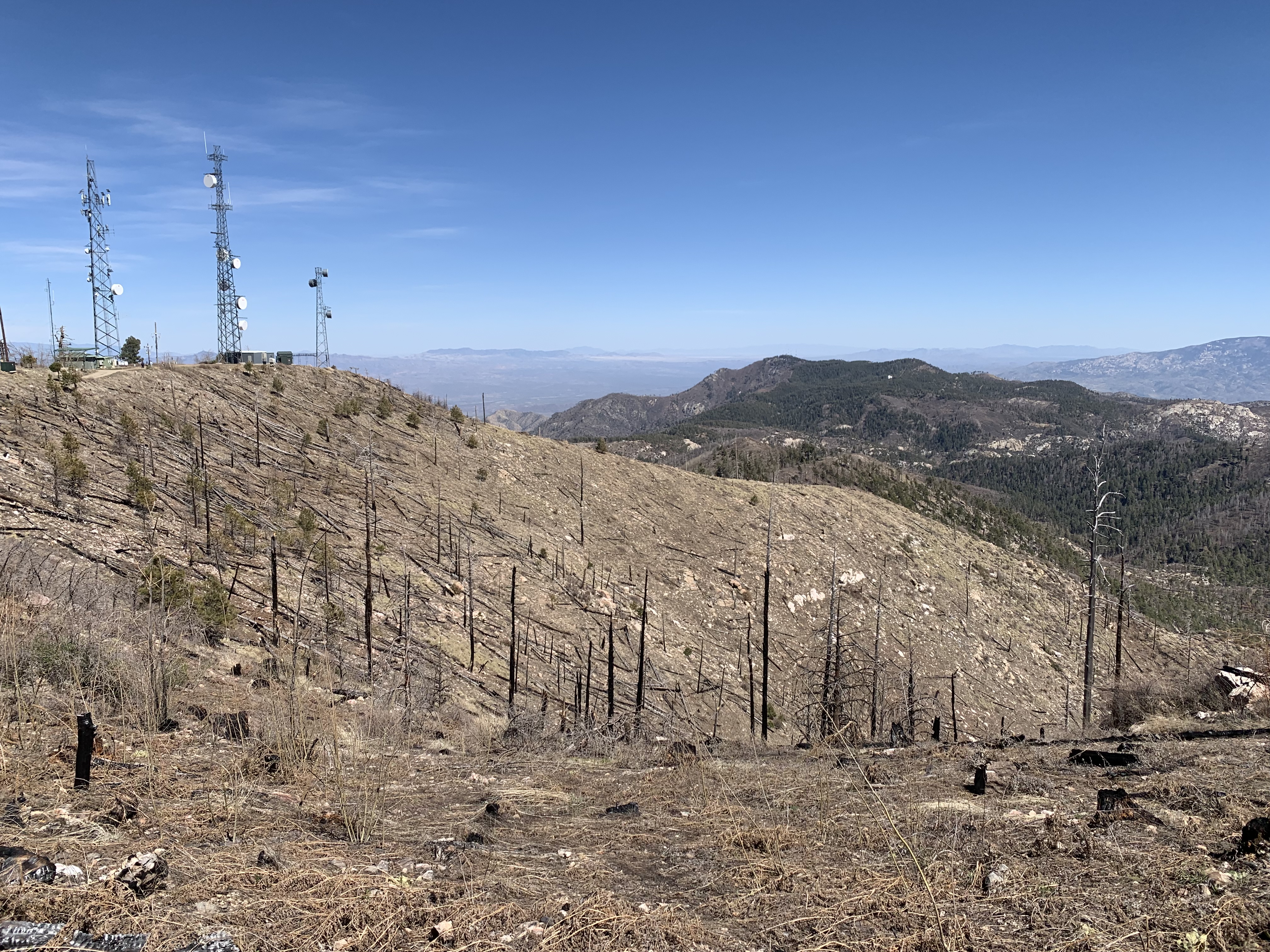
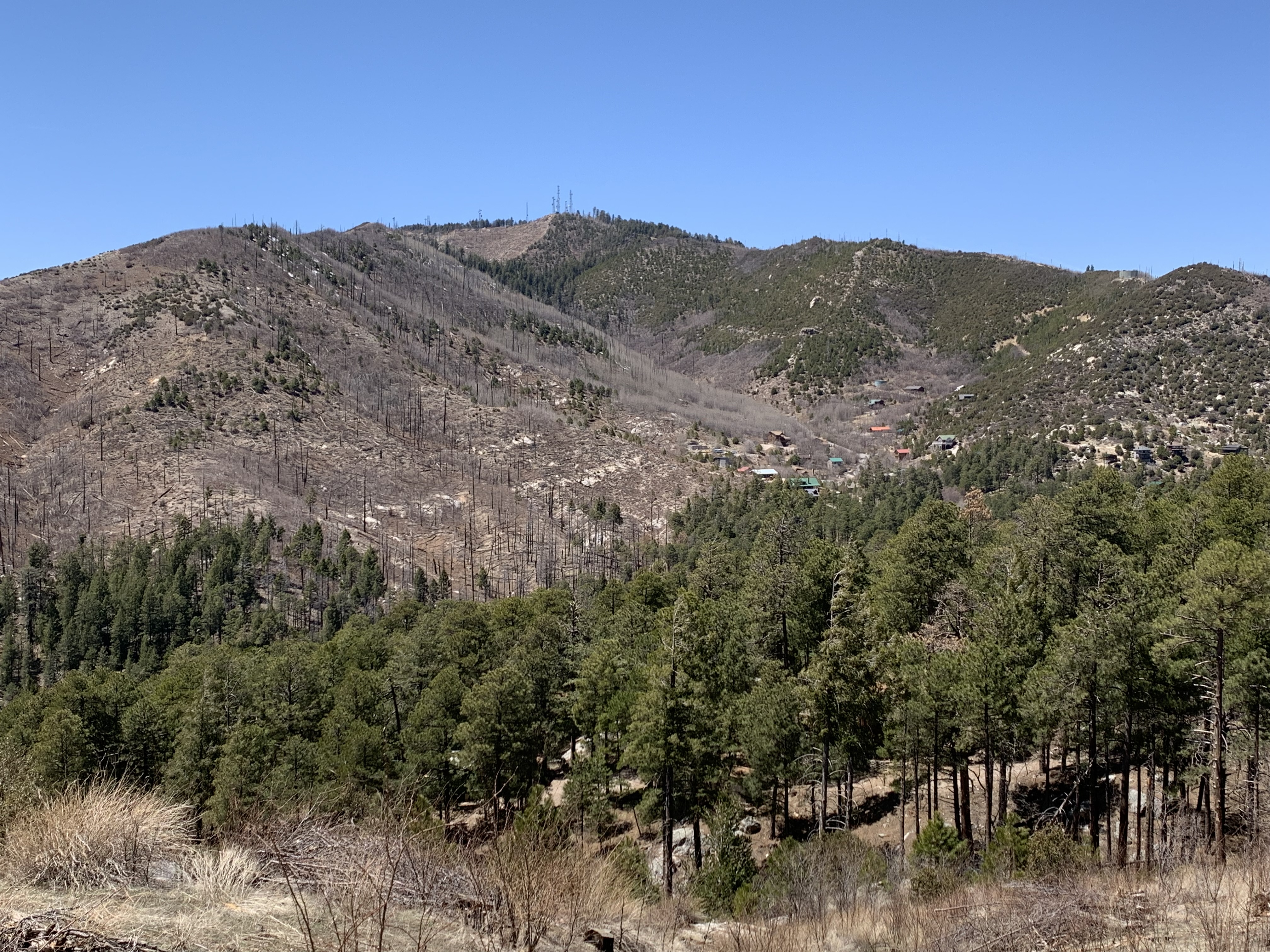
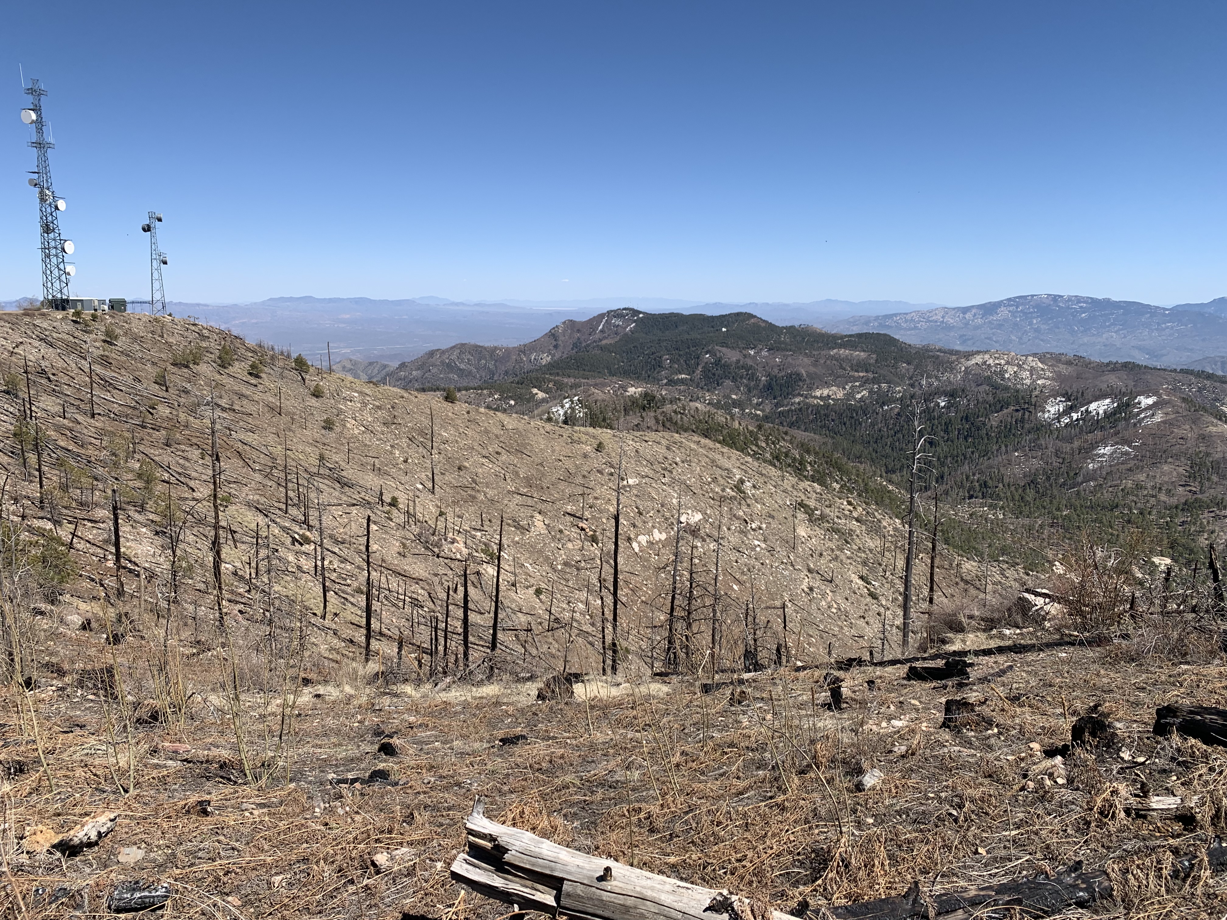
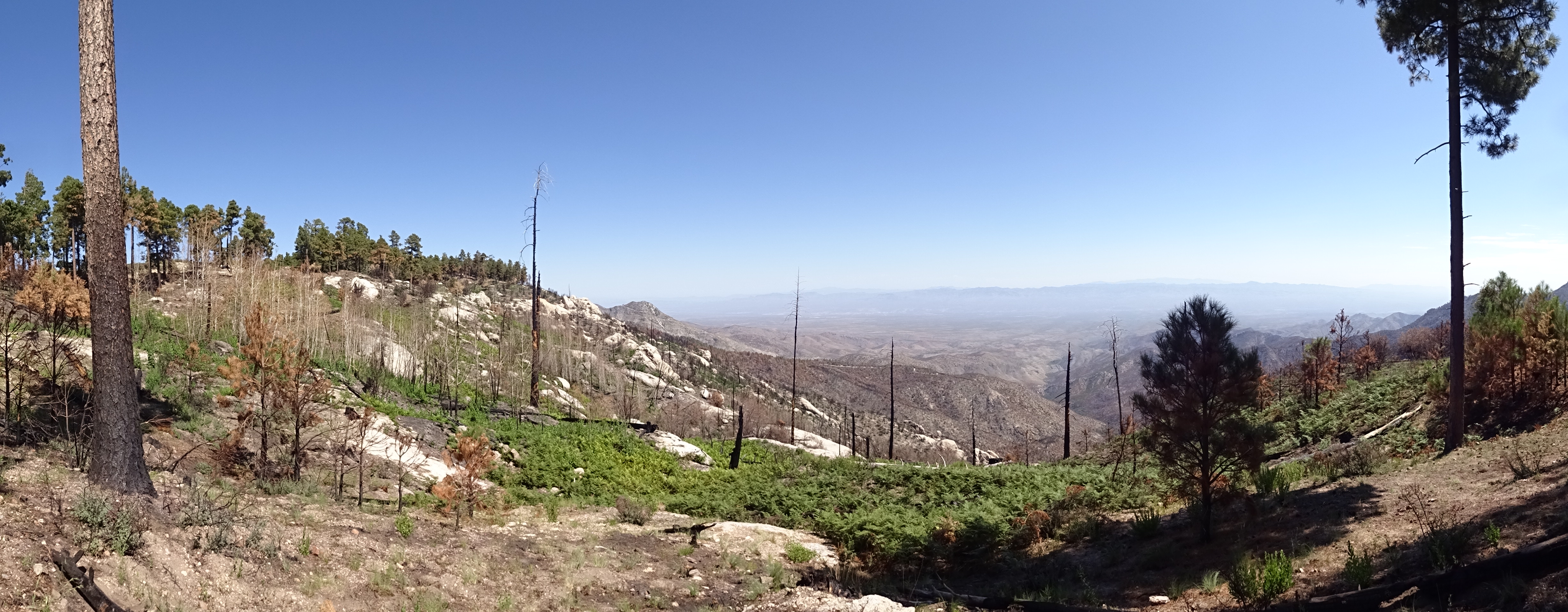
Aspen burn area from above, April 2022.This is 19 years after the Aspen Fire, two years post-Bighorn Fire. Photo — Paul Sheppard
January 2023: A pano looking up from Inspiration Rock, with snow on the ground.
Aspen burn area from below, April 2023.
Aspen burn area from above, April 2023.This is 20 years after the Aspen Fire, three years post-Bighorn Fire. Photo — Paul Sheppard
Aspen burn area from below, April 2024.
Aspen burn area from above, April 2024.This is 21 years after the Aspen Fire, four years post-Bighorn Fire. Photo — Paul Sheppard
- 5/14/07: Former FS chiefs say fire costs eating budget. This article, printed in The Missoulian (Missoula, Montana) decries the real costs of fire suppression. Fighting fires is now a large percentage of the USFS budget.
- 9/19/11: Catalina Mountains conifers on the way up after '03 fire. Forest ecosystems of the Catalinas are, in fact, recovering from the 2003 Aspen fire.
- 6/16/13: Ten years after Aspen Fire. A status update in and around Summerhaven, 10 years after the 2003 Aspen fire.
- 7/15/13: UA researchers study future forest landscape after Aspen fire. A TV news clip about revegetation after the Aspen fire.
- A 2017 TED talk on current forest fire across the West (14 minutes):
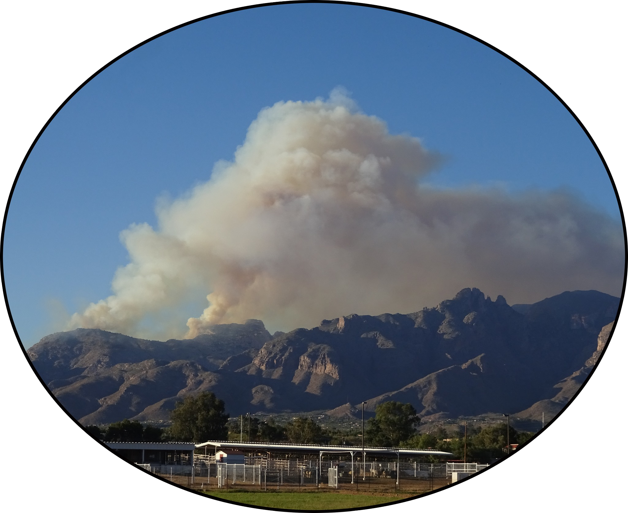
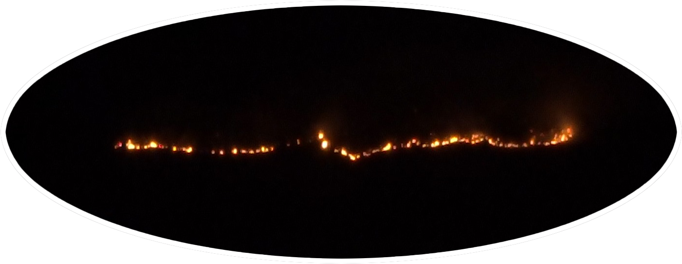
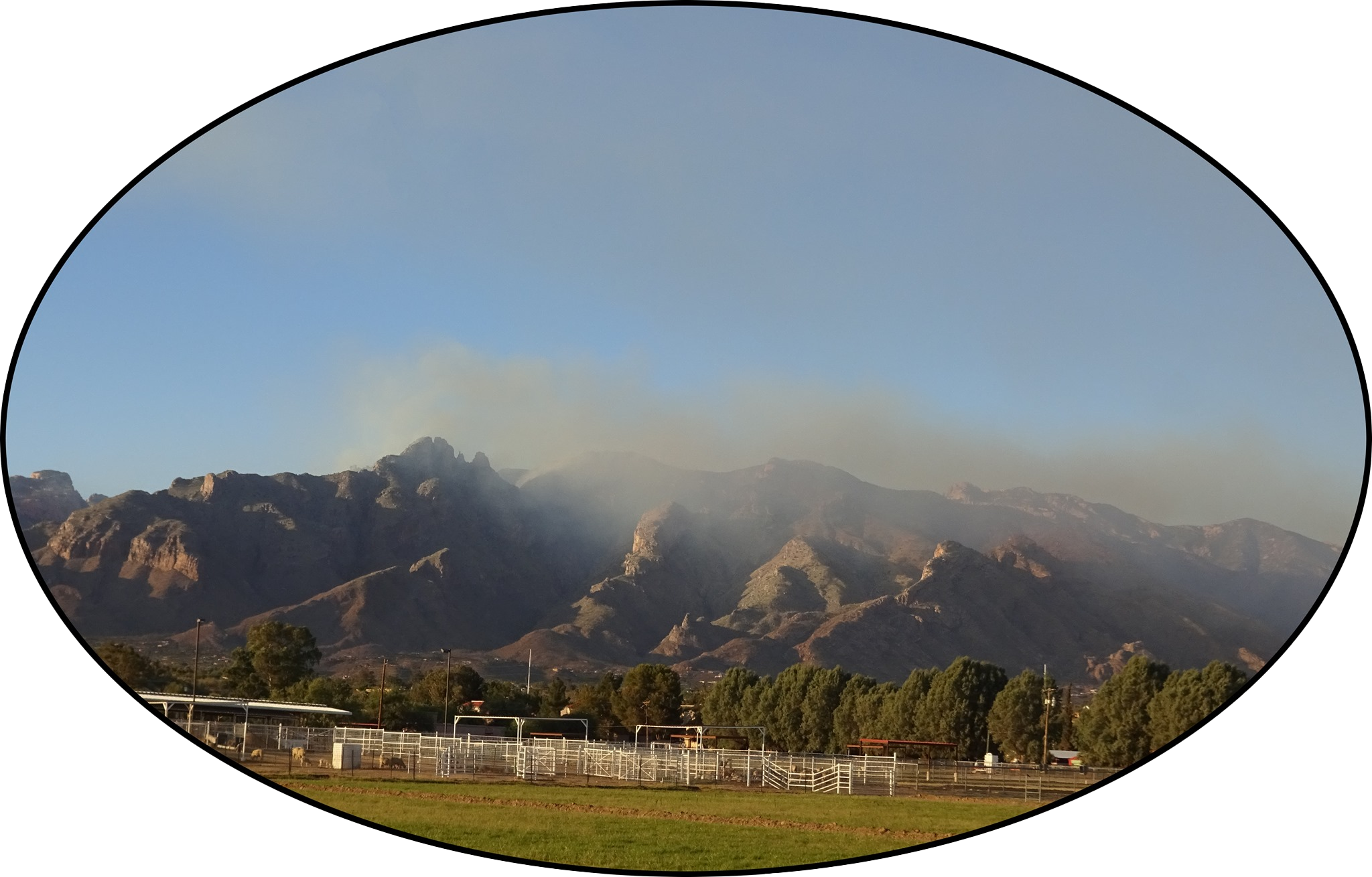
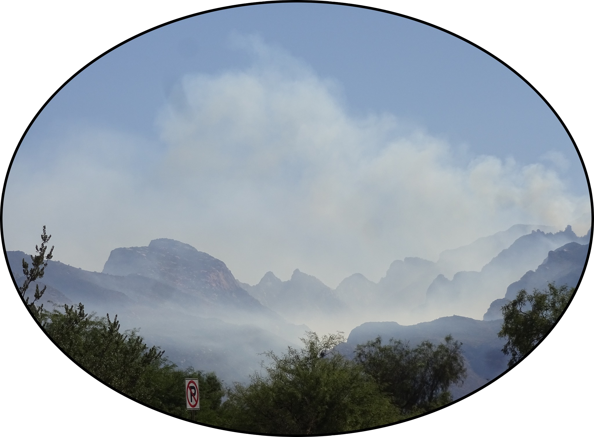
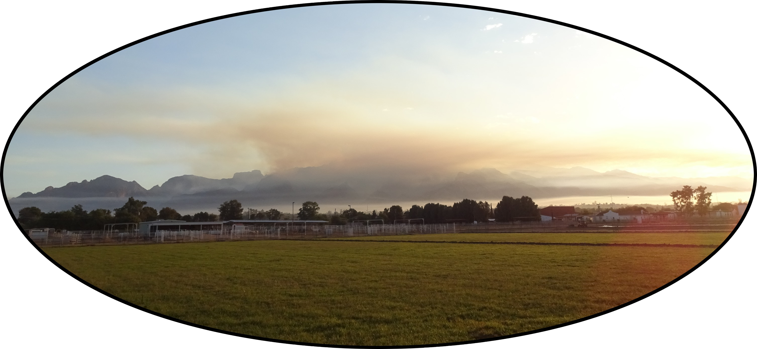
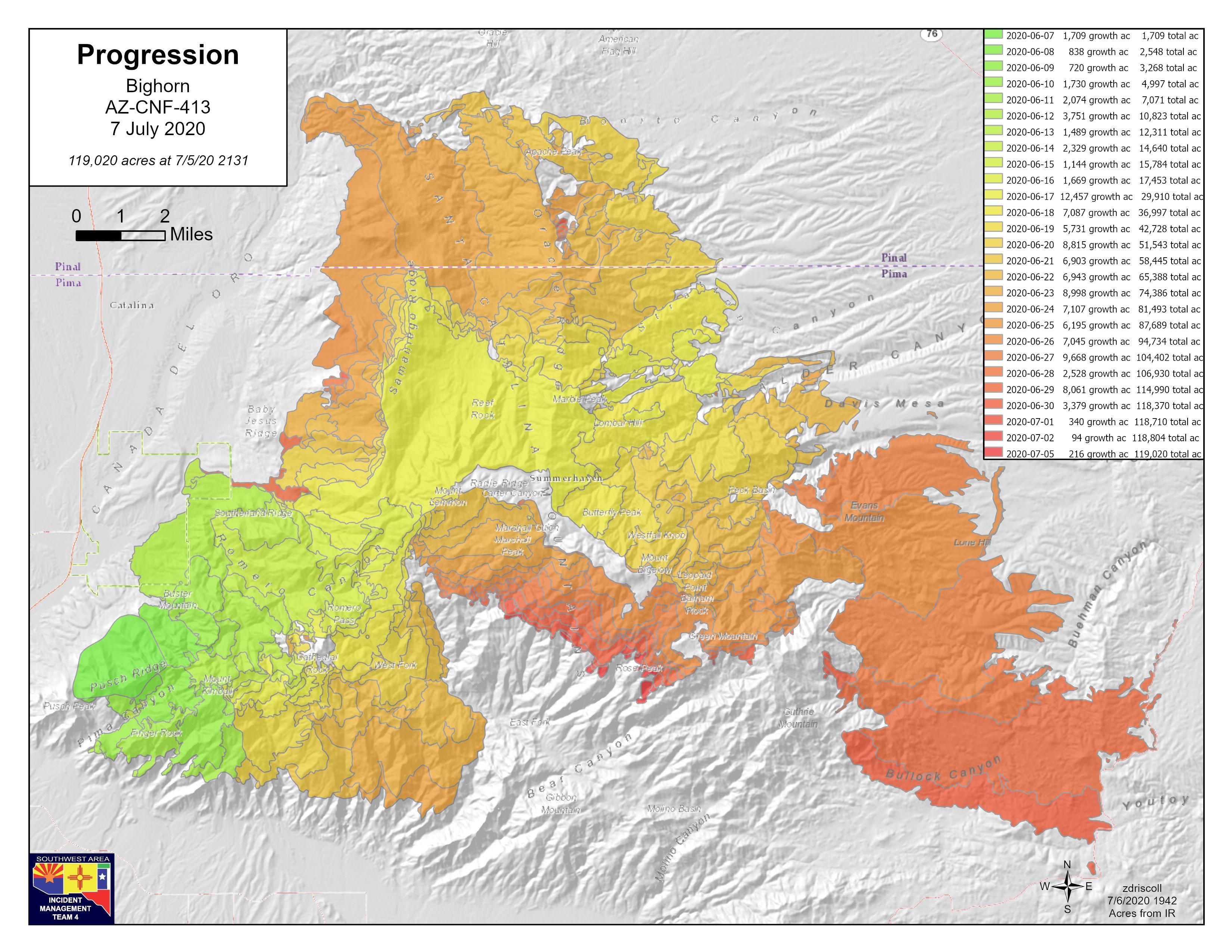
2020 Bighorn Fire (June 5 – July 13)
First day, north side of Pusch Ridge, photo from USFS
June 6 (Day 2)
June 6 (Evening 2)
June 9 (Day 5)
June 10 (Day 6)
June 11 (Day 7)
June 17 (Day 13), Fire Dept., Summerhaven
July 15, "debris flood," Cañada del Oro
Fire on the Mountain, Episode 1: The Event
Fire on the Mountain, Episode 2: The Aftermath
Fire on the Mountain, Episode 3: The Future Catalinas
Fire and the Future: Tucson's Bighorn Fire One Year Later
Bighorn (Sept 2020) burn area, Loma Linda Vista
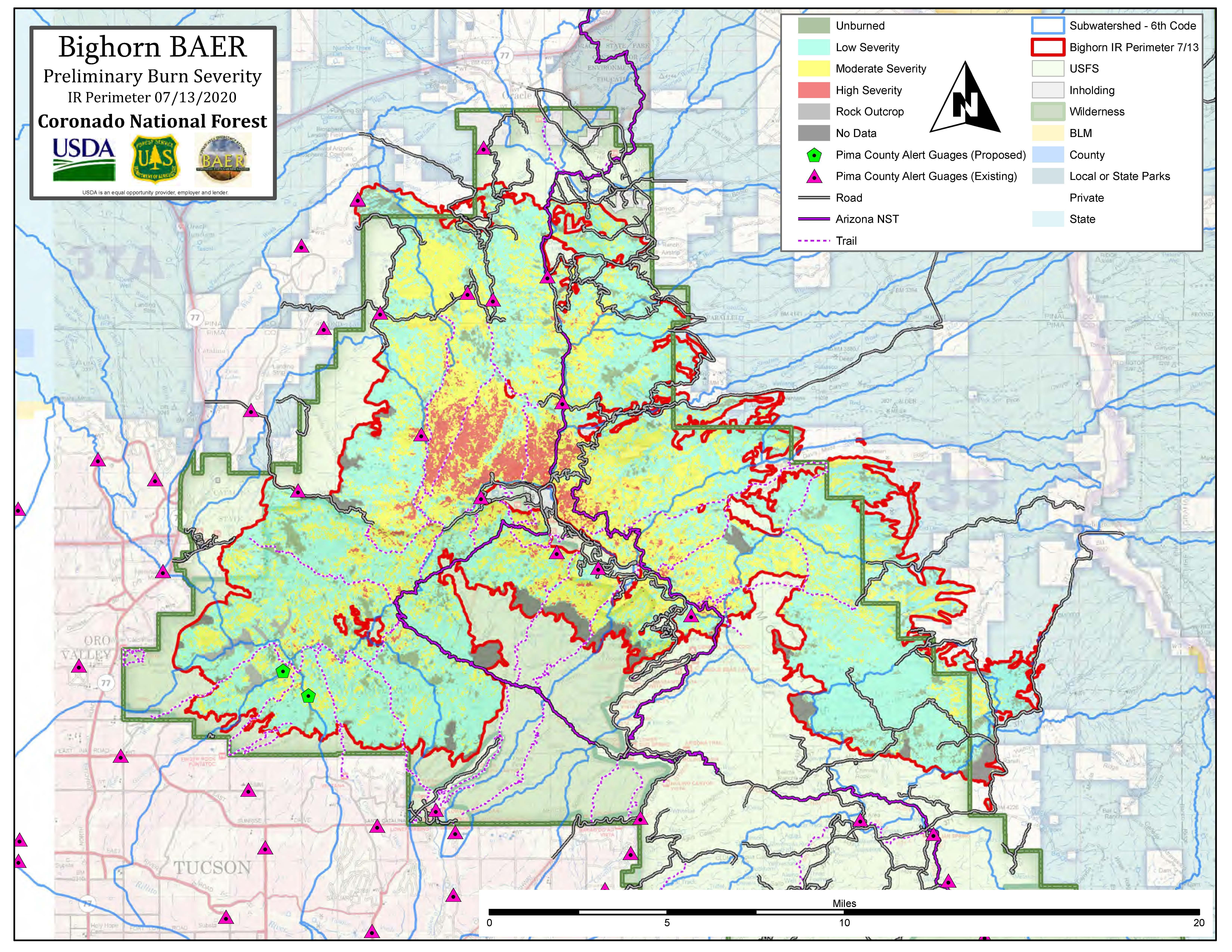
Bighorn Fire (2020) Burn Progression Map
Bighorn Fire (2020) Burn Severity Map
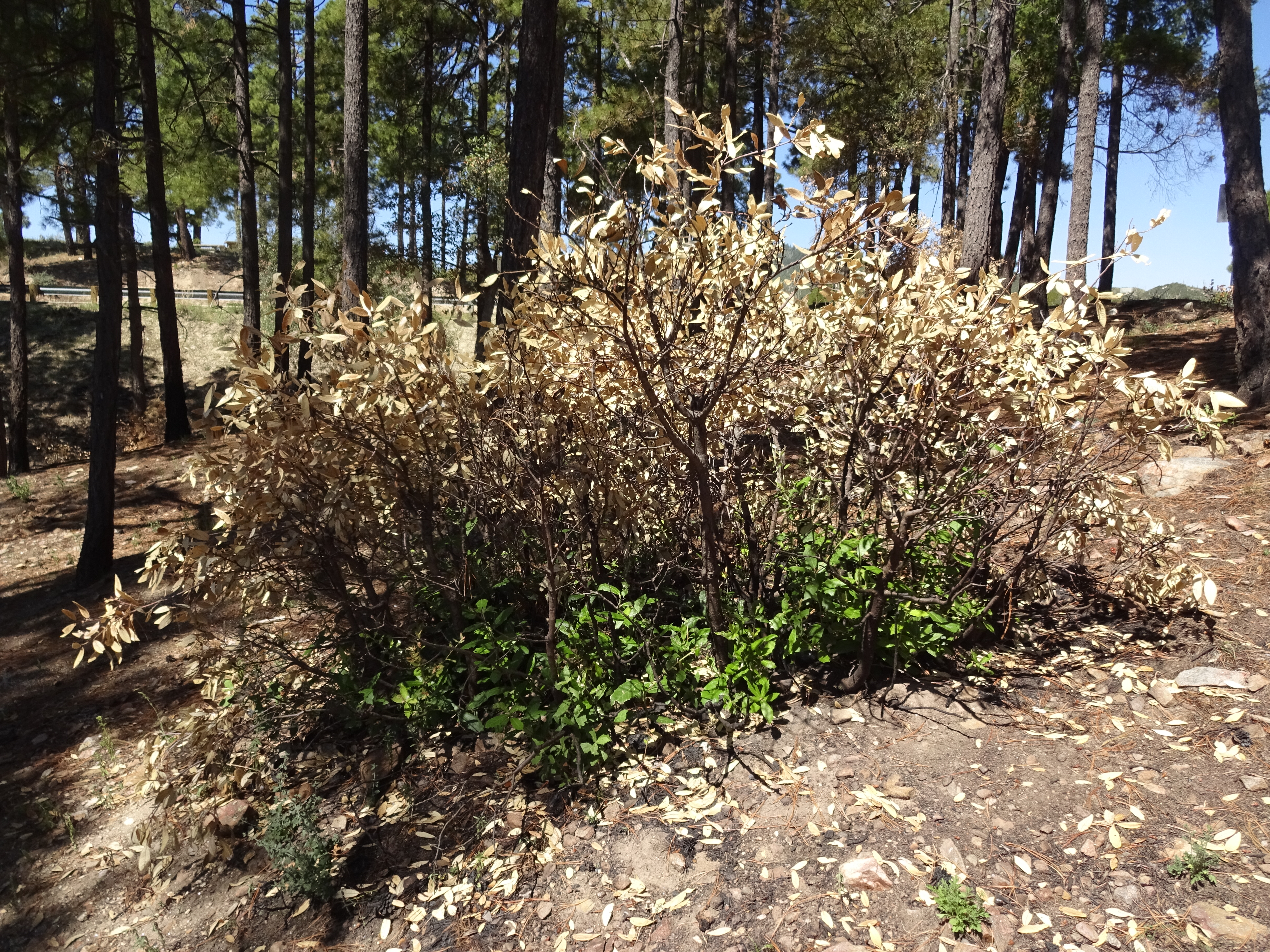
Bighorn (Sept 2020) burn area, behind the Iron Door
Bighorn (Sept 2020) burn area, emory oak sprouting already
AZ Illustrated, Nov. 2020: Understanding the Bighorn Fire
Paul on forest fires and CO2 (3:16 min.)Fire Lookouts
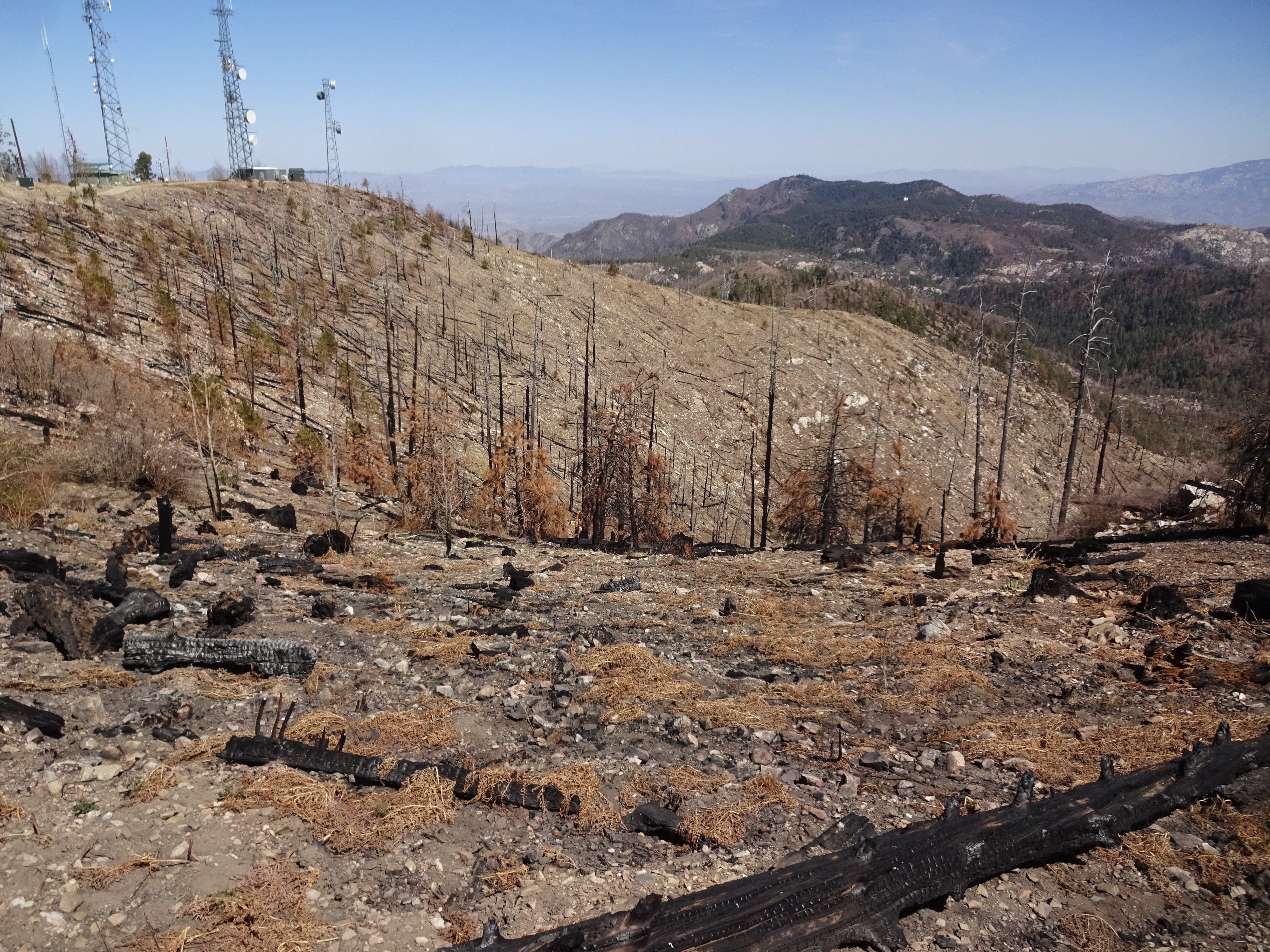
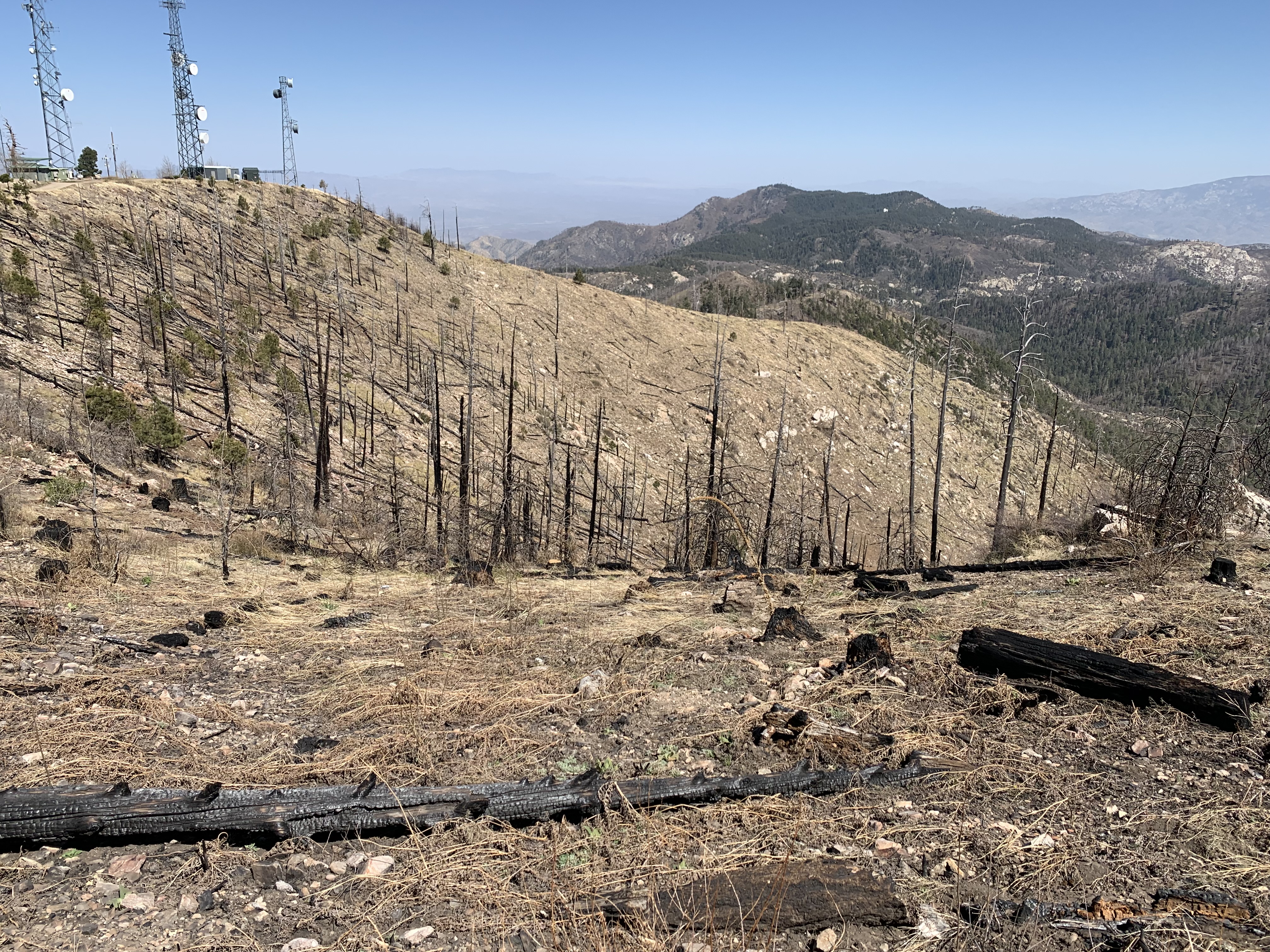
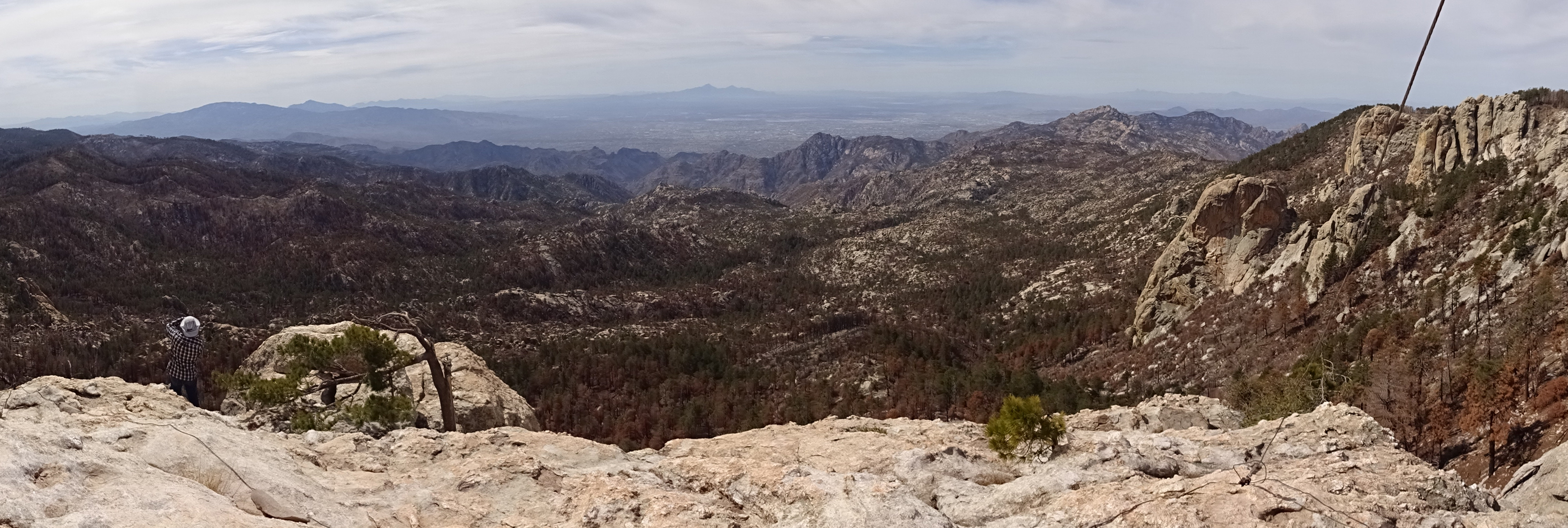
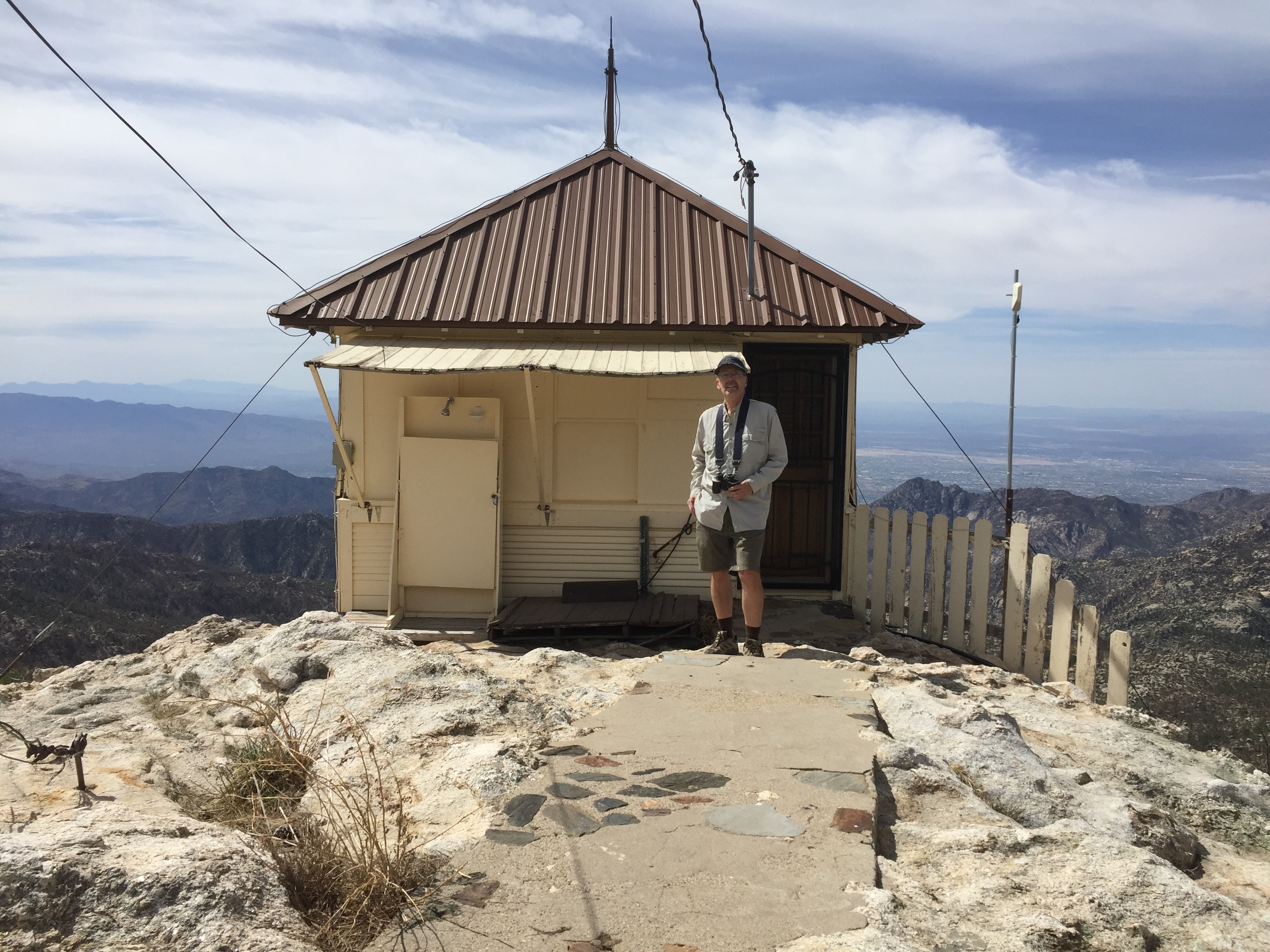
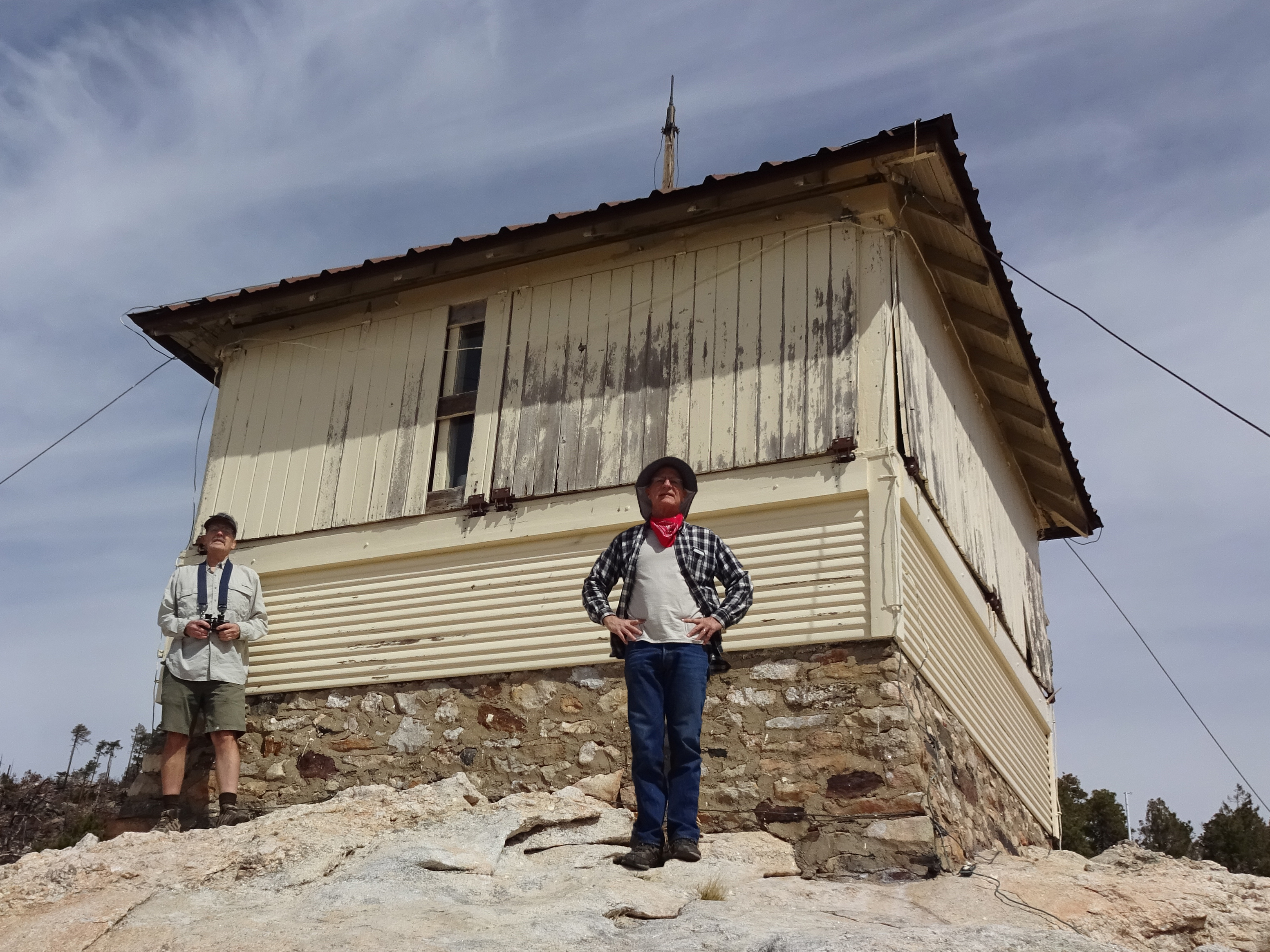
The Santa Catalinas have two fire lookouts, cabins and/or towers where people perch all day looking for fire (smoke) in the forest. The Mt. Lemmon Lookout is just off the very peak, easy to walk to from the last parking lot. It may or may not be open for close visitation, depending on when you visit. Follow the signs.
Wilderness of Rocks, from the Lemmon Lookout, 2021 (post Bighorn Fire)
From to back side
From the front sideForest Slash Into Compost?
Forest slash (small limbs, branches, needles, cones) is carbon rich but nitrogen poor. Food waste is nitrogen rich but carbon poor. Mix the two and what do you get: high-quality compost.
- 1/16/15: Local compost business joins forest restoration. An SOP grad, Patrick Pfeifer (Geos. 195D, 2009), solving issues to turn food waste and forest slash into commercial compost. This can be considered applied SOP.
- Homework assignment for current SOP students: How might you apply Sense of Place in your lives after Geos. 195D? Consider geological-ecological-cultural situations in your home town, or in a favorite vacation spot of yours. Be prepared to speak for between 30 seconds and 1 minute.
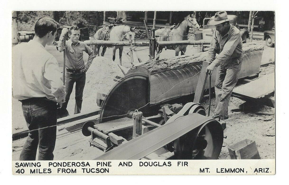
Historic photo (~1950s) of log milling up on Mt. Lemmon. Might this be a way to reduce fuel loading in forests of the Catalinas while supplying construction boards to Summerhaven?
Coronado National Forest 2010 Forest Plan
National Forests have management plans, official documents on how to manage the forests. The Coronado National Forest Plan is available here. Public comment is open on this. Feel free to exert your new-found sense of place and comment.
2022: Ecosystems on mountain slopes are not migrating uphill fast enough!
Palisades, the final SOP stop, 2017.
Photo — Robin Williams
Too many small trees? Photo — Paul Sheppard
Ladder fuels? Photo — Paul Sheppard
Snow on the Mountain
It snowed in April the day of the 2007 SOP trip, just before the day of the 2010 and 2014 trips, and the next day after the 2015 trip. Unusual, but not unheard of, even for Southern Arizona.
2007: Palisades Ranger Station, ~8,000 ft. elevation.
Photo — Paul Sheppard
2010: The top, ~9,100 ft. elevation.
Photo — Paul Sheppard
2014: Ski Center, ~8,500 ft. elevation.
Photo — Meghan Marriott
2015: Inspiration Rock, ~8,000 ft. elevation, cold and windy. Photo — Paul Sheppard
2024: The top, ~9,100 ft. elevation.
Photo — Paul
Extra Shots
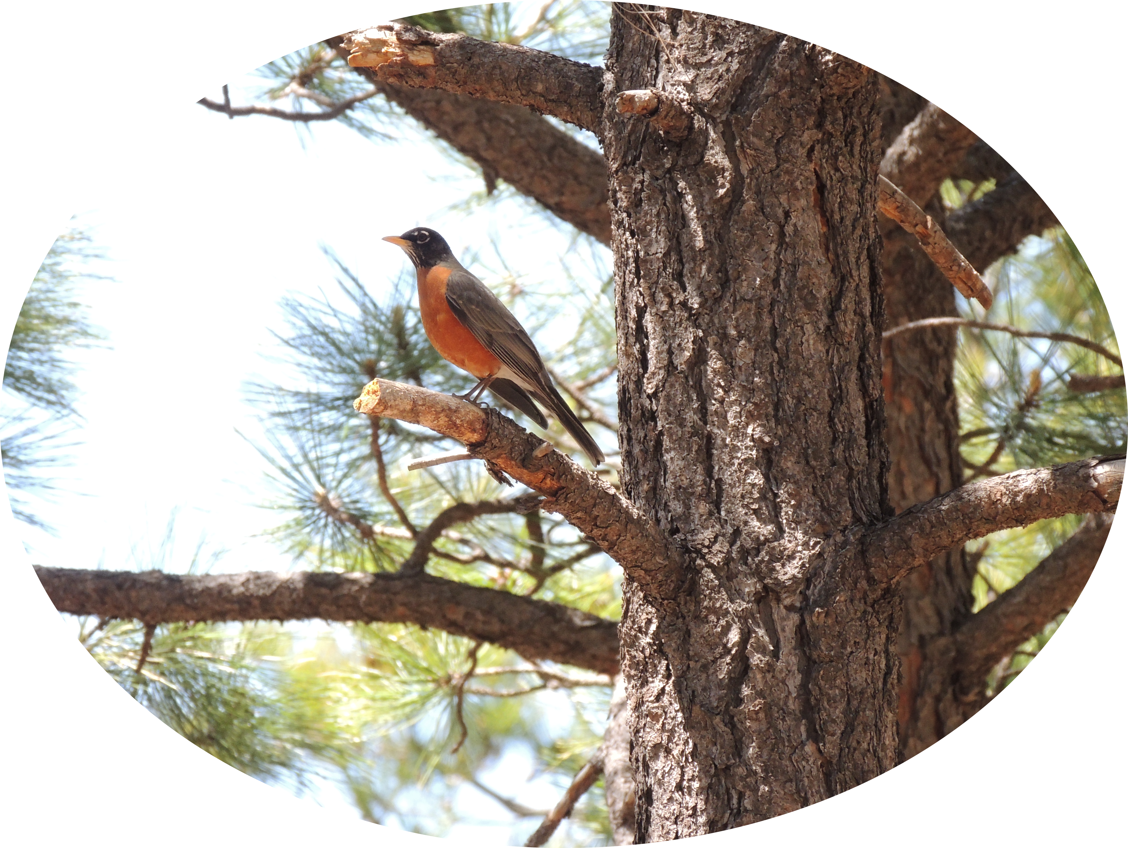
2017: American Robin, common at 8,000 ft.
Photo — Robin Williams (click to see full image)
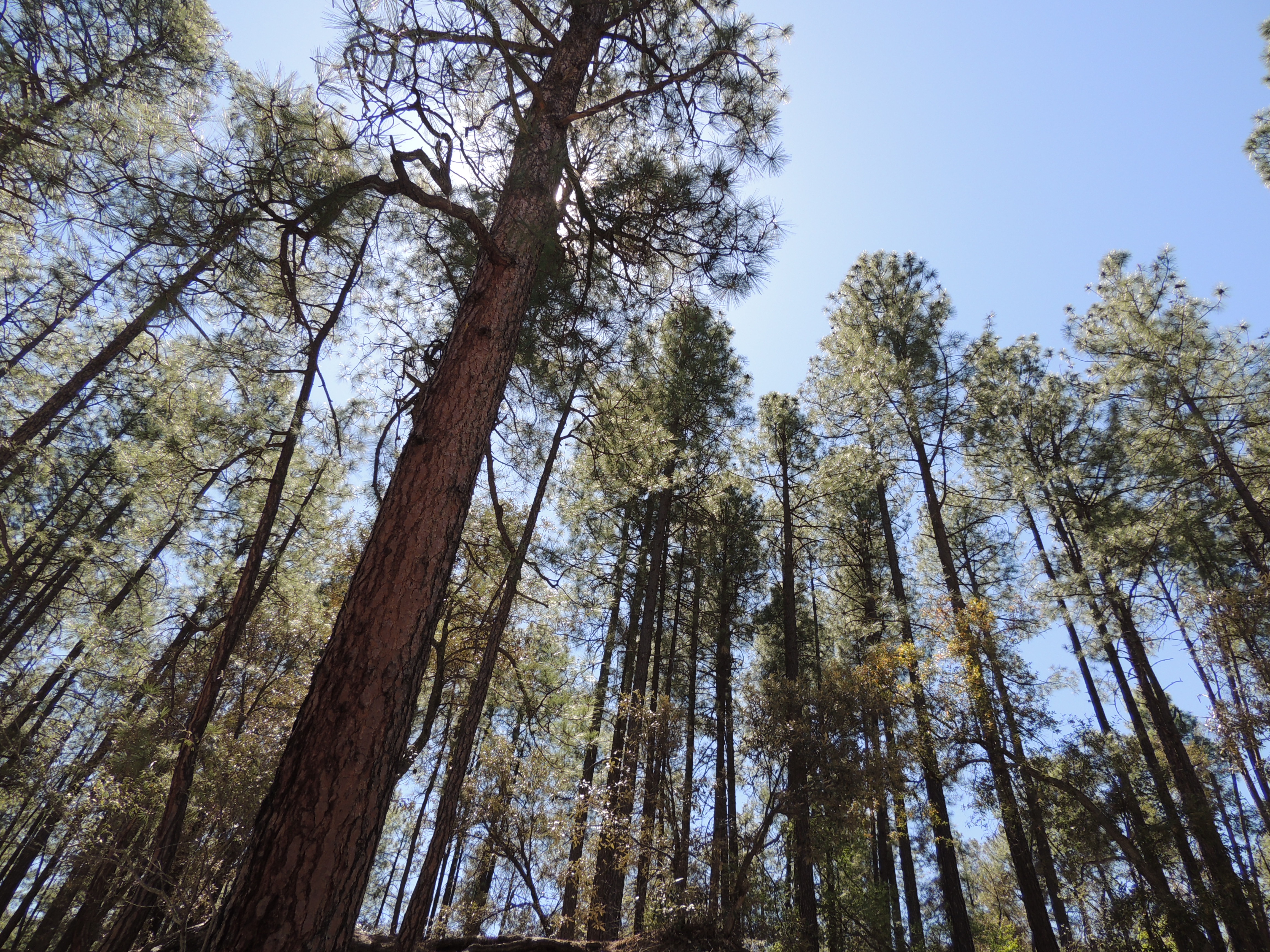
2017: Fish-eye view of the ponderosa canopy.
Photo — Robin Williams (click to see full image)
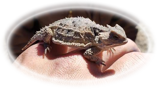
2019: Mt. Lemmon "horned toad,"
(actual name: Short-Horned Lizard),
at the top 9,100 ft.
Photo — Brandon Groom (click to see full image)
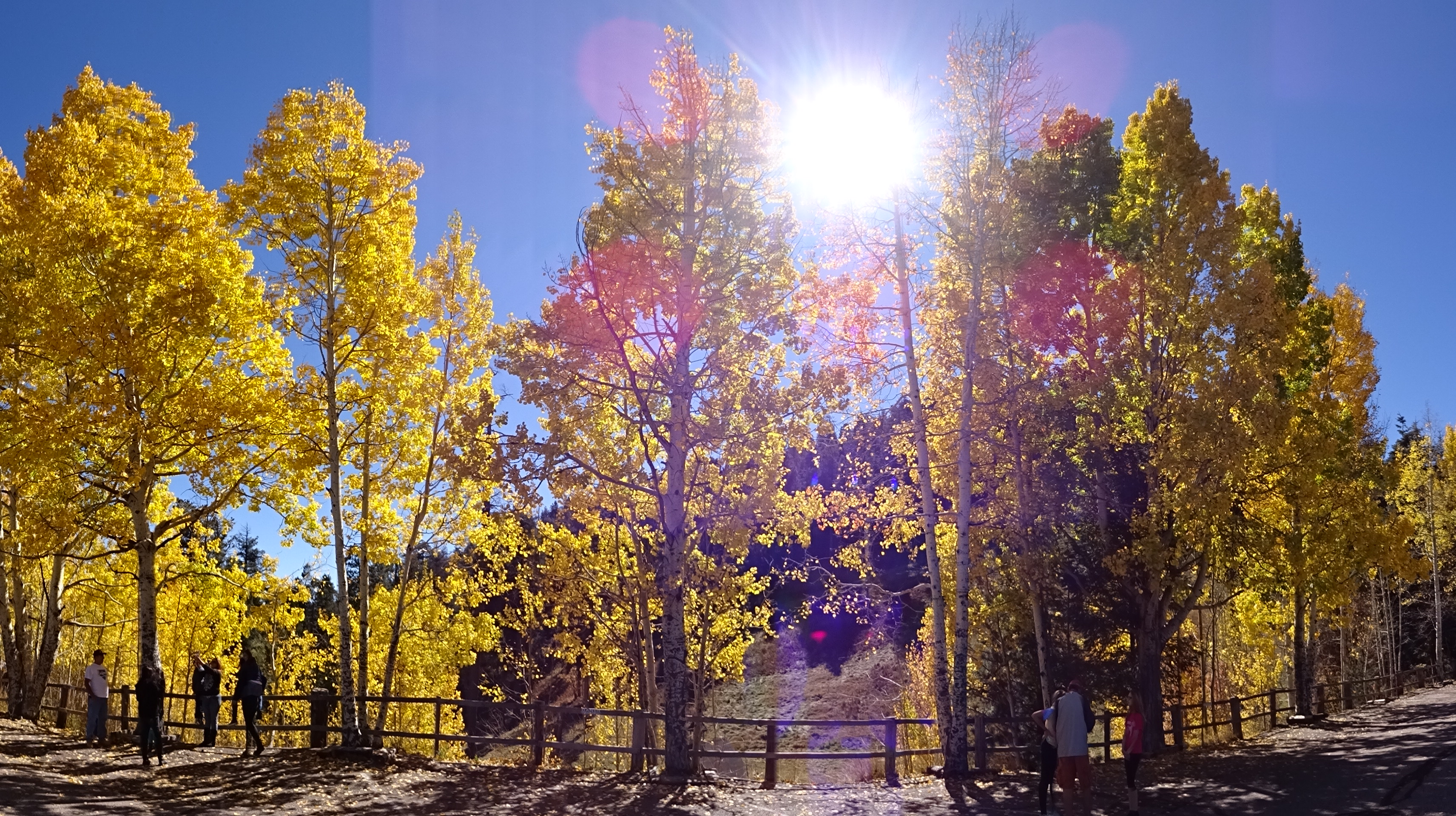
Mt. Lemmon Fall Colors
Mt. Lemmon has many broadleaf tree species, including quaking aspen, cottonwood, alder, bigtooth maple, New Mexican locust, and Arizona walnut, all of which display fall colors. Late October-early November is leaf color season.
Photo — Paul Sheppard, November 1, 2015
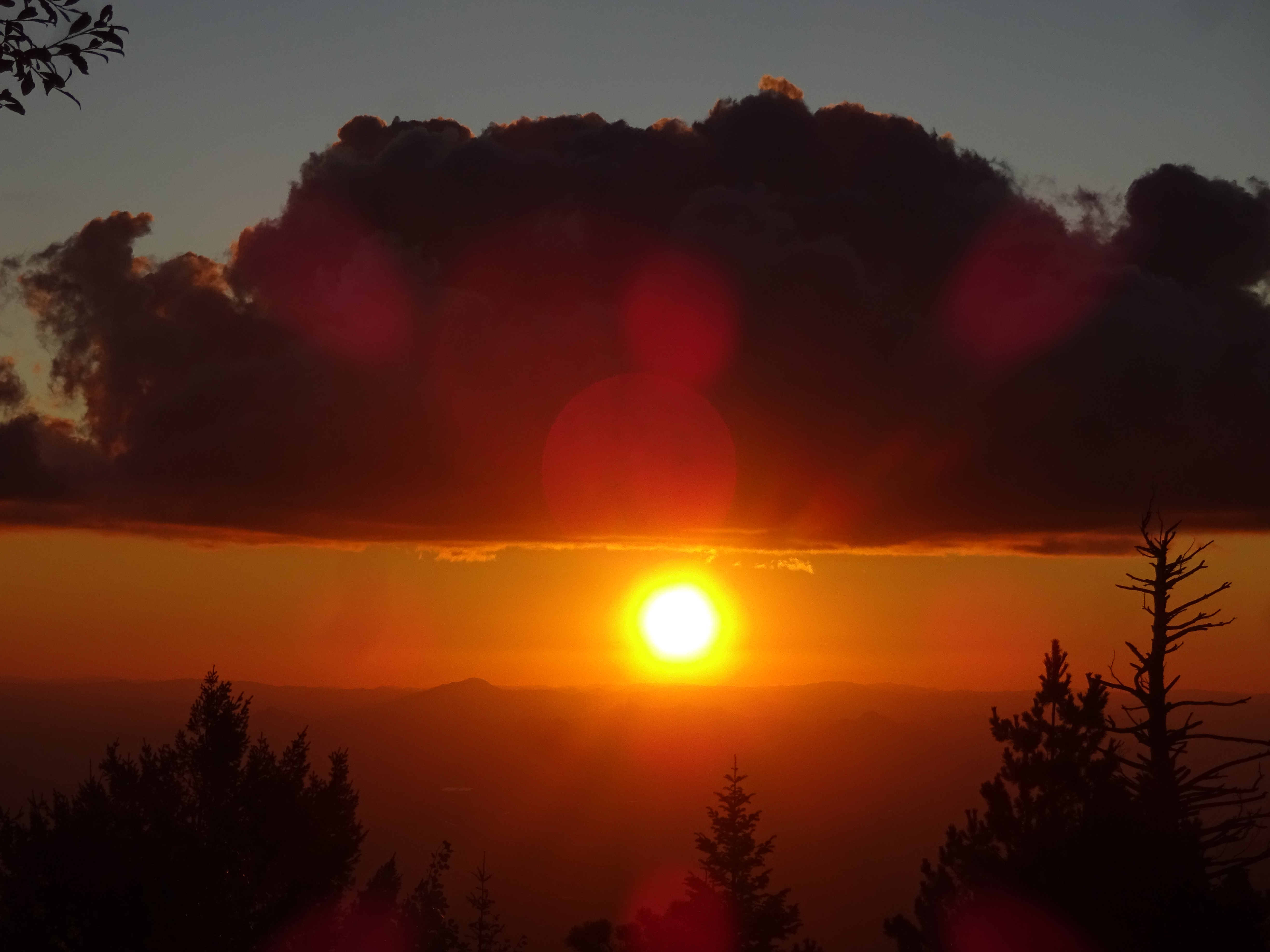
Mt. Lemmon Sunsets
Mt. Lemmon has a couple vantage points for catching sunsets: The very top, and Windy Point.
From the top, September 28, 2019 — Paul Sheppard
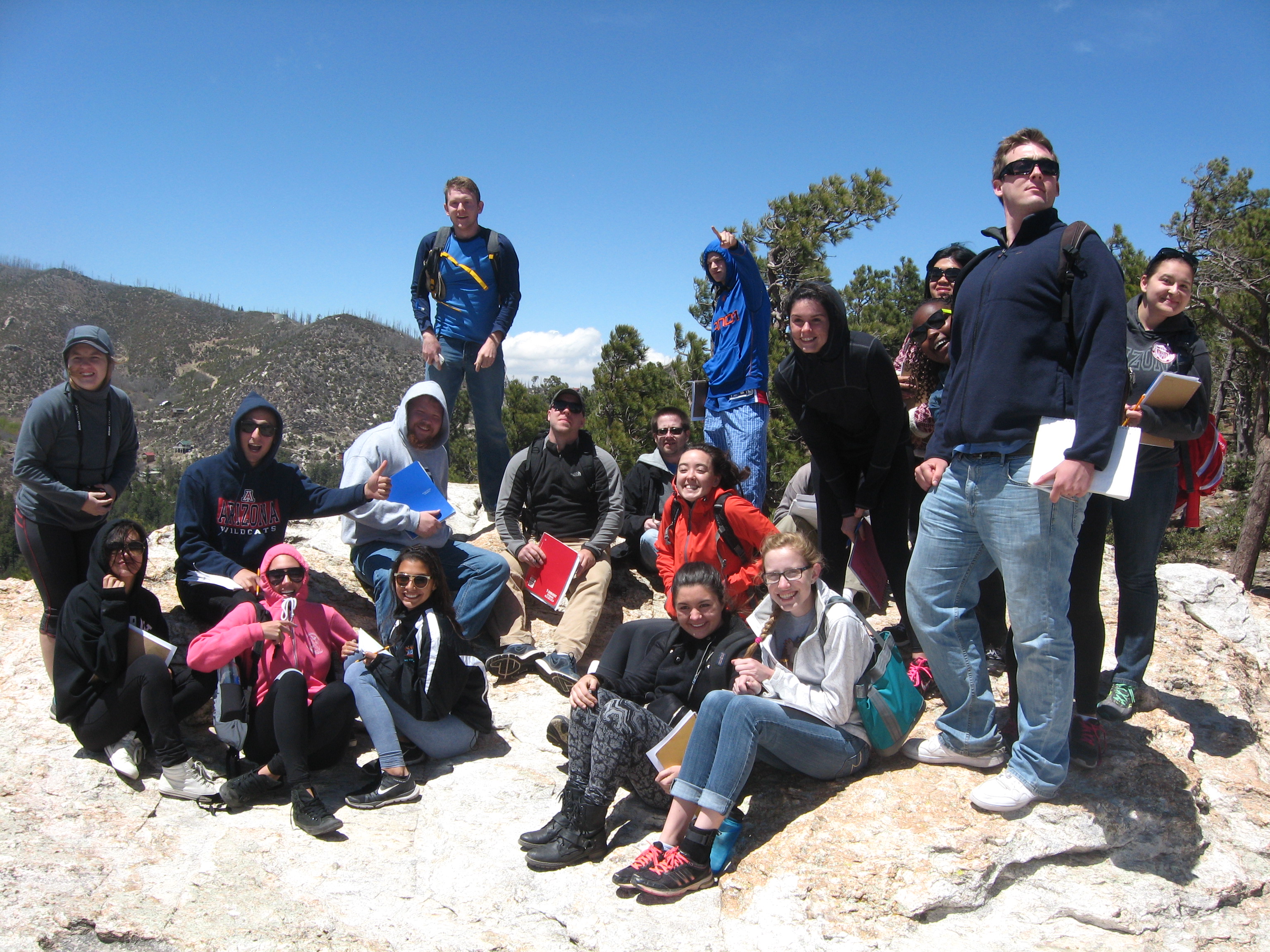
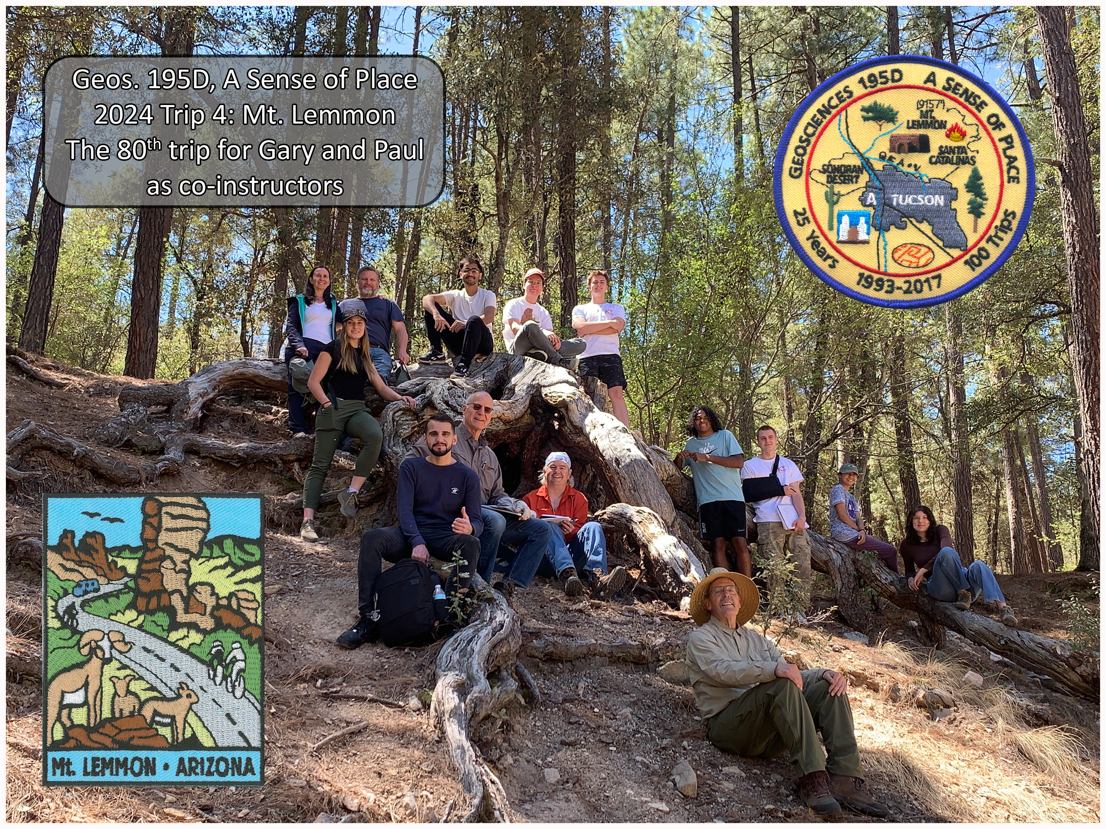
Team Photo, 2024: Middle Bear
Photo — Paul Sheppard
There's an App for That
The UA College of Science has a free app to help travelers of the Catalina Highway interpret the drive up and down.
Click here to access the download sites.
Note:
If you're using this app to do a make-up trip for SOP, take plenty of photos
along the way, including selfies at every stop, and include them in your report.
Back to Sense of Place Home Page