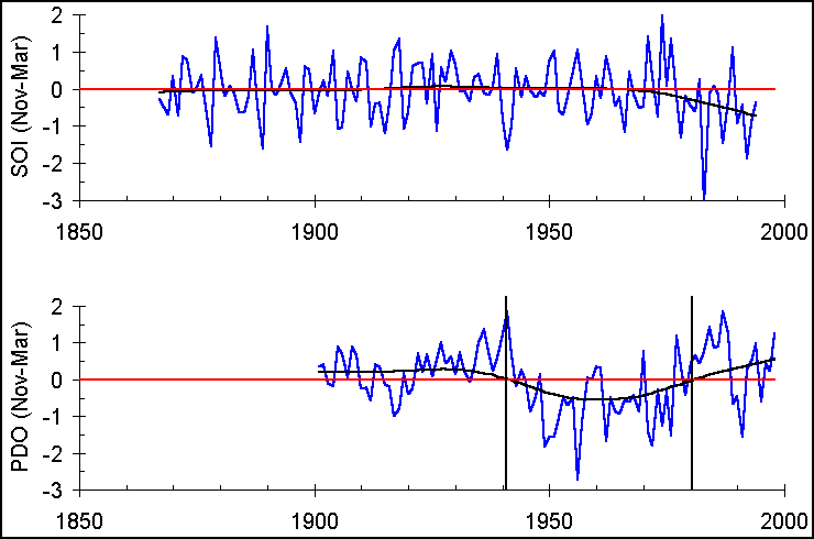
Fig. Southern Oscillation Index (SOI) and Pacific Decadal Oscillation (PDO) Index. Smooth lines show 80-year-period variation.
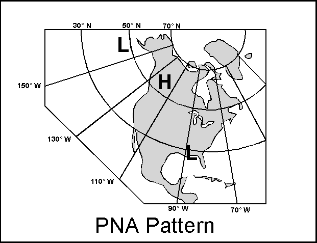
Fig. Pacific/North American (PNA) Climatology.
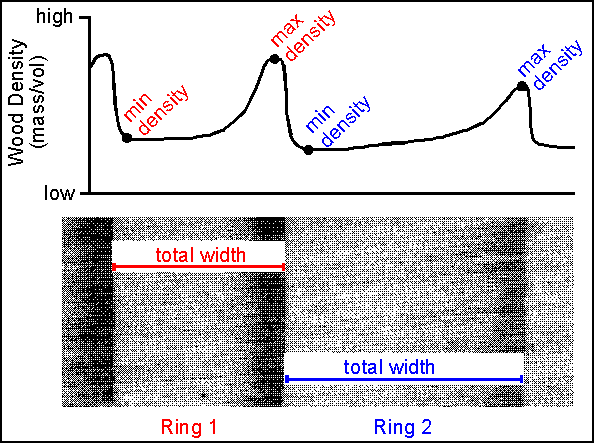
Fig. Tree rings: The image shows two full tree rings, one of which is narrow (Ring 1) compared to the other (Ring 2). In the Southwest, annual ring-width variation typically corresponds to annual variation in moisture availability. The wood density scan above the image shows that the maximum densities, which associate with the dark latewood bands of each ring, also vary, with Ring 1 having a higher density than Ring 2. In many cool, mesic tree-ring sites, annual variation of maximum latewood density corresponds to annual variation in growing-season temperature.
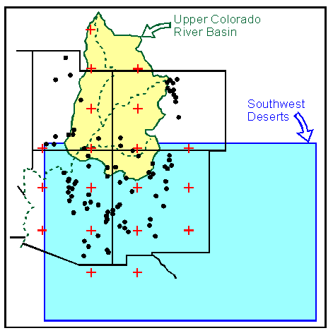
Fig. Southwest and UCRB: For the purposes of this assessment of climate of the Southwest, the region of interest includes Arizona, New Mexico, and the Upper Colorado River Basin. The black dots indicate tree-ring sites, showing an extensive network throughout the Four-Corners states. The red crosses indicate grid points of the PDSI reconstruction of Cook et al. (1996). The blue Southwest Deserts box is the region of temperature reconstruction by Briffa et al. (1992).
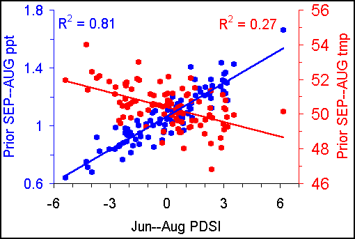
Fig. Palmer Drought Severity Index (PDSI) as related to precipitation (average per month [in.]) and temperature (ºF).
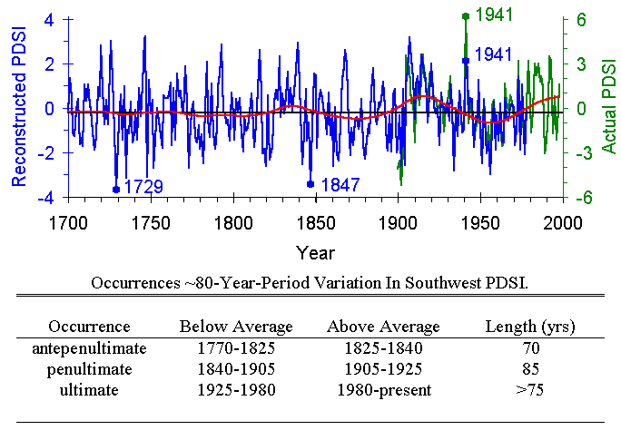
Fig. Southwest PDSI: Tree-ring reconstructed PDSI (blue) and actual PDSI (green). During the period of overlap (1900 to 1978), the two series correlate strongly but have different ranges (note the different y-axis scales); in particular, 1941 was underestimated using tree rings. The full series shows an 80-year-period variation since the late 18th century, one that has been increasing in amplitude with time. The dates of the 80-year variation are given in the table.
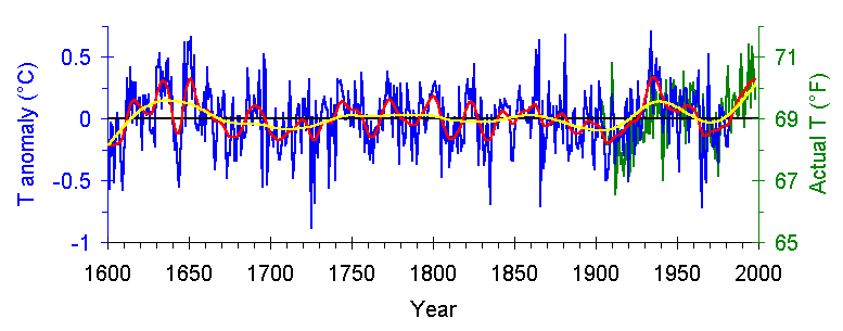
Fig. Southwest Temperature: Tree-ring reconstructed temperature (blue) and actual temperature (green). During the period of overlap (1900 to 1980), the two series correlate strongly. Red line shows 20-year-period variation, and yellow line shows 80-year-period variation.
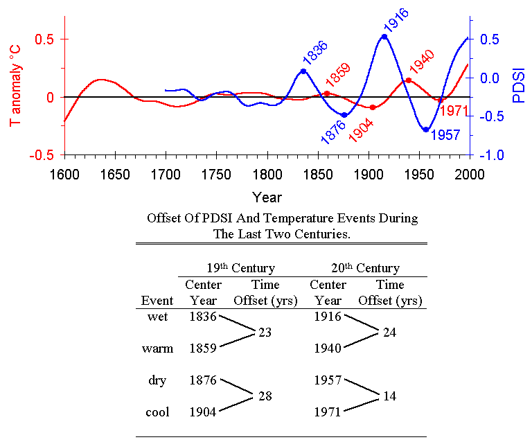
Fig. Southwest Climate: 80-year-period variation of both PDSI (blue line) and temperature (red line). Notable maxima and minima are marked and their lagged temporal relationships are quantified in the table.